15 Hackness Road, Manchester, M21 9HB
About 15 Hackness Road
15 Hackness Road is a one-bedroom mid-terrace house in Manchester (M21 9HB). It has a recorded floor area of 80 m² (around 861 sq ft), construction records dating it to 1900-1929 and council tax band B. Tenure is freehold. The latest certificate (April 2013) shows a D (score 61), on the cusp of jumping into the C band. The recommended improvements would lift it to B (score 88), a 2-band jump. The latest certificate is from April 2013, so improvements made since then won't be reflected.
Last sold in October 2017, so it's been off the market for around 9 years. Across the public record there are 5 sales, relatively high churn for a single property. 2 planning records sit against the property, 2 approved, 0 refused. Past consents include an extension, meaningful when judging how the property has evolved. Across 1996–2017, sale prices on this property compounded at 8.9% per year. Today's modelled estimate of £404,000 is 32.5% above the 2017 sale price. On a £-per-square-foot basis, the last sale (£354/sq ft) was about 90.5% above the typical sold price in the postcode.
Know exactly what you're buying at 15 Hackness Road
Before you offer, see what the listing won't tell you, the true value, the red flags and the full history.
Already flagged here
Valuation
against the asking price
Risks
planning & flood
Sold prices
similar homes nearby
Trends
the local market
What this property has
Inside
- Bedrooms1
- Bathrooms1
Building
- TenureFreehold
- RefurbishedYes
Energy performance
Recommended upgrades on file would lift this property by multiple EPC bands.
EPC Expired
This certificate is over 10 years old and is no longer valid.Expired 09 Apr 2023
EPC Rating
Planning history
15 Hackness Road has 2 separate extension applications on the council record.
- Jan 2018ExtensionFullIn report
Extension: Single storey · Rear of property
Erection of single-storey rear extension to form additional living accommodation
- Agent
- Mat Design
- Documents
- 4 docs on file
- Reference
- 118417/FH/2017
- Nov 2017ExtensionFullIn report
Extension: Single storey · Rear of property
Erection of single-storey rear extension to form additional living accommodation
- Agent
- MAT Design
- Documents
- 4 docs on file
- Reference
- 117686/FH/2017
We flagged 1 thing worth checking at 15 Hackness Road
Independent checks surfaced things a buyer would want to understand before offering. The report explains each one in full, with the underlying data and what to ask.
- Larger development activity nearby
30-day money-back guarantee
Sales history & valuation
15 Hackness Road has more than quadrupled in price since its earliest registered sale in 1996.
£404,000
Modelled from EPC, postcode comparables and a sale-price growth of 8.9% per year over 21 years.
£305,000
Growth on file: 8.9% per year over 21 years.
Sales timeline
3 October 2017Most recent
£305,000
+27.1%over 4 years7 July 2013
£239,950
+1.5%over 6 years24 May 2007
£236,500
+61.2%over 4 years30 April 2003
£146,750
+202.6%over 7 years21 April 1996
£48,500
Median price across the last 5 sales in M21 9HB: £412,300 (2025–2022).
Nearby sales in M21 9HB
Everything we know about 15 Hackness Road, in one report
What it's really worth, what could be wrong, and the planning, sales and area data in full.
What we flagged
- Larger development activity nearby

Versus other Hackness Road homes
Habitable Rooms for 15 Hackness Road lags the street by a wide margin.
Price per m²
£3,813
Street avg £3,455
Floor Area
80 m²
Street avg 90 m²
Habitable Rooms
4 rooms
Street avg 5 rooms
CO₂ Emissions
3.8 t/year
Street avg 4.9 t/year
Similar properties nearby
1 Cross Road
M21 9DH
1 Hammett Road
M21 9HY
1 Chequers Road
M21 9DX
1 Halstead Avenue
M21 9FT
1 Belgravia Gardens
M21 9JJ
1 Albemarle Road
M21 9HX
1 Attercliffe Road
M21 9FS
1 Beech Mews, Beech Road
M21 9EQ
The neighbourhood at a glance
Rail-style transport is unusually close for this postcode.
Nearest stop
0.1 km
Kingshill Road — bus stop.
Closest school
0.2 km
Chorlton CofE Primary School. 38 schools nearby.
Go deeper on the local area
The full report breaks down crime, transport links, schools and air quality in depth.
Road noise across the postcode
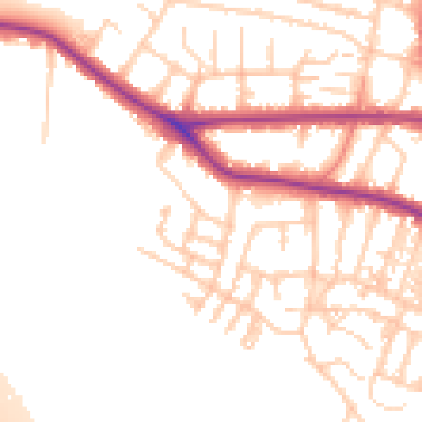
Daytime· 07:00 – 23:00
53.2dB

Night-time· 23:00 – 07:00
44.5dB