1 Halstead Avenue, Manchester, M21 9FT
About 1 Halstead Avenue
1 Halstead Avenue is a two-bedroom end-of-terrace house in Manchester (M21 9FT). It has a recorded floor area of 60 m² (around 646 sq ft), construction records dating it to 1900-1929 and council tax band B. The latest certificate (September 2018) shows a D (score 61), on the cusp of jumping into the C band. The recommended improvements would lift it to B (score 88), a 2-band jump.
Across 2007–2022, sale prices on this property compounded at 4.7% per year. Today's modelled estimate of £427,000 is 11.5% above the 2022 sale price. On a £-per-square-foot basis, the last sale (£593/sq ft) was about 181.7% above the typical sold price in the postcode. Last sale on file: £383,000 in October 2022. That sale was during the post-pandemic price surge, when transactions cleared materially above pre-2020 trend.
Know exactly what you're buying at 1 Halstead Avenue
Before you offer, see what the listing won't tell you, the true value, the red flags and the full history.
Already flagged here
Valuation
against the asking price
Risks
planning & flood
Sold prices
similar homes nearby
Trends
the local market
What this property has
Inside
- Bedrooms2
- Bathrooms1
Energy performance
Recommended upgrades on file would lift this property by multiple EPC bands.
EPC Rating
Planning history
1 Halstead Avenue has no planning applications on record.
Notable planning nearby
4applications of note in the surrounding area
We flagged 1 thing worth checking at 1 Halstead Avenue
Independent checks surfaced things a buyer would want to understand before offering. The report explains each one in full, with the underlying data and what to ask.
- Larger development activity nearby
30-day money-back guarantee
Sales history & valuation
Sale price has at least doubled since 2007.
£427,000
Modelled from EPC, postcode comparables and a sale-price growth of 4.7% per year over 16 years.
£383,000
Growth on file: 4.7% per year over 16 years.
Sales timeline
27 October 2022Most recent
£383,000
+40.2%over 3 years4 January 2019
£273,250
+47.7%over 11 years12 January 2007
£185,000
Median price across the last 5 sales in M21 9FT: £385,000 (2025–2022).
Nearby sales in M21 9FT
23 Halstead Avenue, Manchester, M21 9FT
Sold Sept 2025
£392,5002 Halstead Avenue, Manchester, M21 9FT
Sold Aug 2024
£425,00016 Halstead Avenue, Manchester, M21 9FT
Sold Jul 2023
£385,00012 Halstead Avenue, Manchester, M21 9FT
Sold Jan 2023
£336,00014 Halstead Avenue, Manchester, M21 9FT
Sold Sept 2022
£355,050
Everything we know about 1 Halstead Avenue, in one report
What it's really worth, what could be wrong, and the planning, sales and area data in full.
What we flagged
- Larger development activity nearby

Versus other Halstead Avenue homes
Price per m² for 1 Halstead Avenue runs comfortably ahead of the street norm.
Price per m²
£6,383
Street avg £3,741
Floor Area
60 m²
Street avg 70 m²
Habitable Rooms
4 rooms
Street avg 4 rooms
CO₂ Emissions
3.2 t/year
Street avg 3.0 t/year
Similar properties nearby
1 Hammett Road
M21 9HY
1 Albemarle Road
M21 9HX
1 Chequers Road
M21 9DX
1 Beech Mews, Beech Road
M21 9EQ
1 Copgrove Road
M21 9FP
1 Belgravia Gardens
M21 9JJ
1 Attercliffe Road
M21 9FS
1 Cheltenham Road
M21 9GL
The neighbourhood at a glance
Nearest stop
0.1 km
Ivygreen Road — bus stop.
Closest school
0.3 km
Brookburn Community School. 42 schools nearby.
Go deeper on the local area
The full report breaks down crime, transport links, schools and air quality in depth.
Road noise across the postcode
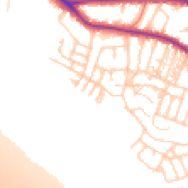
Daytime· 07:00 – 23:00
53.0dB

Night-time· 23:00 – 07:00
44.5dB