10 Bolesworth Close, Manchester, M21 9BE
About 10 Bolesworth Close
10 Bolesworth Close is a two-bedroom semi-detached house in Manchester (M21 9BE). It has a recorded floor area of 60 m² (around 646 sq ft), construction records dating it to 1983-1990 and council tax band C. The latest certificate (January 2014) shows a C (score 70). The recommended improvements would push it to B (score 86). The latest certificate is from January 2014, so improvements made since then won't be reflected. The home occupies a cul-de-sac position.
Held since July 2007 — that's 19 years off the open market, well above the local norm. That sale landed at the peak of the pre-credit-crunch market, which is a useful reference point when interpreting the price. Today's modelled estimate of £376,000 sits 99% above the 2007 sale of £188,950.
Know exactly what you're buying at 10 Bolesworth Close
Before you offer, see what the listing won't tell you, the true value, the red flags and the full history.
Already flagged here
Valuation
against the asking price
Risks
planning & flood
Sold prices
similar homes nearby
Trends
the local market
What this property has
Inside
- Bedrooms2
- Bathrooms1
- Dining roomYes
Outside
- Private gardenSouth-facing
- DrivewayYes
- Summer houseYes
- Cul-de-sacYes
Building
- Heating systemGas
Energy performance
10 Bolesworth Close's EPC is over a decade old — improvements since won't be reflected.
EPC Expired
This certificate is over 10 years old and is no longer valid.Expired 12 Jan 2024
EPC Rating
Planning history
10 Bolesworth Close has no planning applications on record.
Notable planning nearby
4applications of note in the surrounding area
We flagged 1 thing worth checking at 10 Bolesworth Close
Independent checks surfaced things a buyer would want to understand before offering. The report explains each one in full, with the underlying data and what to ask.
- Larger development activity nearby
30-day money-back guarantee
Sales history & valuation
The latest sale landed at the peak of the pre-credit-crunch market — a high-water reference point.
£376,000
Modelled from EPC, postcode comparables.
£188,950
Recorded with HM Land Registry.
Sales timeline
30 July 2007Most recent
£188,950
Median price across the last 5 sales in M21 9BE: £355,000 (2025–2022).
Nearby sales in M21 9BE
22 Bolesworth Close, Manchester, M21 9BE
Sold Oct 2025
£420,00024 Bolesworth Close, Manchester, M21 9BE
Sold Jan 2025
£420,00025 Bolesworth Close, Manchester, M21 9BE
Sold Dec 2023
£355,0004 Bolesworth Close, Manchester, M21 9BE
Sold Mar 2023
£302,50014 Bolesworth Close, Manchester, M21 9BE
Sold Oct 2022
£335,000
Everything we know about 10 Bolesworth Close, in one report
What it's really worth, what could be wrong, and the planning, sales and area data in full.
What we flagged
- Larger development activity nearby

Versus other Bolesworth Close homes
10 Bolesworth Close is notably below the street on floor area.
Price per m²
£3,149
Street avg £3,924
Floor Area
60 m²
Street avg 74 m²
Habitable Rooms
4 rooms
Street avg 5 rooms
CO₂ Emissions
2.3 t/year
Street avg 2.9 t/year
Similar properties nearby
1 Chequers Road
M21 9DX
1 Belgravia Gardens
M21 9JJ
1 Attercliffe Road
M21 9FS
1 Hammett Road
M21 9HY
1 Halstead Avenue
M21 9FT
1 Albemarle Road
M21 9HX
1 Beech Mews, Beech Road
M21 9EQ
1 Copgrove Road
M21 9FP
The neighbourhood at a glance
Nearest stop
0.2 km
Kingshill Road — bus stop.
Closest school
0.4 km
Chorlton CofE Primary School. 39 schools nearby.
Go deeper on the local area
The full report breaks down crime, transport links, schools and air quality in depth.
Road noise across the postcode
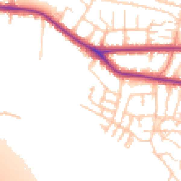
Daytime· 07:00 – 23:00
53.1dB

Night-time· 23:00 – 07:00
44.9dB