20 Dunston Street, Manchester, M11 2JU
About 20 Dunston Street
20 Dunston Street is a two-bedroom mid-terrace house in Manchester (M11 2JU). It has a recorded floor area of 58 m² (around 624 sq ft), construction records dating it to 1900-1929 and council tax band A. The latest certificate (October 2013) shows a C (score 76), near the top of the C band. When first surveyed in February 2011 the rating was F, the property has climbed 3 bands since. Between certificates, wall efficiency went from Very Poor to Good, roof efficiency went from Average to Very Good and window efficiency went from Poor to Very Good. The recommended improvements would lift it to A (score 92), a 2-band jump. The latest certificate is from October 2013, so improvements made since then won't be reflected.
Across 2002–2017, sale prices on this property compounded at 9.5% per year. Today's modelled estimate of £137,000 sits 71.2% above the 2017 sale of £80,000. On a £-per-square-foot basis, the last sale (£128/sq ft) was about 229.5% above the typical sold price in the postcode. Last changed hands 9 years ago, in May 2017. Across the public record there are 4 sales, relatively high churn for a single property.
Know exactly what you're buying at 20 Dunston Street
Before you offer, see what the listing won't tell you, the true value, the red flags and the full history.
Valuation
against the asking price
Risks
planning & flood
Sold prices
similar homes nearby
Trends
the local market
What this property has
Inside
- Bedrooms2
- Bathrooms1
- Dining roomYes
- EnsuiteYes
Outside
- Private gardenYes
Building
- Central heatingYes
Energy performance
Recommended upgrades on file would lift this property by multiple EPC bands.
EPC Expired
This certificate is over 10 years old and is no longer valid.Expired 01 Oct 2023
EPC Rating
Property Improvements
Changes detected from historical EPC data
Upgraded to gas central heating
Hot water system upgraded
Windows upgraded, improving insulation
Wall insulation improved
Loft insulation upgraded to recommended levels
More low energy lighting installed
Planning history
20 Dunston Street has no planning applications on record.
Notable planning nearby
1applications of note in the surrounding area
Sales history & valuation
Sale price has grown by over 3x since 2002.
£137,000
Modelled from EPC, postcode comparables and a sale-price growth of 9.5% per year over 15 years.
£80,000
Growth on file: 9.5% per year over 15 years.
Sales timeline
29 May 2017Most recent
£80,000
+33.4%over 3 years11 March 2014
£59,950
+149.8%over 9 years6 June 2004
£24,000
+14.3%over 1 year27 August 2002
£21,000
Median price across the last 5 sales in M11 2JU: £82,000 (2022–2017).
Nearby sales in M11 2JU
Everything we know about 20 Dunston Street, in one report
What it's really worth, what could be wrong, and the planning, sales and area data in full.
- Am I paying too much?
- Is something wrong with it?
- Is the agent's story true?
- Will it hold its value?

Versus other Dunston Street homes
20 Dunston Street is notably below the street on floor area.
Price per m²
£1,379
Street avg £871
Floor Area
58 m²
Street avg 65 m²
Habitable Rooms
4 rooms
Street avg 4 rooms
CO₂ Emissions
1.6 t/year
Street avg 2.9 t/year
Similar properties nearby
1 Beede Street, Openshaw
M11 2AT
1 Dulgar Street, Openshaw
M11 2BU
1 Herne Street
M11 2AJ
1 Freeland Walk, Openshaw
M11 2LP
1 Coronation Street
M11 2JN
1 Greer Street, Openshaw
M11 2GL
1 Dunston Street
M11 2JU
1 Attewell Street, Openshaw
M11 2BX
The neighbourhood at a glance
Rail-style transport is unusually close for this postcode.
Nearest stop
0.1 km
Meech Street — bus stop.
Closest school
0.4 km
St Barnabas CofE Primary Academy. 52 schools nearby.
Go deeper on the local area
The full report breaks down crime, transport links, schools and air quality in depth.
Road noise across the postcode
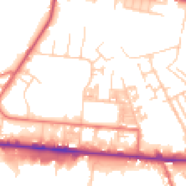
Daytime· 07:00 – 23:00
53.0dB

Night-time· 23:00 – 07:00
43.7dB