2 Derwentwater Grove, Leeds, LS6 3EN
About 2 Derwentwater Grove
2 Derwentwater Grove is a four-bedroom semi-detached house in Leeds (LS6 3EN). It has a recorded floor area of 100 m² (around 1076 sq ft) and construction records dating it to 1900-1929. The latest certificate (June 2017) shows an E (score 50), well below the UK norm with real room to improve. The recommended improvements would lift it to C (score 79), a 2-band jump.
Last sale on file: £288,000 in December 2023. Across the public record there are 4 sales, relatively high churn for a single property. 4 planning records sit against the property, 1 approved, 0 refused. Past consents include tree works, meaningful when judging how the property has evolved. It lags the bulk of the postcode on energy efficiency (less efficient than 76% of similar EPCs). Across 2001–2023, sale prices on this property compounded at 4% per year. Today's modelled estimate of £326,000 is 13.2% above the 2023 sale price. On a £-per-square-foot basis, the last sale (£268/sq ft) was about 58.5% above the typical sold price in the postcode.
Know exactly what you're buying at 2 Derwentwater Grove
Before you offer, see what the listing won't tell you, the true value, the red flags and the full history.
Already flagged here
Valuation
against the asking price
Risks
planning & flood
Sold prices
similar homes nearby
Trends
the local market
What this property has
Inside
- Bedrooms4
- Bathrooms2
- EnsuiteYes
Outside
- Private gardenRear
- DrivewayYes
Building
- Central heatingYes
- RefurbishedYes
Energy performance
2 Derwentwater Grove's carbon output runs well above what efficient homes in the postcode produce.
EPC Rating
Planning history
Planning history at 2 Derwentwater Grove is exclusively tree-management applications — typical for a property with mature trees on or near the plot.
- Aug 2025Tree WorksTreesIn report
T1 Eucalyptus: Proposed to crown reduce tree by 7-8 metres in height, with a finished height of 14-15metres. Reduce crown spread over road by 5m. Reduce crown spread over garden by 4m. Crown lift over footpath by 3m. Crown lift to 5.2m from ground level over road.
- Agent
- Yorkshire Tree Contractors Ltd
- Documents
- 4 docs on file
- Reference
- 25/03777/TR
- Jul 2022Tree WorksTreesIn report
T1 Eucalyptus - To dismantle and remove due to continued direct damage, to surfacing on and off-site, along with damage to walls and drainage. Replace with an appropriate species.
- Documents
- 7 docs on file
- Reference
- 21/01327/TR
We flagged 1 thing worth checking at 2 Derwentwater Grove
Independent checks surfaced things a buyer would want to understand before offering. The report explains each one in full, with the underlying data and what to ask.
- Signs of HMO activity in the area
30-day money-back guarantee
Sales history & valuation
2 Derwentwater Grove has more than doubled in price since the earliest registered sale in 2001.
£326,000
Modelled from EPC, postcode comparables and a sale-price growth of 4.0% per year over 23 years.
£288,000
Growth on file: 4.0% per year over 23 years.
Sales timeline
19 December 2023Most recent
£288,000
-10.0%over 15 years30 April 2008
£320,000
+44.8%over 3 years3 October 2004
£221,000
+87.3%over 3 years31 May 2001
£118,000
Median price across the last 5 sales in LS6 3EN: £130,000 (2024–2022).
Nearby sales in LS6 3EN
Everything we know about 2 Derwentwater Grove, in one report
What it's really worth, what could be wrong, and the planning, sales and area data in full.
What we flagged
- Signs of HMO activity in the area

Versus other Derwentwater Grove homes
2 Derwentwater Grove outperforms the street on price per m² by a wide margin.
Price per m²
£2,880
Street avg £1,823
Floor Area
100 m²
Street avg 102 m²
Habitable Rooms
5 rooms
Street avg 6 rooms
CO₂ Emissions
6.6 t/year
Street avg 5.5 t/year
Similar properties nearby
1 Dennistead Crescent
LS6 3PU
1 Ash Gardens
LS6 3LD
1 Batcliffe Drive
LS6 3QB
1 Foxcroft Green
LS6 3NR
1 Foxcroft Close
LS6 3NT
1 Foxcroft Road
LS6 3NJ
1 Cardigan Road
LS6 3AE
1 Foxcroft Walk
LS6 3NP
The neighbourhood at a glance
Rail-style transport is unusually close for this postcode.
Crime
5/mo
Steady year-on-year across the wider district.
Nearest stop
0.1 km
Headingley Stadium — bus stop.
Closest school
0.6 km
Spring Bank Primary School. 36 schools nearby.
Go deeper on the local area
The full report breaks down crime, transport links, schools and air quality in depth.
Road noise across the postcode
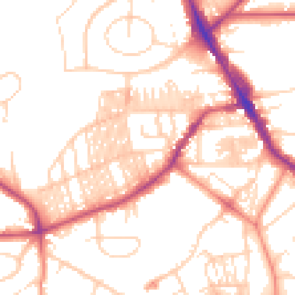
Daytime· 07:00 – 23:00
52.1dB

Night-time· 23:00 – 07:00
41.5dB