14 Barrett Grove, Dunholme, Lincoln, LN2 3SX
About 14 Barrett Grove
14 Barrett Grove is a three-bedroom detached house in Dunholme, Lincoln, Lincoln (LN2 3SX). It has a recorded floor area of 99 m² (around 1070 sq ft), construction records dating it to 1983-1990 and council tax band D. The latest certificate (March 2012) shows a D (score 59), a step below the typical UK home. The recommended improvements would push it to C (score 69). The latest certificate is from March 2012, so improvements made since then won't be reflected. The home occupies a cul-de-sac position.
At 99 m² the property is well over the postcode median (61 m² across 21 EPCs), placing it in the larger end of the local stock. Across 2012–2018, sale prices on this property compounded at 7.2% per year. Today's modelled estimate of £301,000 is 22.9% above the 2018 sale price. Most recent transfer: September 2018 at £245,000.
What this property has
Inside
- Bedrooms3
- Bathrooms1
- Dining roomYes
Outside
- Private gardenRear
- GarageDouble, Detached
- Cul-de-sacYes
Everything you need to know about 14 Barrett Grove
The true value, the hidden risks and the full sale history, in one report.
Pick your report · every report is £14.99
One time fee only - money back guarantee

The data behind every report


Energy performance
14 Barrett Grove's EPC is over a decade old — improvements since won't be reflected.
EPC Expired
This certificate is over 10 years old and is no longer valid.Expired 02 Mar 2022
EPC Rating
Get a survey for this property
Level 2 HomeBuyer Report
We've checked 10 risk factors against the available data for this property and believe a Level 2 HomeBuyer Report could be a suitable option for you.
From £595 · Includes VAT
Planning history
14 Barrett Grove has no planning applications on record.
But the area is active
1 notable application nearby — larger schemes and conversions that could reshape the street. The report maps them all.
Sales history & valuation
14 Barrett Grove saw 3 transfers in just over a decade — high turnover for the postcode.
£301,000
Modelled from EPC, postcode comparables and a sale-price growth of 7.2% per year over 6 years.
£245,000
Growth on file: 7.2% per year over 6 years.
Sales timeline
6 September 2018Most recent
£245,000
+32.5%over 2 years12 February 2016
£184,950
+12.8%over 3 years16 November 2012
£164,000
Median price across the last 5 sales in LN2 3SX: £255,000 (2025–2016).
Nearby sales in LN2 3SX
1a, Barrett Grove, Dunholme, Lincoln, LN2 3SX
Sold Nov 2025
£285,00010 Barrett Grove, Dunholme, Lincoln, LN2 3SX
Sold Jun 2021
£275,00017 Barrett Grove, Dunholme, Lincoln, LN2 3SX
Sold Mar 2021
£255,00019 Barrett Grove, Dunholme, Lincoln, LN2 3SX
Sold Mar 2019
£215,00012 Barrett Grove, Dunholme, Lincoln, LN2 3SX
Sold Aug 2007
£200,000
Versus other Barrett Grove homes
On co₂ emissions, 14 Barrett Grove runs well behind the street norm.
Price per m²
£2,464
Street avg £2,799
Floor Area
99 m²
Street avg 67 m²
Habitable Rooms
5 rooms
Street avg 4 rooms
CO₂ Emissions
4.9 t/year
Street avg 2.8 t/year
Everything you need to know about 14 Barrett Grove
The true value, the hidden risks and the full sale history, in one report.
Pick your report · every report is £14.99
One time fee only - money back guarantee
The data behind every report
Similar properties nearby
1 Ashing Lane, Dunholme
LN2 3NN
1 Ayam Close, Welton
LN2 3QG
1 Bramble Close, Welton
LN2 3TX
1 Chancel Court, Welton
LN2 3NT
1 Brinkhall Way, Welton
LN2 3NS
1 Allwood Road, Dunholme
LN2 3SG
1 Creasy Drive, Dunholme
LN2 3TB
1 Arrow Mews, Dunholme
LN2 3GB
The neighbourhood at a glance
Crime
3/mo
Steady year-on-year across the wider district.
Nearest stop
0.1 km
Ryland Road — bus stop.
Closest school
0.3 km
Dunholme St Chad's Church of England Primary School. 4 schools nearby.
Go deeper on the local area
A Local Area report breaks down crime, transport links, schools and air quality in depth.
Road noise across the postcode
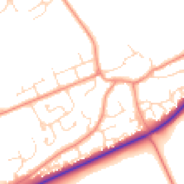
Daytime· 07:00 – 23:00
50.3dB

Night-time· 23:00 – 07:00
40.2dB