9 Gaddesby Lane, Rearsby, Leicester, LE7 4YJ
About 9 Gaddesby Lane
9 Gaddesby Lane is a detached house in Rearsby, Leicester, Leicester (LE7 4YJ). It has a recorded floor area of 162 m² (around 1744 sq ft), construction records dating it to 1950-1966 and council tax band G. The latest certificate (December 2016) shows a D (score 58), a step below the typical UK home. Earlier certificates rated it C (April 2015); the latest reading is one band lower. Between certificates, wall efficiency dropped from Good to Poor and roof efficiency dropped from Average to Poor. The recommended improvements would push it to C (score 79).
At 162 m² it sits well below the postcode median (232 m² across 14 EPCs), making it one of the more compact homes locally. It lags the bulk of the postcode on energy efficiency (less efficient than 79% of similar EPCs). 8 planning records sit against the property, 7 approved, 0 refused. Past consents include tree works and an extension, meaningful when judging how the property has evolved. Across 2008–2015, sale prices on this property compounded at 9.5% per year. Today's modelled estimate of £633,000 is 34.7% above the 2015 sale price. On a £-per-square-foot basis, the last sale (£270/sq ft) was about 51.7% above the typical sold price in the postcode. Last changed hands 11 years ago, in June 2015.
Know exactly what you're buying at 9 Gaddesby Lane
Before you offer, see what the listing won't tell you, the true value, the red flags and the full history.
Already flagged here
Valuation
against the asking price
Risks
planning & flood
Sold prices
similar homes nearby
Trends
the local market
Energy performance
9 Gaddesby Lane's carbon output runs well above what efficient homes in the postcode produce.
EPC Rating
Planning history
9 Gaddesby Lane has been through 7 approved planning applications — a well-evolved property.
- Sept 2025Tree WorksTreesIn report
Fell 1 No. Birch tree to ground level.
- Documents
- 4 docs on file
- Reference
- P/25/1855/2
- Nov 2022Tree WorksTreesIn report
1 x Lime Tree with substantial decay to the point that a screwdriver can be inserted straight in to the tree. Obvious ganoderma fungal infection and the tree is considered unsafe therefore I would recommend and am applying for it to be felled.
- Documents
- 6 docs on file
- Reference
- P/22/1134/2
We flagged 1 thing worth checking at 9 Gaddesby Lane
Independent checks surfaced things a buyer would want to understand before offering. The report explains each one in full, with the underlying data and what to ask.
- Larger development activity nearby
30-day money-back guarantee
Sales history & valuation
9 Gaddesby Lane valuation sits well clear of the typical sold price in this postcode.
£633,000
Modelled from EPC, postcode comparables and a sale-price growth of 9.5% per year over 7 years.
£470,000
Growth on file: 9.5% per year over 7 years.
Sales timeline
29 June 2015Most recent
£470,000
+93.8%over 7 years11 March 2008
£242,500
Median price across the last 5 sales in LE7 4YJ: £857,500 (2025–2022).
Nearby sales in LE7 4YJ
13 Gaddesby Lane, Rearsby, Leicester, LE7 4YJ
Sold Jan 2025
£392,50015 Gaddesby Lane, Rearsby, Leicester, LE7 4YJ
Sold Mar 2024
£1,075,00023 Gaddesby Lane, Rearsby, Leicester, LE7 4YJ
Sold Dec 2023
£857,50021 Gaddesby Lane, Rearsby, Leicester, LE7 4YJ
Sold Nov 2023
£858,50017 Gaddesby Lane, Rearsby, Leicester, LE7 4YJ
Sold Aug 2018
£700,000
Everything we know about 9 Gaddesby Lane, in one report
What it's really worth, what could be wrong, and the planning, sales and area data in full.
What we flagged
- Larger development activity nearby

Versus other Gaddesby Lane homes
On co₂ emissions, 9 Gaddesby Lane runs well behind the street norm.
Price per m²
£2,901
Street avg £2,408
Floor Area
162 m²
Street avg 240 m²
Habitable Rooms
10 rooms
Street avg 8 rooms
CO₂ Emissions
8.9 t/year
Street avg 5.5 t/year
Similar properties nearby
1 Broom Cottage, Baggrave End, Barsby
LE7 4RB
1 Church Lane, Rearsby
LE7 4YE
1 Gaddesby Lane, Rearsby
LE7 4YJ
1 Glebeland Close, Thrussington
LE7 4TT
1 Main Street, Barsby
LE7 4RH
1 Hoby Road, Thrussington
LE7 4TH
1 Fisher Close, Cossington
LE7 4US
1 Bennetts Lane, Cossington
LE7 4UP
The neighbourhood at a glance
Crime
2/mo
Steady year-on-year across the wider district.
Nearest stop
0.2 km
The Wheel — bus stop.
Closest school
0.3 km
St Michael & All Angels Church of England Primary School. 5 schools nearby.
Go deeper on the local area
The full report breaks down crime, transport links, schools and air quality in depth.
Road noise across the postcode
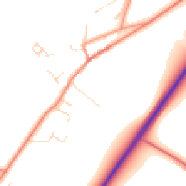
Daytime· 07:00 – 23:00
50.0dB

Night-time· 23:00 – 07:00
41.2dB