Model valuation£417,0008 Busby Close
Local market context
Amina House is a semi-detached house in High Wycombe (HP12 4AE). It has a recorded floor area of 49 m² (around 527 sq ft), construction records dating it to 2007-2011 and council tax band B. At 49 m² this is the smallest unit on EPC record across Amina House (49–56 m²). The building's EPC ratings span C to B, with this unit at the bottom. The latest certificate (March 2022) shows a C (score 80), near the top of the C band. The rating has held steady at C across 2 certificates since October 2013.
Across 2004–2006, sale prices on this property compounded at 15.3% per year. Today's modelled estimate of £317,000 is 15.5% below the 2006 sale of £375,000, a rare downward gap that often correlates with deferred maintenance or unfinished works. On a £-per-square-foot basis, the last sale (£711/sq ft) was about 112.1% above the typical sold price in the postcode. Untraded for 20 years, with the last transfer in July 2006. 4 planning records sit against the property, 2 approved, 2 refused. Past consents include partial demolition, meaningful when judging how the property has evolved. At 49 m² it's 25.2% smaller than the typical home in the postcode (66 m² median across 26 EPCs).
The true value, the hidden risks and the full sale history, in one report.
Pick your report · from £14.99
One time fee only - money back guarantee

The data behind every report


Amina House's carbon output is low for the local stock.
Certificate validity
Valid until 15 March 2032

Get a survey for this property
We've checked 10 risk factors against the available data for this property and believe a Level 2 HomeBuyer Report could be a suitable option for you.
From £595 · Includes VAT
Planning history includes recorded demolition works, indicating a major rebuild phase at this address.
4 applications on record at Amina House, Flat 3, 373 West Wycombe Road, High Wycombe, HP12 4AE
Demolition of detached house and double garage and erection of a block of six one bedroomed flats with associated covered parking, bin store and secure cycle storage
+ 1 more application in the report
You're seeing the shape of it. The report has the substance.
One time fee only - money back guarantee
£317,000
Modelled from EPC, postcode comparables and a sale-price growth of 15.3% per year over 2 years.
£375,000
Growth on file: 15.3% per year over 2 years.
17 July 2006Most recent
£375,000
+38.9%over 2 years28 March 2004
£270,000
Median price across the last 5 sales in HP12 4AE: £275,000 (2025–2023).
4 Elizabeth Place, West Wycombe Road, High Wycombe, HP12 4AE
Sold May 2025
383 West Wycombe Road, High Wycombe, HP12 4AE
Sold Jan 2025
West Side House, Flat 1, 391 West Wycombe Road, High Wycombe, HP12 4AE
Sold Jul 2023
West Side House, Flat 6, 391 West Wycombe Road, High Wycombe, HP12 4AE
Sold Mar 2023
West Side House, Flat 7, 391 West Wycombe Road, High Wycombe, HP12 4AE
Sold Jan 2023
On years held, Amina House stands well clear of the street.
Price per m²
£7,653
Street avg £6,574
Floor Area
49 m²
Street avg 54 m²
Habitable Rooms
2 rooms
Street avg 2 rooms
CO₂ Emissions
1.0 t/year
Street avg 1.0 t/year
Property research, connected
Explore sale histories, valuations, energy ratings and local areas. Ask the assistant to connect the details and take your research further.
Start your researchHP12 4BS
HP12 4BS
HP12 4RQ
HP12 4LH
HP12 4LH
HP12 4LH
HP12 4BS
HP12 4LH
Daytime road noise here sits well below conversation level — a quiet pocket of the postcode.
Crime
125/mo
Falling year-on-year across the wider district.
Nearest stop
0.1 km
Park Farm Road — bus stop.
Closest school
0.7 km
Millbrook Combined School. 10 schools nearby.
Go deeper on the local area
A Local Area report breaks down crime, transport links, schools and air quality in depth.
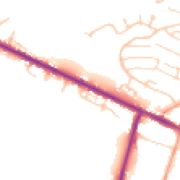
Daytime· 07:00 – 23:00
48.8dB

Night-time· 23:00 – 07:00
41.0dB