71 Barclay Road, Waltham Forest, London, E17 9JH
About 71 Barclay Road
71 Barclay Road is a three-bedroom mid-terrace house in Waltham Forest, London, London (E17 9JH). It has a recorded floor area of 69 m² (around 743 sq ft), construction records dating it to before 1900 and council tax band C. The latest certificate (October 2017) shows a D (score 63), on the cusp of jumping into the C band. The recommended improvements would lift it to B (score 83), a 2-band jump. Period features are noted in the property record.
It changed hands recently, sold June 2025 for £920,000. 6 planning records sit against the property, 3 approved, 2 refused. Past consents include an extension, meaningful when judging how the property has evolved. Across 2018–2025, sale prices on this property compounded at 7% per year. On a £-per-square-foot basis, the last sale (£1,239/sq ft) was about 252.6% above the typical sold price in the postcode.
Know exactly what you're buying at 71 Barclay Road
Before you offer, see what the listing won't tell you, the true value, the red flags and the full history.
Already flagged here
Valuation
against the asking price
Risks
planning & flood
Sold prices
similar homes nearby
Trends
the local market
What this property has
Inside
- Bedrooms3
- Bathrooms2
- Open-plan layoutYes
- Dining roomYes
- EnsuiteYes
- FireplaceYes
Outside
- Private gardenYes
Building
- Period featuresYes
Energy performance
Recommended upgrades on file would lift this property by multiple EPC bands.
EPC Rating
Planning history
71 Barclay Road has been extended on multiple sides of the property across separate planning applications.
- Jul 2018ExtensionFullIn report
Extension: Single storey · Rear of property
Construction of single storey rear extensions
- Council
- WALTHAMSTOW
- Documents
- 4 docs on file
- Reference
- 181302
- Apr 2018ExtensionFullIn report
Extension: Single storey · Side and rear of property
Construction of single storey rear/side extension.
- Council
- WALTHAMSTOW
- Documents
- 4 docs on file
- Reference
- 180539
We flagged 2 things worth checking at 71 Barclay Road
Independent checks surfaced things a buyer would want to understand before offering. The report explains each one in full, with the underlying data and what to ask.
- Signs of HMO activity in the area
- Larger development activity nearby
30-day money-back guarantee
Sales history & valuation
Latest sale on 71 Barclay Road was the highest on Land Registry record across the postcode.
£955,000
Modelled from EPC, postcode comparables and a sale-price growth of 7.0% per year over 7 years.
£920,000
Growth on file: 7.0% per year over 7 years.
Sales timeline
15 June 2025Most recent
£920,000
+64.3%over 7 years16 February 2018
£560,000
Median price across the last 5 sales in E17 9JH: £728,500 (2025–2023).
Nearby sales in E17 9JH
59 Barclay Road, Waltham Forest, London, E17 9JH
Sold May 2025
£805,00039 Barclay Road, Waltham Forest, London, E17 9JH
Sold Oct 2024
£800,00017a, Barclay Road, London, E17 9JH
Sold Jun 2024
£415,00075c, Barclay Road, Waltham Forest, London, E17 9JH
Sold Sept 2023
£522,00027 Barclay Road, Waltham Forest, London, E17 9JH
Sold Aug 2023
£728,500
Everything we know about 71 Barclay Road, in one report
What it's really worth, what could be wrong, and the planning, sales and area data in full.
What we flagged
- Signs of HMO activity in the area
- Larger development activity nearby

Versus other Barclay Road homes
71 Barclay Road is notably below the street on years held.
Price per m²
£13,333
Street avg £7,199
Floor Area
69 m²
Street avg 77 m²
Habitable Rooms
3 rooms
Street avg 4 rooms
CO₂ Emissions
3.1 t/year
Street avg 3.8 t/year
Similar properties nearby
1 Eden Road, Waltham Forest
E17 9JS
1 Brunswick Street, Waltham Forest
E17 9NB
1 Alander Mews, Waltham Forest
E17 9SA
1 Eastern Road, Waltham Forest
E17 9DU
1 Barclay Road, Waltham Forest
E17 9JH
1 Evelyn Road, Waltham Forest
E17 9HE
1 Addison Road, Waltham Forest
E17 9LS
1 Copeland Road, Waltham Forest
E17 9DB
The neighbourhood at a glance
Reported crime in the wider district is trending notably upward year-on-year.
Crime
12/mo
Rising year-on-year across the wider district.
Nearest stop
0.2 km
Shernhall Street — bus stop.
Closest school
0.3 km
Henry Maynard Primary School. 62 schools nearby.
Go deeper on the local area
The full report breaks down crime, transport links, schools and air quality in depth.
Road noise across the postcode
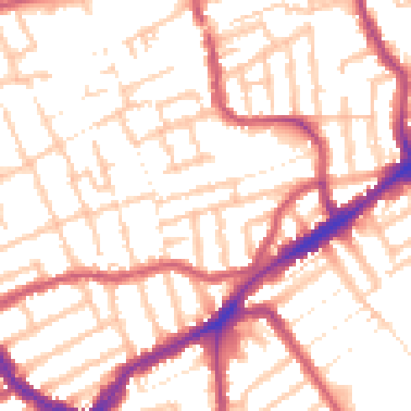
Daytime· 07:00 – 23:00
53.7dB

Night-time· 23:00 – 07:00
42.5dB