20 Wetherden Street, Waltham Forest, London, E17 8EJ
About 20 Wetherden Street
20 Wetherden Street is a three-bedroom mid-terrace house in Waltham Forest, London, London (E17 8EJ). It has a recorded floor area of 74 m² (around 797 sq ft), construction records dating it to 1900-1929 and council tax band B. At 74 m² this is the 25th smallest of 30 units on EPC record in the building, where floor areas span 38–93 m². The building's EPC ratings span E to C across 30 units on file. Period features are noted in the property record. The latest certificate (May 2015) shows a D (score 66), on the cusp of jumping into the C band. The recommended improvements would push it to C (score 80). The latest certificate is from May 2015, so improvements made since then won't be reflected.
Held since February 2002 — that's 24 years off the open market, well above the local norm. Today's modelled estimate of £529,000 sits 384.4% above the 2002 sale of £109,198. On a £-per-square-foot basis, the last sale (£137/sq ft) was about 44.7% below the postcode norm. One planning record on file: an extension approved in 2018. Past consents include an extension and a loft conversion, meaningful when judging how the property has evolved.
Know exactly what you're buying at 20 Wetherden Street
Before you offer, see what the listing won't tell you, the true value, the red flags and the full history.
Already flagged here
Valuation
against the asking price
Risks
planning & flood
Sold prices
similar homes nearby
Trends
the local market
What this property has
Inside
- Bedrooms3
- Bathrooms2
- EnsuiteYes
Outside
- Shared gardenYes
Building
- Period featuresYes
- RefurbishedYes
Energy performance
20 Wetherden Street's EPC is over a decade old — improvements since won't be reflected.
EPC Expired
This certificate is over 10 years old and is no longer valid.Expired 29 May 2025
EPC Rating
Planning history
- Oct 2018Loft ConversionFullIn report
Construction of dormer roof extension to main rear roof, together withthe installation of two roof lights to front roof.
- Council
- LEYTON
Extension- Documents
- 3 docs on file
- Reference
- 182739
We flagged 1 thing worth checking at 20 Wetherden Street
Independent checks surfaced things a buyer would want to understand before offering. The report explains each one in full, with the underlying data and what to ask.
- Signs of HMO activity in the area
30-day money-back guarantee
Sales history & valuation
20 Wetherden Street's modelled value sits at over four times its earliest registered sale price (2002).
£529,000
Modelled from EPC, postcode comparables.
£109,198
Recorded with HM Land Registry.
Sales timeline
18 February 2002Most recent
£109,198
Median price across the last 5 sales in E17 8EJ: £475,000 (2025–2024).
Nearby sales in E17 8EJ
26 Wetherden Street, Waltham Forest, London, E17 8EJ
Sold Aug 2025
£475,00032 Wetherden Street, Waltham Forest, London, E17 8EJ
Sold Jul 2024
£480,00034 Wetherden Street, Waltham Forest, London, E17 8EJ
Sold Jun 2024
£435,35058 Wetherden Street, Waltham Forest, London, E17 8EJ
Sold Mar 2024
£437,20012 Wetherden Street, Waltham Forest, London, E17 8EJ
Sold Mar 2024
£595,000
Everything we know about 20 Wetherden Street, in one report
What it's really worth, what could be wrong, and the planning, sales and area data in full.
What we flagged
- Signs of HMO activity in the area

Versus other Wetherden Street homes
20 Wetherden Street outperforms the street on years held by a wide margin.
Price per m²
£1,476
Street avg £4,818
Floor Area
74 m²
Street avg 66 m²
Habitable Rooms
3 rooms
Street avg 3 rooms
CO₂ Emissions
2.9 t/year
Street avg 2.8 t/year
Similar properties nearby
1 Bowdon Road, Waltham Forest
E17 8JB
1 Connaught Road, Waltham Forest
E17 8QB
1 Harris Street, Waltham Forest
E17 8EG
1 Acacia Road, Waltham Forest
E17 8BN
1 Forster Road, Waltham Forest
E17 8AU
1 Devonshire Road, Waltham Forest
E17 8QH
1 Alexandra Road, Waltham Forest
E17 8DU
1 Brunel Road, Waltham Forest
E17 8SA
The neighbourhood at a glance
Rail-style transport is unusually close for this postcode.
Crime
12/mo
Rising year-on-year across the wider district.
Nearest stop
0.1 km
St Saviour's Church — bus stop.
Closest school
0.2 km
Sybourn Primary School. 72 schools nearby.
Go deeper on the local area
The full report breaks down crime, transport links, schools and air quality in depth.
Road noise across the postcode
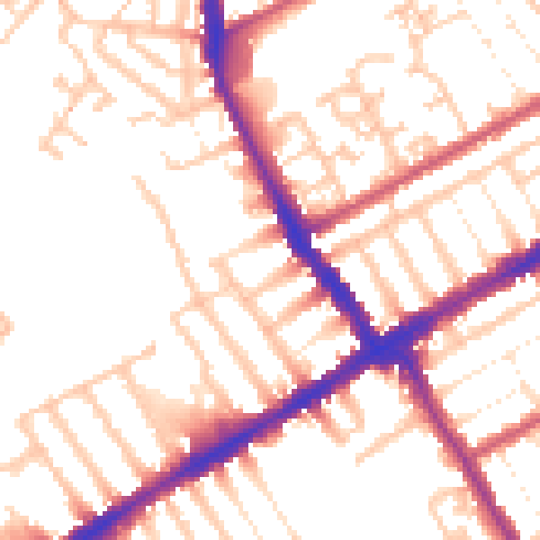
Daytime· 07:00 – 23:00
52.8dB

Night-time· 23:00 – 07:00
42.9dB