338a, Church Road, St George, Bristol, BS5 8AJ
About 338a
338a is a semi-detached house in St. George, Bristol, Bristol (BS5 8AJ). It has a recorded floor area of 109 m² (around 1173 sq ft), construction records dating it to before 1900 and council tax band B. The latest certificate (June 2023) shows a C (score 69), just inside the C band. When first surveyed in December 2014 the rating was E, the property has climbed 2 bands since. Between certificates, wall efficiency went from Very Poor to Good, roof efficiency went from Very Poor to Very Good and window efficiency went from Very Poor to Good.
Today's modelled estimate of £339,000 is 11.9% below the 2023 sale of £385,000, running counter to the wider postcode trend, which makes the EPC and condition history especially worth a look. At 109 m² the property is well over the postcode median (47 m² across 58 EPCs), placing it in the larger end of the local stock. Last sale on file: £385,000 in April 2023.
Everything you need to know about 338a
The true value, the hidden risks and the full sale history, in one report.
Pick your report · from £14.99
One time fee only - money back guarantee

The data behind every report





Energy performance
EPC Rating
Certificate validity
Valid until 21 June 2033
Property Improvements
Changes detected from historical EPC data
Heating controls upgraded for better temperature management
Single glazing replaced with double or better glazing
Wall insulation improved
Loft insulation installed or upgraded to 250mm+
More low energy lighting installed

Get a survey for this property
Level 3 Building Survey
Because the property was built before 1919 and has solid (non-cavity) walls, we believe a Level 3 building survey should be considered.
From £955 · Includes VAT
Planning history
338a has no planning applications on record.
But the area is active
10 notable applications nearby — larger schemes and conversions that could reshape the street. The report maps them all.
Sales history & valuation
338a valuation sits well clear of the typical sold price in this postcode.
£339,000
Modelled from EPC, postcode comparables.
£385,000
Recorded with HM Land Registry.
Sales timeline
16 April 2023Most recent
£385,000
Median price across the last 5 sales in BS5 8AJ: £251,150 (2026–2025).
Nearby sales in BS5 8AJ
Fountain Park Court, Flat 6, 314 Church Road, St George, Bristol, BS5 8AJ
Sold May 2026
£270,000Fountain Park Court, Flat 7, 314 Church Road, St George, Bristol, BS5 8AJ
Sold Jan 2026
£270,000Fountain Park Court, Flat 1, 314 Church Road, St George, Bristol, BS5 8AJ
Sold Nov 2025
£251,150306 Church Road, St George, Bristol, BS5 8AJ
Sold Nov 2025
£170,000Don John House, Flat 13, 312 Church Road, St George, Bristol, BS5 8AJ
Sold Oct 2025
£100,000
Versus other Church Road homes
Floor Area for 338a runs comfortably ahead of the street norm.
Price per m²
£3,532
Street avg £3,948
Floor Area
109 m²
Street avg 45 m²
Habitable Rooms
6 rooms
Street avg 2 rooms
CO₂ Emissions
3.7 t/year
Street avg 1.8 t/year
Everything you need to know about 338a
The true value, the hidden risks and the full sale history, in one report.
Pick your report · from £14.99
One time fee only - money back guarantee
The data behind every report
Similar properties nearby
1 Air Balloon Road
BS5 8LB
1 Battens Lane
BS5 8TG
1 Bennett Road
BS5 8EY
1 Butler Villas, Summerhill Road
BS5 8FU
1 Avon Close, St George
BS5 8DE
1 Ebenezer Street
BS5 8EF
1 Cossham Road
BS5 8DR
1 Anchor Close, St George
BS5 8DF
The neighbourhood at a glance
Crime
627/mo
Steady year-on-year across the wider district.
Nearest stop
0.1 km
Northcote Road — bus stop.
Closest school
0.3 km
Summerhill Infant School. 44 schools nearby.
Go deeper on the local area
A Local Area report breaks down crime, transport links, schools and air quality in depth.
Road noise across the postcode
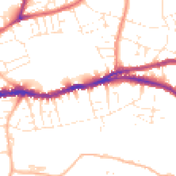
Daytime· 07:00 – 23:00
50.5dB

Night-time· 23:00 – 07:00
40.9dB