27 Carr Lane, Lowton, Warrington, WA3 1AF
About 27 Carr Lane
27 Carr Lane is a two-bedroom mid-terrace house in Lowton, Warrington, Warrington (WA3 1AF). It has a recorded floor area of 82 m² (around 883 sq ft), construction records dating it to 1900-1929 and council tax band A. The latest certificate (April 2021) shows a C (score 71). The recommended improvements would push it to B (score 87).
Untraded for 18 years, with the last transfer in July 2008. That sale landed at the peak of the pre-credit-crunch market, which is a useful reference point when interpreting the price. Its energy rating outperforms most of the postcode (better than 85% of similar EPCs). Across 1997–2008, sale prices on this property compounded at 15.7% per year. Today's modelled estimate of £143,000 is 49% above the 2008 sale price. On a £-per-square-foot basis, the last sale (£109/sq ft) was about 21.3% above the typical sold price in the postcode.
What this property has
Inside
- Bedrooms2
Outside
- Private gardenRear
Building
- RefurbishedYes
Everything you need to know about 27 Carr Lane
The true value, the hidden risks and the full sale history, in one report.
Pick your report · every report is £14.99
One time fee only - money back guarantee

The data behind every report


Energy performance
EPC Rating
Get a survey for this property
Level 3 Building Survey
Because the property was built before 1919, we believe a Level 3 building survey should be considered.
From £820 · Includes VAT
Planning history
27 Carr Lane has no planning applications on record.
A planning report still maps activity across the surrounding area and reads this property's extension & conversion potential.
Sales history & valuation
27 Carr Lane has more than quadrupled in price since its earliest registered sale in 1997.
£143,000
Modelled from EPC, postcode comparables and a sale-price growth of 15.7% per year over 12 years.
£96,000
Growth on file: 15.7% per year over 12 years.
Sales timeline
24 July 2008Most recent
£96,000
+65.4%over 5 years2 December 2002
£58,050
+222.5%over 5 years21 January 1997
£18,000
Median price across the last 5 sales in WA3 1AF: £149,000 (2025–2019).
Nearby sales in WA3 1AF
13 Carr Lane, Lowton, Warrington, WA3 1AF
Sold Nov 2025
£149,00033 Carr Lane, Lowton, Warrington, WA3 1AF
Sold Sept 2025
£606,0005 Carr Lane, Lowton, Warrington, WA3 1AF
Sold Nov 2019
£91,00029 Carr Lane, Lowton, Warrington, WA3 1AF
Sold Jul 2019
£135,00015 Carr Lane, Lowton, Warrington, WA3 1AF
Sold Sept 2018
£92,000
Versus other Carr Lane homes
On epc rating, 27 Carr Lane stands well clear of the street.
Price per m²
£1,171
Street avg £1,517
Floor Area
82 m²
Street avg 86 m²
Habitable Rooms
4 rooms
Street avg 5 rooms
CO₂ Emissions
2.8 t/year
Street avg 4.3 t/year
Everything you need to know about 27 Carr Lane
The true value, the hidden risks and the full sale history, in one report.
Pick your report · every report is £14.99
One time fee only - money back guarantee
The data behind every report
Similar properties nearby
1 Carr Lane, Lowton
WA3 1AF
1 Chapel Terrace, Lowton
WA3 1EF
1 Bodden Street, Lowton
WA3 1DX
1 Heathmoor Avenue, Lowton
WA3 1HP
1 Clayhill Grove, Lowton
WA3 1FZ
1 Adwell Close, Lowton
WA3 1DE
1 Kirkham Avenue, Lowton
WA3 1LL
1 Glastonbury Avenue, Lowton
WA3 1ET
The neighbourhood at a glance
Crime
1/mo
Steady year-on-year across the wider district.
Nearest stop
0.2 km
Pocket Nook Lane — bus stop.
Closest school
0.3 km
Lowton Junior and Infant School. 11 schools nearby.
Go deeper on the local area
A Local Area report breaks down crime, transport links, schools and air quality in depth.
Road noise across the postcode
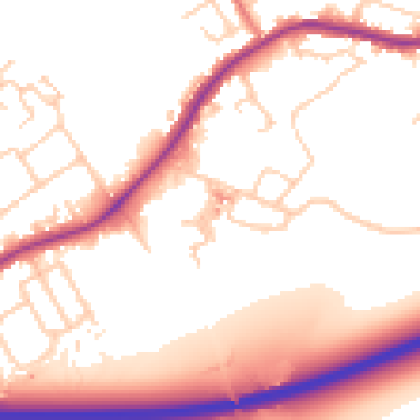
Daytime· 07:00 – 23:00
54.7dB

Night-time· 23:00 – 07:00
48.1dB