1 Carr Lane, Lowton, Warrington, WA3 1AF
About 1 Carr Lane
1 Carr Lane is a two-bedroom end-of-terrace house in Lowton, Warrington, Warrington (WA3 1AF). It has a recorded floor area of 38 m² (around 409 sq ft), construction records dating it to 1900-1929 and council tax band A. The latest certificate (July 2014) shows an E (score 47), well below the UK norm with real room to improve. The recommended improvements would lift it to B (score 84), a 3-band jump. The latest certificate is from July 2014, so improvements made since then won't be reflected.
Across 2007–2017, sale prices on this property compounded at 16% per year. Today's modelled estimate of £158,000 sits 54.9% above the 2017 sale of £102,000. On a £-per-square-foot basis, the last sale (£249/sq ft) was about 184.2% above the typical sold price in the postcode. At 38 m² it sits well below the postcode median (83 m² across 13 EPCs), making it one of the more compact homes locally. It lags the bulk of the postcode on energy efficiency (less efficient than 85% of similar EPCs). On the market in July 2017 and unlisted since — roughly 9 years.
What this property has
Inside
- Bedrooms2
- Bathrooms1
Outside
- Private gardenYes
- DrivewayYes
Building
- RefurbishedYes
Everything you need to know about 1 Carr Lane
The true value, the hidden risks and the full sale history, in one report.
Pick your report · every report is £14.99
One time fee only - money back guarantee

The data behind every report


Energy performance
Recommended upgrades on file would lift this property by multiple EPC bands.
EPC Expired
This certificate is over 10 years old and is no longer valid.Expired 26 Jul 2024
EPC Rating
Get a survey for this property
Level 3 Building Survey
Because the property was built before 1919, we believe a Level 3 building survey should be considered.
From £820 · Includes VAT
Planning history
1 Carr Lane has no planning applications on record.
A planning report still maps activity across the surrounding area and reads this property's extension & conversion potential.
Sales history & valuation
1 Carr Lane has more than quadrupled in price since its earliest registered sale in 2007.
£158,000
Modelled from EPC, postcode comparables and a sale-price growth of 16.0% per year over 10 years.
£102,000
Growth on file: 16.0% per year over 10 years.
Sales timeline
23 July 2017Most recent
£102,000
+4.1%over 2 years5 May 2015
£98,000
+334.3%over 7 years30 May 2007
£22,567
Median price across the last 5 sales in WA3 1AF: £149,000 (2025–2019).
Nearby sales in WA3 1AF
13 Carr Lane, Lowton, Warrington, WA3 1AF
Sold Nov 2025
£149,00033 Carr Lane, Lowton, Warrington, WA3 1AF
Sold Sept 2025
£606,0005 Carr Lane, Lowton, Warrington, WA3 1AF
Sold Nov 2019
£91,00029 Carr Lane, Lowton, Warrington, WA3 1AF
Sold Jul 2019
£135,00015 Carr Lane, Lowton, Warrington, WA3 1AF
Sold Sept 2018
£92,000
Versus other Carr Lane homes
On floor area, 1 Carr Lane runs well behind the street norm.
Price per m²
£2,684
Street avg £1,366
Floor Area
38 m²
Street avg 90 m²
Habitable Rooms
5 rooms
Street avg 4 rooms
CO₂ Emissions
3.4 t/year
Street avg 4.2 t/year
Everything you need to know about 1 Carr Lane
The true value, the hidden risks and the full sale history, in one report.
Pick your report · every report is £14.99
One time fee only - money back guarantee
The data behind every report
Similar properties nearby
1 Chapel Terrace, Lowton
WA3 1EF
1 Bodden Street, Lowton
WA3 1DX
1 Heathmoor Avenue, Lowton
WA3 1HP
1 Clayhill Grove, Lowton
WA3 1FZ
1 Adwell Close, Lowton
WA3 1DE
1 Kirkham Avenue, Lowton
WA3 1LL
1 Glastonbury Avenue, Lowton
WA3 1ET
1 Crompton Way, Lowton
WA3 1FS
The neighbourhood at a glance
Crime
1/mo
Steady year-on-year across the wider district.
Nearest stop
0.2 km
Pocket Nook Lane — bus stop.
Closest school
0.3 km
Lowton Junior and Infant School. 11 schools nearby.
Go deeper on the local area
A Local Area report breaks down crime, transport links, schools and air quality in depth.
Road noise across the postcode
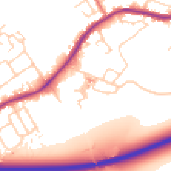
Daytime· 07:00 – 23:00
54.7dB

Night-time· 23:00 – 07:00
48.1dB