35 Petersfield Road, Staines Upon Thames, TW18 1DF
About 35 Petersfield Road
35 Petersfield Road is a four-bedroom semi-detached house in Staines Upon Thames (TW18 1DF). It has a recorded floor area of 104 m² (around 1119 sq ft), construction records dating it to 1900-1929 and council tax band D. The latest certificate (June 2017) shows a D (score 57), a step below the typical UK home. The recommended improvements would push it to C (score 76). Records show the property has been extended at some point in its history. The home occupies a cul-de-sac position.
2 planning records sit against the property, 2 approved, 0 refused. Past consents include an extension, meaningful when judging how the property has evolved. At 104 m² it's 16.9% larger than the typical home in the postcode (89 m² median across 3 EPCs). Across 1998–2024, sale prices on this property compounded at 5.2% per year. On a £-per-square-foot basis, the last sale (£438/sq ft) was about 49.2% above the typical sold price in the postcode. Last sale on file: £490,000 in October 2024.
Know exactly what you're buying at 35 Petersfield Road
Before you offer, see what the listing won't tell you, the true value, the red flags and the full history.
Already flagged here
Valuation
against the asking price
Risks
planning & flood
Sold prices
similar homes nearby
Trends
the local market
What this property has
Inside
- Bedrooms4
- Bathrooms1
- Dining roomYes
- CloakroomYes
Outside
- Private gardenYes
- GarageYes
- Cul-de-sacYes
Building
- Previously extendedYes
Energy performance
EPC Rating
Planning history
35 Petersfield Road has been extended on multiple sides of the property across separate planning applications.
- May 2025ExtensionFullIn report
Extension: Single storey · Side and rear of property
Erection of a single storey side/rear extension to the back of existing rear extension, connecting to existing store.
- Agent
- AJT Design Services Ltd
- Documents
- 9 docs on file
- Reference
- 25/00340/HOU
- Sept 2005ExtensionFullIn report
Extension: Single storey · Rear of property
Erection of a single-storey rear extension.
- Documents
- 9 docs on file
- Reference
- 05/00779/FUL
We flagged 1 thing worth checking at 35 Petersfield Road
Independent checks surfaced things a buyer would want to understand before offering. The report explains each one in full, with the underlying data and what to ask.
- Signs of HMO activity in the area
30-day money-back guarantee
Sales history & valuation
Latest sale on 35 Petersfield Road was the highest on Land Registry record across the postcode.
£509,000
Modelled from EPC, postcode comparables and a sale-price growth of 5.2% per year over 26 years.
£490,000
Growth on file: 5.2% per year over 26 years.
Sales timeline
31 October 2024Most recent
£490,000
+281.3%over 26 years14 July 1998
£128,500
Median price across the last 5 sales in TW18 1DF: £245,000 (2023–2000).
Nearby sales in TW18 1DF
49 Petersfield Road, Staines Upon Thames, TW18 1DF
Sold Aug 2023
£450,00039 Petersfield Road, Staines Upon Thames, TW18 1DF
Sold Sept 2013
£322,00051 Petersfield Road, Staines Upon Thames, TW18 1DF
Sold Aug 2006
£245,00045 Petersfield Road, Staines Upon Thames, TW18 1DF
Sold Jun 2001
£185,00033 Petersfield Road, Staines Upon Thames, TW18 1DF
Sold Aug 2000
£157,500
Everything we know about 35 Petersfield Road, in one report
What it's really worth, what could be wrong, and the planning, sales and area data in full.
What we flagged
- Signs of HMO activity in the area

Versus other Petersfield Road homes
EPC Rating for 35 Petersfield Road lags the street by a wide margin.
EPC Rating
57 (D)
Street avg 66 (D)
Floor Area
104 m²
Street avg 90 m²
CO₂ Emissions
5.2 t/year
Street avg 3.3 t/year
Habitable Rooms
5 rooms
Street avg 5 rooms
Similar properties nearby
1 Berryscroft Road
TW18 1ND
1 Abbot Close
TW18 1QY
1 Chestnut Manor Close
TW18 1AG
1 Church Villas, The Broadway, Laleham
TW18 1SB
1 Cherry Tree Avenue
TW18 1JB
1 Chestnut Grove
TW18 1DB
1 Fenton Avenue
TW18 1DD
1 Edinburgh Drive
TW18 1PX
The neighbourhood at a glance
Rail-style transport is unusually close for this postcode.
Crime
8/mo
Steady year-on-year across the wider district.
Nearest stop
0.2 km
Fenton Avenue — bus stop.
Closest school
0.4 km
The Matthew Arnold School. 15 schools nearby.
Go deeper on the local area
The full report breaks down crime, transport links, schools and air quality in depth.
Road noise across the postcode
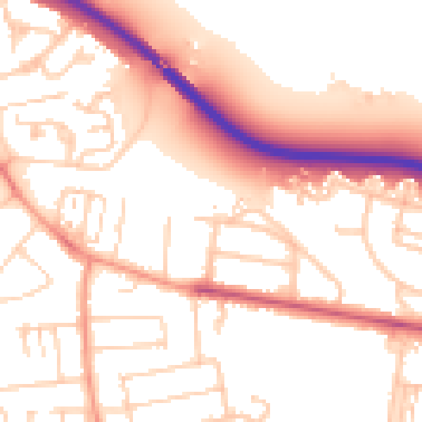
Daytime· 07:00 – 23:00
53.8dB

Night-time· 23:00 – 07:00
45.2dB