29 Church Road, West Kingsdown, Sevenoaks, TN15 6LL
About 29 Church Road
29 Church Road is a three-bedroom mid-terrace house in West Kingsdown, Sevenoaks, Sevenoaks (TN15 6LL). It has a recorded floor area of 88 m² (around 947 sq ft), construction records dating it to 1967-1975 and council tax band C. The latest certificate (September 2020) shows a C (score 71). When first surveyed in March 2010 the rating was G, the property has climbed 4 bands since. Between certificates, roof efficiency went from Poor to Very Good, hot-water efficiency went from Very Poor to Good and main heating went from Very Poor to Good. The recommended improvements would push it to B (score 87). Other recorded features include notable views.
Its energy rating outperforms most of the postcode (better than 79% of similar EPCs). Across 2006–2022, sale prices on this property compounded at 5.2% per year. Today's modelled estimate of £397,000 is 10.3% above the 2022 sale price. On a £-per-square-foot basis, the last sale (£380/sq ft) was about 96.4% above the typical sold price in the postcode. Last sale on file: £360,000 in March 2022. That sale was during the post-pandemic price surge, when transactions cleared materially above pre-2020 trend.
Know exactly what you're buying at 29 Church Road
Before you offer, see what the listing won't tell you, the true value, the red flags and the full history.
Valuation
against the asking price
Risks
planning & flood
Sold prices
similar homes nearby
Trends
the local market
What this property has
Inside
- Bedrooms3
- Bathrooms1
- Dining roomYes
Outside
- Private gardenWest-facing
- ParkingOff street
- Notable viewsYes
Building
- RefurbishedYes
Energy performance
EPC Rating
Property Improvements
Changes detected from historical EPC data
Heating system changed
Heating controls upgraded for better temperature management
Hot water efficiency improved
Loft insulation upgraded to recommended levels
Low energy lighting percentage decreased
Upgraded to gas central heating
Connected to mains gas supply
Heating controls upgraded for better temperature management
Hot water system upgraded
More low energy lighting installed
Planning history
29 Church Road has no planning applications on record.
The full report still covers planning activity across the surrounding area.
Sales history & valuation
Sale price has at least doubled since 2006.
£397,000
Modelled from EPC, postcode comparables and a sale-price growth of 5.2% per year over 16 years.
£360,000
Growth on file: 5.2% per year over 16 years.
Sales timeline
27 March 2022Most recent
£360,000
+34.8%over 5 years15 September 2016
£267,000
+66.9%over 10 years27 April 2006
£160,000
Median price across the last 5 sales in TN15 6LL: £337,000 (2024–2019).
Nearby sales in TN15 6LL
45 Church Road, West Kingsdown, Sevenoaks, TN15 6LL
Sold Oct 2024
£360,00033 Church Road, West Kingsdown, Sevenoaks, TN15 6LL
Sold Oct 2022
£337,00023 Church Road, West Kingsdown, Sevenoaks, TN15 6LL
Sold Jul 2022
£368,0007 Church Road, West Kingsdown, Sevenoaks, TN15 6LL
Sold Jun 2020
£305,00013 Church Road, West Kingsdown, Sevenoaks, TN15 6LL
Sold Nov 2019
£325,000
Everything we know about 29 Church Road, in one report
What it's really worth, what could be wrong, and the planning, sales and area data in full.
- Am I paying too much?
- Is something wrong with it?
- Is the agent's story true?
- Will it hold its value?

Versus other Church Road homes
Price per m² for 29 Church Road runs comfortably ahead of the street norm.
Price per m²
£4,091
Street avg £3,129
Floor Area
88 m²
Street avg 85 m²
Habitable Rooms
4 rooms
Street avg 4 rooms
CO₂ Emissions
3.1 t/year
Street avg 3.6 t/year
Similar properties nearby
1 Boleyn Road, Kemsing
TN15 6RY
1 Astor Road, West Kingsdown
TN15 6HH
1 Brookfield, Kemsing
TN15 6SQ
1 Church Road, West Kingsdown
TN15 6LL
1 Beacon Row, London Road, West Kingsdown
TN15 6HT
1 Childsbridge Lane, Kemsing
TN15 6TH
1 Bennetts Avenue, West Kingsdown
TN15 6AT
1 Birchway, West Kingsdown
TN15 6JZ
The neighbourhood at a glance
Daytime road noise here sits well below conversation level — a quiet pocket of the postcode.
Crime
3/mo
Steady year-on-year across the wider district.
Nearest stop
0.2 km
Hever Avenue — bus stop.
Closest school
0.9 km
St. Edmund's Church of England Primary School. 1 school nearby.
Go deeper on the local area
The full report breaks down crime, transport links, schools and air quality in depth.
Road noise across the postcode
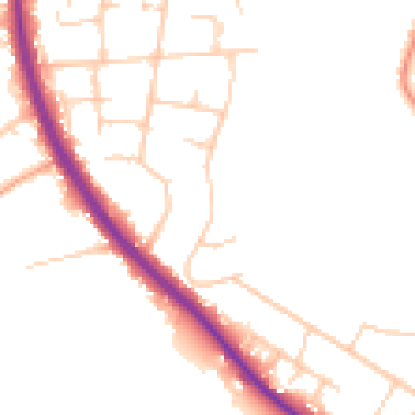
Daytime· 07:00 – 23:00
49.7dB

Night-time· 23:00 – 07:00
42.0dB