22 Church Street, Romsey, SO51 8BU
About 22 Church Street
22 Church Street is an end-of-terrace house in Romsey (SO51 8BU). It has a recorded floor area of 121 m² (around 1302 sq ft), construction records dating it to 1900-1929 and council tax band B. The latest certificate (June 2024) shows a D (score 61), on the cusp of jumping into the C band. When first surveyed in March 2014 the rating was E, the property has climbed 1 band since. Between certificates, window efficiency went from Average to Good and lighting went from Very Poor to Very Good. The recommended improvements would lift it to B (score 84), a 2-band jump.
Across 1995–2017, sale prices on this property compounded at 7.8% per year. Today's modelled estimate of £445,000 is 15.6% below the 2017 sale of £527,000, an unusual pattern given regional price growth and worth checking against the EPC condition. On a £-per-square-foot basis, the last sale (£405/sq ft) was about 75.3% above the typical sold price in the postcode. At 121 m² the property is well over the postcode median (87 m² across 17 EPCs), placing it in the larger end of the local stock. Last changed hands 8 years ago, in December 2017. Across the public record there are 5 sales, relatively high churn for a single property.
Know exactly what you're buying at 22 Church Street
Before you offer, see what the listing won't tell you, the true value, the red flags and the full history.
Already flagged here
Valuation
against the asking price
Risks
planning & flood
Sold prices
similar homes nearby
Trends
the local market
Energy performance
Recommended upgrades on file would lift this property by multiple EPC bands.
EPC Rating
Property Improvements
Changes detected from historical EPC data
Heating controls upgraded for better temperature management
Loft insulation upgraded to recommended levels
More low energy lighting installed
Windows upgraded, improving insulation
More low energy lighting installed
Planning history
22 Church Street has no planning applications on record.
Notable planning nearby
2applications of note in the surrounding area
We flagged 1 thing worth checking at 22 Church Street
Independent checks surfaced things a buyer would want to understand before offering. The report explains each one in full, with the underlying data and what to ask.
- Larger development activity nearby
30-day money-back guarantee
Sales history & valuation
Latest sale on 22 Church Street was the highest on Land Registry record across the postcode.
£445,000
Modelled from EPC, postcode comparables and a sale-price growth of 7.8% per year over 22 years.
£527,000
Growth on file: 7.8% per year over 22 years.
Sales timeline
12 December 2017Most recent
£527,000
+55.0%over 10 years23 November 2007
£340,000
+28.8%over 5 years5 August 2002
£264,000
+91.3%over 5 years16 June 1997
£138,000
+40.1%over 1 year10 August 1995
£98,500
Median price across the last 5 sales in SO51 8BU: £290,000 (2023–2018).
Nearby sales in SO51 8BU
Flat B, 26 Church Street, Romsey, SO51 8BU
Sold Nov 2023
£290,000Flat B, 28 Church Street, Romsey, SO51 8BU
Sold Mar 2022
£282,0002a, Church Street, Romsey, SO51 8BU
Sold May 2021
£290,000Flat A, 28 Church Street, Romsey, SO51 8BU
Sold Feb 2019
£302,500Flat C, 28 Church Street, Romsey, SO51 8BU
Sold Apr 2018
£260,000
Everything we know about 22 Church Street, in one report
What it's really worth, what could be wrong, and the planning, sales and area data in full.
What we flagged
- Larger development activity nearby

Versus other Church Street homes
On floor area, 22 Church Street stands well clear of the street.
EPC Rating
61 (D)
Street avg 61 (D)
Floor Area
121 m²
Street avg 120 m²
CO₂ Emissions
5.2 t/year
Street avg 5.3 t/year
Habitable Rooms
6 rooms
Street avg 5 rooms
Similar properties nearby
1 Cherville Mews
SO51 8FY
1 Holt Mews, Latimer Street
SO51 8LD
1 Coachmakers Mews
SO51 8AH
1 Hestia Close
SO51 8PA
1 Bell Court
SO51 8JR
1 Benedict Close
SO51 8PN
1 Elm Place, Winchester Road
SO51 8JL
1 Bark Mill Mews, Middlebridge Street
SO51 8HL
The neighbourhood at a glance
Rail-style transport is unusually close for this postcode.
Crime
3/mo
Steady year-on-year across the wider district.
Nearest stop
0.0 km
Council Offices — bus stop.
Closest school
0.2 km
Romsey Abbey Church of England Primary School. 7 schools nearby.
Go deeper on the local area
The full report breaks down crime, transport links, schools and air quality in depth.
Road noise across the postcode
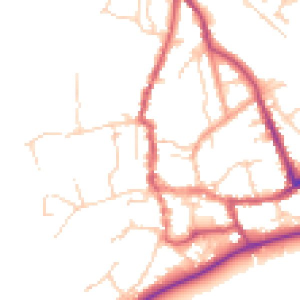
Daytime· 07:00 – 23:00
49.5dB

Night-time· 23:00 – 07:00
41.0dB