14 Stoddart Avenue, Southampton, SO19 4ED
About 14 Stoddart Avenue
14 Stoddart Avenue is a four-bedroom detached house in Southampton (SO19 4ED). It has a recorded floor area of 157 m² (around 1690 sq ft), construction records dating it to 1930-1949 and council tax band D. The latest certificate (August 2020) shows a D (score 65), on the cusp of jumping into the C band. The recommended improvements would push it to C (score 77). Period features are noted in the property record.
At 157 m² the property is well over the postcode median (98 m² across 19 EPCs), placing it in the larger end of the local stock. One planning record on file: an extension approved in 2006. Past consents include an extension, meaningful when judging how the property has evolved. Across 1998–2021, sale prices on this property compounded at 8.9% per year. Today's modelled estimate of £578,000 is 10.1% above the 2021 sale price. On a £-per-square-foot basis, the last sale (£311/sq ft) was about 49.5% above the typical sold price in the postcode. Last sale on file: £525,000 in February 2021. That sale was during the post-pandemic price surge, when transactions cleared materially above pre-2020 trend.
What this property has
Inside
- Bedrooms4
- Bathrooms1
- Open-plan layoutYes
- Dining roomYes
- EnsuiteYes
- FireplaceYes
Outside
- Private gardenRear
- GarageYes
Building
- Period featuresYes
Everything you need to know about 14 Stoddart Avenue
The true value, the hidden risks and the full sale history, in one report.
Pick your report · every report is £14.99
One time fee only - money back guarantee

The data behind every report


Energy performance
EPC Rating
Get a survey for this property
Level 3 Building Survey
Because the property has been extended more than once, we believe a Level 3 building survey should be considered.
From £1,085 · Includes VAT
Planning history
Council records include a two-storey rear extension at 14 Stoddart Avenue.
1 application on record at 14 Stoddart Avenue, Southampton, SO19 4ED
- Sept 2006ExtensionFullOutcome in report
Extension: Two storey · Rear of property
Erection of a two storey rear extension.
- Documents
- 7 docs on file
- Reference
- 06/01044/FUL
Unlock 14 Stoddart Avenue, Southampton, SO19 4ED's full planning history
You're seeing the shape of it. The report has the substance.
- Every decision — granted, refused or withdrawn (1 on record)
- All 1 application on this property in full, plus 1 notable nearby
- The 7 documents, officer reports & conditions
- What the pattern means for extending or converting here
One time fee only - money back guarantee
Sales history & valuation
14 Stoddart Avenue has more than quadrupled in price since its earliest registered sale in 1998.
£578,000
Modelled from EPC, postcode comparables and a sale-price growth of 8.9% per year over 23 years.
£525,000
Growth on file: 8.9% per year over 23 years.
Sales timeline
24 February 2021Most recent
£525,000
+88.8%over 15 years9 June 2005
£278,000
+271.2%over 7 years29 March 1998
£74,900
Median price across the last 5 sales in SO19 4ED: £325,000 (2025–2020).
Nearby sales in SO19 4ED
1 Stoddart Avenue, Southampton, SO19 4ED
Sold Oct 2025
£367,5005 Stoddart Avenue, Southampton, SO19 4ED
Sold Jan 2025
£375,0007 Stoddart Avenue, Southampton, SO19 4ED
Sold Jan 2024
£325,00022 Stoddart Avenue, Southampton, SO19 4ED
Sold Aug 2022
£325,0002 Stoddart Avenue, Southampton, SO19 4ED
Sold Feb 2020
£270,000
Versus other Stoddart Avenue homes
On floor area, 14 Stoddart Avenue stands well clear of the street.
Price per m²
£3,344
Street avg £2,569
Floor Area
157 m²
Street avg 115 m²
Habitable Rooms
7 rooms
Street avg 6 rooms
CO₂ Emissions
5.5 t/year
Street avg 5.9 t/year
Everything you need to know about 14 Stoddart Avenue
The true value, the hidden risks and the full sale history, in one report.
Pick your report · every report is £14.99
One time fee only - money back guarantee
The data behind every report
Similar properties nearby
10 Stoddart Avenue
SO19 4ED
1 Bitterne Way
SO19 4EB
102 Chessel Avenue
SO19 4DX
10 Chessel Crescent
SO19 4BS
1 Garfield Road
SO19 4DA
10 Cross Road
SO19 4BX
1 Stoddart Avenue
SO19 4ED
102 Athelstan Road
SO19 4DF
The neighbourhood at a glance
Crime
12/mo
Steady year-on-year across the wider district.
Nearest stop
0.1 km
Freemantle Common — bus stop.
Closest school
0.4 km
Bitterne Church of England Primary School. 35 schools nearby.
Go deeper on the local area
A Local Area report breaks down crime, transport links, schools and air quality in depth.
Road noise across the postcode
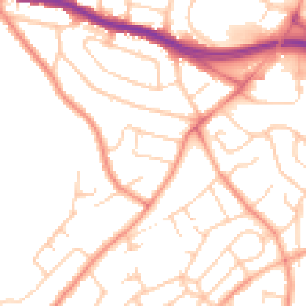
Daytime· 07:00 – 23:00
50.9dB

Night-time· 23:00 – 07:00
40.5dB