47 Salisbury Avenue, Cheam, Sutton, SM1 2DH
About 47 Salisbury Avenue
47 Salisbury Avenue is a property in Cheam, Sutton, Sutton (SM1 2DH). It has council tax band G.
Held since March 1996 — that's 30 years off the open market, well above the local norm. Only one transfer is on record with HM Land Registry, suggesting it has stayed in the same hands for a long time.
Everything you need to know about 47 Salisbury Avenue
The true value, the hidden risks and the full sale history, in one report.
30-day money-back guarantee

The data behind every report


Energy performance
No EPC on record
This property doesn't have an Energy Performance Certificate yet. An EPC is required to sell or let — and unlocks our automated valuation.
Planning history
47 Salisbury Avenue has no planning applications on record.
Notable planning nearby
12applications of note in the surrounding area
We flagged 2 things worth checking at 47 Salisbury Avenue
Independent checks surfaced things a buyer would want to understand before offering. The report explains each one in full, with the underlying data and what to ask.
- Signs of HMO activity in the area
- Larger development activity nearby
30-day money-back guarantee
Sales history & valuation
47 Salisbury Avenue has been held in the same hands since before 2000.
£182,500
Recorded with HM Land Registry.
Sales timeline
8 March 1996Most recent
£182,500
Median price across the last 5 sales in SM1 2DH: £830,000 (2023–2020).
Nearby sales in SM1 2DH
3 Salisbury Avenue, Cheam, Sutton, SM1 2DH
Sold Mar 2023
£745,0007 Salisbury Avenue, Cheam, Sutton, SM1 2DH
Sold Feb 2022
£889,00065 Salisbury Avenue, Cheam, Sutton, SM1 2DH
Sold Mar 2021
£1,100,00063 Salisbury Avenue, Cheam, Sutton, SM1 2DH
Sold Mar 2021
£379,00037 Salisbury Avenue, Cheam, Sutton, SM1 2DH
Sold Sept 2020
£830,000
Everything you need to know about 47 Salisbury Avenue
The true value, the hidden risks and the full sale history, in one report.
30-day money-back guarantee
The data behind every report
Similar properties nearby
1 Albany Mews, Camden Road
SM1 2RE
1 Alberta Avenue, Cheam
SM1 2LF
1 Alexandra Avenue
SM1 2NZ
1 Alma Crescent, Cheam
SM1 2LN
1 Anton Crescent
SM1 2NT
1 Antrobus Close, Cheam
SM1 2EL
1 Ashton Close
SM1 2HJ
1 Beauchamp Road
SM1 2PY
The neighbourhood at a glance
Rail-style transport is unusually close for this postcode.
Crime
9/mo
Rising year-on-year across the wider district.
Nearest stop
0.3 km
St Dunstan's Hill — bus stop.
Closest school
0.8 km
St Dunstan's Cheam CofE Primary School. 28 schools nearby.
Go deeper on the local area
The full report breaks down crime, transport links, schools and air quality in depth.
Road noise across the postcode
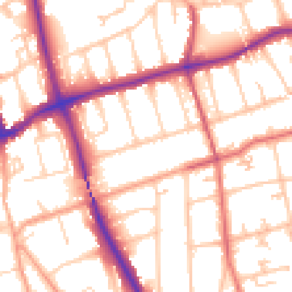
Daytime· 07:00 – 23:00
54.3dB

Night-time· 23:00 – 07:00
44.8dB