5 Bramway, High Lane, Stockport, SK6 8EN
About 5 Bramway
5 Bramway is a property in High Lane, Stockport, Stockport (SK6 8EN). It has council tax band E.
One planning record on file: an extension approved in 2002. Past consents include an extension, meaningful when judging how the property has evolved.
Energy performance
No EPC on record
This property doesn't have an Energy Performance Certificate yet. An EPC is required to sell or let — and unlocks our automated valuation.
Get a survey for this property
Level 2 HomeBuyer Report
We've checked 10 risk factors against the available data for this property and believe a Level 2 HomeBuyer Report could be a suitable option for you.
Planning history
5 Bramway has an approved single-storey side extension on the planning record.
- Jun 2002ExtensionFullOutcome in report
Extension: Single storey · Side of property
Single storey side extension
- Reference
- DC/007723
Sales history & valuation
No sales recorded with HM Land Registry
That can mean the property has never traded since the registry began publishing in 1995, was a new build that hasn't been registered yet, or is held in the same hands long-term.
Median price across the last 5 sales in SK6 8EN: £247,000 (2023–2012).
Nearby sales in SK6 8EN
6 Bramway, High Lane, Stockport, SK6 8EN
Sold Oct 2023
£390,0007 Bramway, High Lane, Stockport, SK6 8EN
Sold Jul 2016
£240,00010 Bramway, High Lane, Stockport, SK6 8EN
Sold Jul 2014
£250,0002 Bramway, High Lane, Stockport, SK6 8EN
Sold Jun 2013
£190,0003 Bramway, High Lane, Stockport, SK6 8EN
Sold Jul 2012
£247,000
Similar properties nearby
1 Alderdale Drive, High Lane
SK6 8BX
1 Alders Green Avenue, High Lane
SK6 8EB
1 Andrew Lane, High Lane
SK6 8HT
1 Arnside Close, High Lane
SK6 8AN
1 Ashbourne Drive, High Lane
SK6 8DB
1 Ashley Gardens, Windlehurst Road, High Lane
SK6 8AB
1 Aspen Way, High Lane
SK6 8EZ
1 Balmoral Drive, High Lane
SK6 8BN
The neighbourhood at a glance
Daytime road noise here sits well below conversation level — a quiet pocket of the postcode.
Crime
1/mo
Steady year-on-year across the wider district.
Nearest stop
0.1 km
South Meadway — bus stop.
Closest school
0.3 km
High Lane Primary School. 6 schools nearby.
Road noise across the postcode
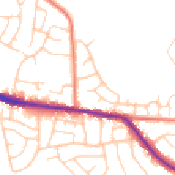
Daytime· 07:00 – 23:00
49.8dB

Night-time· 23:00 – 07:00
41.1dB