1 Little Bornes, Southwark, London, SE21 8SD
About 1 Little Bornes
1 Little Bornes is a property in Southwark, London, London (SE21 8SD). It has council tax band E.
Energy performance
No EPC on record
This property doesn't have an Energy Performance Certificate yet. An EPC is required to sell or let — and unlocks our automated valuation.
Get a survey for this property
Level 2 HomeBuyer Report
We've checked 10 risk factors against the available data for this property and believe a Level 2 HomeBuyer Report could be a suitable option for you.
Planning history
No planning applications are recorded against 1 Little Bornes, Southwark, London, SE21 8SD. The full report also covers planning activity across the surrounding area.
Sales history & valuation
No sales recorded with HM Land Registry
That can mean the property has never traded since the registry began publishing in 1995, was a new build that hasn't been registered yet, or is held in the same hands long-term.
Median price across the last 5 sales in SE21 8SD: £930,000 (2025–2019).
Nearby sales in SE21 8SD
41 Little Bornes, Southwark, London, SE21 8SD
Sold May 2025
£960,75031 Little Bornes, Southwark, London, SE21 8SD
Sold May 2024
£930,00039 Little Bornes, Southwark, London, SE21 8SD
Sold Jun 2023
£935,00025 Little Bornes, Southwark, London, SE21 8SD
Sold Apr 2020
£857,00029 Little Bornes, Southwark, London, SE21 8SD
Sold Nov 2019
£838,000
Similar properties nearby
1 Acacia Grove, Southwark
SE21 8ER
1 Alleyn Crescent, Southwark
SE21 8BN
1 Alleyn Road, Southwark
SE21 8AB
1 Berry Lane, Lambeth
SE21 8AR
1 Birkbeck Hill, Lambeth
SE21 8JS
1 Birkbeck Place, Lambeth
SE21 8JU
1 Bowen Drive, Southwark
SE21 8NS
1 Burrow Walk, Lambeth
SE21 8LY
The neighbourhood at a glance
Rail-style transport is unusually close for this postcode.
Crime
6/mo
Rising year-on-year across the wider district.
Nearest stop
0.3 km
Gipsy Hill — bus stop.
Closest school
0.2 km
Kingsdale Foundation School. 60 schools nearby.
Road noise across the postcode
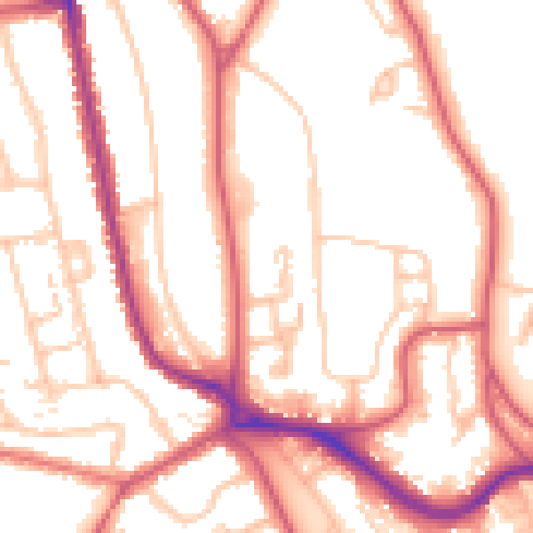
Daytime· 07:00 – 23:00
53.0dB
Night-time· 23:00 – 07:00
42.0dB