74 Gubbins Lane, Romford, RM3 0BL
About 74 Gubbins Lane
74 Gubbins Lane is a three-bedroom end-of-terrace house in Romford (RM3 0BL). It has a recorded floor area of 70 m² (around 753 sq ft), construction records dating it to 1930-1949 and council tax band D. The latest certificate (December 2013) shows a D (score 57), a step below the typical UK home. When first surveyed in March 2013 the rating was E, the property has climbed 1 band since. Between certificates, lighting went from Average to Good; while roof efficiency dropped from Average to Very Poor. The recommended improvements would lift it to B (score 87), a 2-band jump. The latest certificate is from December 2013, so improvements made since then won't be reflected.
It hasn't traded since January 2003, a hold of 23 years that's notably long for the area. Across 1996–2003, sale prices on this property compounded at 13.9% per year. Today's modelled estimate of £415,000 sits 150% above the 2003 sale of £166,000. On a £-per-square-foot basis, the last sale (£220/sq ft) was about 31% below the postcode norm. At 70 m² it's 15.7% smaller than the typical home in the postcode (83 m² median across 17 EPCs).
Know exactly what you're buying at 74 Gubbins Lane
Before you offer, see what the listing won't tell you, the true value, the red flags and the full history.
Already flagged here
Valuation
against the asking price
Risks
planning & flood
Sold prices
similar homes nearby
Trends
the local market
What this property has
Inside
- Bedrooms3
Outside
- Private gardenYes
- ParkingYes
Building
- Central heatingYes
Energy performance
Recommended upgrades on file would lift this property by multiple EPC bands.
EPC Expired
This certificate is over 10 years old and is no longer valid.Expired 06 Dec 2023
EPC Rating
Property Improvements
Changes detected from historical EPC data
More low energy lighting installed
Planning history
74 Gubbins Lane has no planning applications on record.
Notable planning nearby
6applications of note in the surrounding area
We flagged 2 things worth checking at 74 Gubbins Lane
Independent checks surfaced things a buyer would want to understand before offering. The report explains each one in full, with the underlying data and what to ask.
- Signs of HMO activity in the area
- Larger development activity nearby
30-day money-back guarantee
Sales history & valuation
Sale price has at least doubled since 1996.
£415,000
Modelled from EPC, postcode comparables and a sale-price growth of 13.9% per year over 6 years.
£166,000
Growth on file: 13.9% per year over 6 years.
Sales timeline
10 January 2003Most recent
£166,000
+121.3%over 6 years3 December 1996
£75,000
Median price across the last 5 sales in RM3 0BL: £410,000 (2025–2022).
Nearby sales in RM3 0BL
84 Gubbins Lane, Romford, RM3 0BL
Sold Sept 2025
£475,000Herald Court, Flat 2, 60 Gubbins Lane, Romford, RM3 0BL
Sold Feb 2023
£420,000Herald Court, Flat 3, 60 Gubbins Lane, Romford, RM3 0BL
Sold Feb 2023
£375,000Herald Court, Flat 5, 60 Gubbins Lane, Romford, RM3 0BL
Sold Feb 2023
£400,00078 Gubbins Lane, Romford, RM3 0BL
Sold Apr 2022
£410,000
Everything we know about 74 Gubbins Lane, in one report
What it's really worth, what could be wrong, and the planning, sales and area data in full.
What we flagged
- Signs of HMO activity in the area
- Larger development activity nearby

Versus other Gubbins Lane homes
Floor Area for 74 Gubbins Lane lags the street by a wide margin.
Price per m²
£2,371
Street avg £4,211
Floor Area
70 m²
Street avg 91 m²
Habitable Rooms
5 rooms
Street avg 5 rooms
CO₂ Emissions
3.8 t/year
Street avg 4.3 t/year
Similar properties nearby
1 Bennison Drive, Harold Wood
RM3 0WJ
1 Aubrietia Close
RM3 0XG
1 Archibald Road
RM3 0RD
1 Blakeborough Drive, Harold Wood
RM3 0WS
1 Chelsworth Close
RM3 0ET
1 Ashflower Drive
RM3 0FL
1 Cavell Crescent, Harold Wood
RM3 0WL
1 Cane Hill, Harold Wood
RM3 0WH
The neighbourhood at a glance
Rail-style transport is unusually close for this postcode.
Crime
6/mo
Rising year-on-year across the wider district.
Nearest stop
0.0 km
Harold Wood Station — bus stop.
Closest school
0.8 km
Harold Court Primary School. 20 schools nearby.
Go deeper on the local area
The full report breaks down crime, transport links, schools and air quality in depth.
Road noise across the postcode
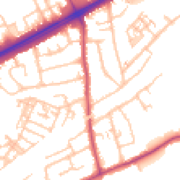
Daytime· 07:00 – 23:00
52.3dB

Night-time· 23:00 – 07:00
41.8dB