24 Rookfield Road, Faygate, Horsham, RH12 0AX
About 24 Rookfield Road
24 Rookfield Road is a detached house in Faygate, Horsham, Horsham (RH12 0AX). It has a recorded floor area of 70 m² (around 753 sq ft). The latest certificate (July 2018) returns a B (score 83), comfortably above the UK average.
Everything you need to know about 24 Rookfield Road
The true value, the hidden risks and the full sale history, in one report.
Pick your report · every report is £14.99
One time fee only - money back guarantee

The data behind every report


Energy performance
24 Rookfield Road's carbon output is low for the local stock.
EPC Rating
Get a survey for this property
Level 2 HomeBuyer Report
We've checked 10 risk factors against the available data for this property and believe a Level 2 HomeBuyer Report could be a suitable option for you.
From £545 · Includes VAT
Planning history
24 Rookfield Road has no planning applications on record.
A planning report still maps activity across the surrounding area and reads this property's extension & conversion potential.
Sales history & valuation
24 Rookfield Road has no Land Registry sales on file, suggesting it has stayed in the same hands since registration began.
£243,000
Modelled from EPC, postcode comparables.
No sales recorded with HM Land Registry
That can mean the property has never traded since the registry began publishing in 1995, was a new build that hasn't been registered yet, or is held in the same hands long-term.
Median price across the last 5 sales in RH12 0AX: £469,950 (2025–2022).
Nearby sales in RH12 0AX
16 Rookfield Road, Faygate, Horsham, RH12 0AX
Sold May 2025
£94,50014 Rookfield Road, Faygate, Horsham, RH12 0AX
Sold Dec 2022
£89,25072 Rookfield Road, Faygate, Horsham, RH12 0AX
Sold Oct 2022
£640,00076 Rookfield Road, Faygate, Horsham, RH12 0AX
Sold Oct 2022
£469,95074 Rookfield Road, Faygate, Horsham, RH12 0AX
Sold Oct 2022
£579,950
Versus other Rookfield Road homes
On co₂ emissions, 24 Rookfield Road runs well behind the street norm.
EPC Rating
83 (B)
Street avg 83 (B)
Floor Area
70 m²
Street avg 69 m²
CO₂ Emissions
1.2 t/year
Street avg 0.9 t/year
Everything you need to know about 24 Rookfield Road
The true value, the hidden risks and the full sale history, in one report.
Pick your report · every report is £14.99
One time fee only - money back guarantee
The data behind every report
Similar properties nearby
1 Crusades Road, Faygate
RH12 0DF
1 Hoppers Brook, Calvert Link, Faygate
RH12 0DS
1 Cambridgeshire Walk, Faygate
RH12 0DD
1 Alder Way, Faygate
RH12 0BU
1 Illett Way, Faygate
RH12 0AJ
1 Clay Vale, Faygate
RH12 0AU
1 Holmbush Drive, Faygate
RH12 0BW
1 Holmbush Mews, Faygate
RH12 0AZ
The neighbourhood at a glance
Daytime road noise here sits well below conversation level — a quiet pocket of the postcode.
Crime
2/mo
Steady year-on-year across the wider district.
Nearest stop
0.1 km
Rainbow Field — bus stop.
Closest school
0.2 km
Kilnwood Vale Primary School. 11 schools nearby.
Go deeper on the local area
A Local Area report breaks down crime, transport links, schools and air quality in depth.
Road noise across the postcode
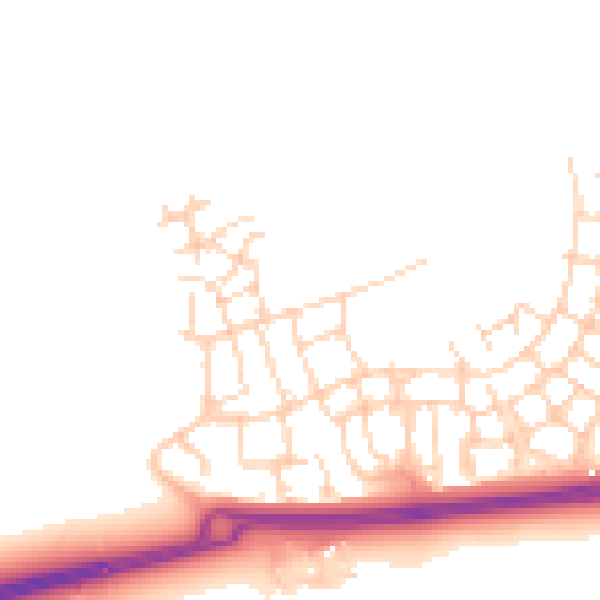
Daytime· 07:00 – 23:00
48.4dB

Night-time· 23:00 – 07:00
40.0dB