13 Garrison Road, Fulwood, Preston, PR2 8AL
About 13 Garrison Road
13 Garrison Road is a four-bedroom semi-detached house in Fulwood, Preston, Preston (PR2 8AL). It has a recorded floor area of 185 m² (around 1991 sq ft), construction records dating it to 1900-1929 and council tax band E. The latest certificate (January 2018) shows a D (score 56), a step below the typical UK home. The recommended improvements would push it to C (score 78).
At 185 m² the property is well over the postcode median (100 m² across 20 EPCs), placing it in the larger end of the local stock. Today's modelled estimate of £338,000 sits 53.6% above the 2018 sale of £220,000. On a £-per-square-foot basis, the last sale (£110/sq ft) was about 38.5% below the postcode norm. 4 planning records sit against the property, 3 approved, 1 refused. Past consents include an extension, partial demolition and new windows, meaningful when judging how the property has evolved. Last changed hands 8 years ago, in May 2018.
Know exactly what you're buying at 13 Garrison Road
Before you offer, see what the listing won't tell you, the true value, the red flags and the full history.
Already flagged here
Valuation
against the asking price
Risks
planning & flood
Sold prices
similar homes nearby
Trends
the local market
What this property has
Inside
- Bedrooms4
- Bathrooms1
- Dining roomYes
- Utility roomYes
- CloakroomYes
- EnsuiteYes
Outside
- GarageYes
Building
- Heating systemElectric
Energy performance
13 Garrison Road's carbon output runs well above what efficient homes in the postcode produce.
EPC Rating
Planning history
Planning history includes recorded demolition works, indicating a major rebuild phase at this address.
- Mar 2024ExtensionFullIn report
Extension: Single storey · Rear of property
Single storey rear extension following demolition of store/WC
- Documents
- 15 docs on file
- Reference
- 06/2023/1326
- Nov 2021DemolitionFullIn report
Extension: Single storey · Rear of property
Single storey rear extension, dormer to rear following demolition of wc and store; removal of chimney stack; erection of outbuilding; new boundary treatment to rear, re-building front boundary, following demolition of existing wall, gate, garage and greenhouse
Extension- Documents
- 26 docs on file
- Reference
- 06/2021/0491
We flagged 2 things worth checking at 13 Garrison Road
Independent checks surfaced things a buyer would want to understand before offering. The report explains each one in full, with the underlying data and what to ask.
- Signs of HMO activity in the area
- Larger development activity nearby
30-day money-back guarantee
Sales history & valuation
13 Garrison Road valuation sits well clear of the typical sold price in this postcode.
£338,000
Modelled from EPC, postcode comparables.
£220,000
Recorded with HM Land Registry.
Sales timeline
24 May 2018Most recent
£220,000
Median price across the last 5 sales in PR2 8AL: £255,000 (2023–2012).
Nearby sales in PR2 8AL
5 Garrison Road, Fulwood, Preston, PR2 8AL
Sold Feb 2023
£280,7504 Garrison Road, Fulwood, Preston, PR2 8AL
Sold Jan 2019
£255,00017 Garrison Road, Fulwood, Preston, PR2 8AL
Sold Nov 2014
£380,00010 Garrison Road, Fulwood, Preston, PR2 8AL
Sold Oct 2013
£195,0002 Garrison Road, Fulwood, Preston, PR2 8AL
Sold Sept 2012
£218,000
Everything we know about 13 Garrison Road, in one report
What it's really worth, what could be wrong, and the planning, sales and area data in full.
What we flagged
- Signs of HMO activity in the area
- Larger development activity nearby

Versus other Garrison Road homes
13 Garrison Road is notably below the street on price per m².
Price per m²
£1,189
Street avg £2,022
Floor Area
185 m²
Street avg 116 m²
Habitable Rooms
6 rooms
Street avg 5 rooms
CO₂ Emissions
9.2 t/year
Street avg 4.5 t/year
Similar properties nearby
1 Allengate, Fulwood
PR2 8LF
1 Fairways, Fulwood
PR2 8FX
1 Foregate, Fulwood
PR2 8LA
1 Garrison Road, Fulwood
PR2 8AL
1 Fulwood Hall Lane, Fulwood
PR2 8DA
1 Allenby Avenue, Fulwood
PR2 8DL
1 Croftgate, Fulwood
PR2 8LS
1 Beechway, Fulwood
PR2 8EU
The neighbourhood at a glance
Crime
6/mo
Steady year-on-year across the wider district.
Nearest stop
0.1 km
Garrison Road — bus stop.
Closest school
0.4 km
St Gregory's Catholic Primary School, Preston. 45 schools nearby.
Go deeper on the local area
The full report breaks down crime, transport links, schools and air quality in depth.
Road noise across the postcode
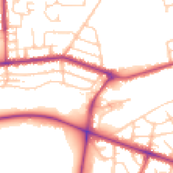
Daytime· 07:00 – 23:00
52.3dB

Night-time· 23:00 – 07:00
43.8dB