2 Beehive Walk, Portsmouth, PO1 2PW
About 2 Beehive Walk
2 Beehive Walk is a one-bedroom end-of-terrace house in Portsmouth (PO1 2PW). It has a recorded floor area of 41 m² (around 441 sq ft), construction records dating it to 1983-1990 and council tax band B. The latest certificate (October 2023) shows a D (score 63), on the cusp of jumping into the C band. The recommended improvements would lift it to B (score 91), a 2-band jump. Main heating runs on electricity.
At 41 m² it sits well below the postcode median (60 m² across 28 EPCs), making it one of the more compact homes locally. Across 2000–2024, sale prices on this property compounded at 4.6% per year. On a £-per-square-foot basis, the last sale (£506/sq ft) was about 81.5% above the typical sold price in the postcode. Most recent transfer: July 2024 at £223,250.
What this property has
Inside
- Bedrooms1
- Bathrooms1
Everything you need to know about 2 Beehive Walk
The true value, the hidden risks and the full sale history, in one report.
Pick your report · every report is £14.99
One time fee only - money back guarantee

The data behind every report


Energy performance
Recommended upgrades on file would lift this property by multiple EPC bands.
EPC Rating
Get a survey for this property
Level 3 Building Survey
Because the property has no mains gas supply, we believe a Level 3 building survey should be considered.
From £885 · Includes VAT
Planning history
2 Beehive Walk has no planning applications on record.
A planning report still maps activity across the surrounding area and reads this property's extension & conversion potential.
Sales history & valuation
2 Beehive Walk has more than doubled in price since the earliest registered sale in 2000.
£227,000
Modelled from EPC, postcode comparables and a sale-price growth of 4.6% per year over 24 years.
£223,250
Growth on file: 4.6% per year over 24 years.
Sales timeline
4 July 2024Most recent
£223,250
+188.1%over 23 years8 December 2000
£77,500
Median price across the last 5 sales in PO1 2PW: £268,000 (2024–2022).
Nearby sales in PO1 2PW
Versus other Beehive Walk homes
Floor Area for 2 Beehive Walk lags the street by a wide margin.
Price per m²
£5,445
Street avg £3,515
Floor Area
41 m²
Street avg 68 m²
Habitable Rooms
2 rooms
Street avg 4 rooms
CO₂ Emissions
3.2 t/year
Street avg 2.6 t/year
Everything you need to know about 2 Beehive Walk
The true value, the hidden risks and the full sale history, in one report.
Pick your report · every report is £14.99
One time fee only - money back guarantee
The data behind every report
Similar properties nearby
1 Armory Lane
PO1 2PE
1 Grays Court
PO1 2PN
1 Regency Court, King Charles Street
PO1 2RR
1 Seagers Court
PO1 2GD
1 Lombard Street
PO1 2HT
1 Farthingale Terrace, Peacock Lane
PO1 2TL
1 Ark Royal House, Winston Churchill Avenue
PO1 2GF
1 Beehive Walk
PO1 2PW
The neighbourhood at a glance
Rail-style transport is unusually close for this postcode.
Crime
9/mo
Steady year-on-year across the wider district.
Nearest stop
0.2 km
Cambridge Junction — bus stop.
Closest school
0.5 km
St Jude's CofE Primary School. 30 schools nearby.
Go deeper on the local area
A Local Area report breaks down crime, transport links, schools and air quality in depth.
Road noise across the postcode
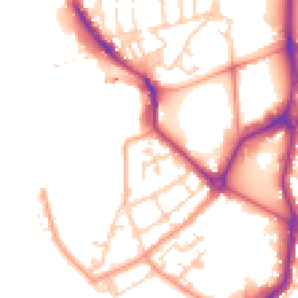
Daytime· 07:00 – 23:00
51.3dB
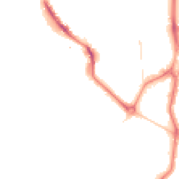
Night-time· 23:00 – 07:00
43.3dB