35 High Street, Long Sutton, Spalding, PE12 9DB
About 35 High Street
35 High Street is a five-bedroom detached house in Long Sutton, Spalding, Spalding (PE12 9DB). It has a recorded floor area of 327 m² (around 3520 sq ft) and construction records dating it to 1983-1990. The latest certificate (June 2025) returns a B (score 82), comfortably above the UK average. When first surveyed in May 2010 the rating was D, the property has climbed 2 bands since. Between certificates, wall efficiency went from Average to Good, roof efficiency went from Good to Very Good and window efficiency went from Poor to Good; while hot-water efficiency dropped from Very Good to Good and main heating dropped from Very Good to Good. The property has an EV charger on record, all of which lower running costs and tend to lift resale appeal.
At 327 m² the property is well over the postcode median (76 m² across 17 EPCs), placing it in the larger end of the local stock. On energy efficiency it sits in the top 10% of properties in this postcode. 5 bedrooms is on the larger side for this postcode, where 3 is the typical count. 5 planning records sit against the property, 0 approved, 0 refused. The record references conservation-area consent, which constrain future alterations.
What this property has
Inside
- Bedrooms5
- Bathrooms4
- Dining roomYes
- Utility roomYes
- CloakroomYes
- EnsuiteYes
- FireplaceYes
Outside
- Private gardenYes
- GarageDouble
Building
- EV chargerYes
Everything you need to know about 35 High Street
The true value, the hidden risks and the full sale history, in one report.
Pick your report · from £14.99
One time fee only - money back guarantee

The data behind every report







Energy performance
35 High Street ranks among the most efficient homes in the postcode for energy use.
EPC Rating
Certificate validity
Valid until 3 June 2035
Property Improvements
Changes detected from historical EPC data
Heating controls changed
Hot water efficiency decreased
Windows upgraded, improving insulation
Wall insulation upgraded
Roof insulation improved
More low energy lighting installed

Get a survey for this property
Level 3 Building Survey
Because the property is a large detached home over 300m² and has been extended more than once, we believe a Level 3 building survey should be considered.
From £1,085 · Includes VAT
Planning history
Planning history at 35 High Street is exclusively tree-management applications — typical for a property with mature trees on or near the plot.
5 applications on record at 35 High Street, Long Sutton, Spalding, PE12 9DB
- Apr 2015Tree WorksTreesOutcome in report
Notification of works to reduce by 70% a large mature ash tree which has a severe infection by a species of Ganoderma fungi at its base. The tree is located on the western boundary of the grounds of the property known as 'The Cedars' 35 High Street, Long Sutton; immediately adjacent to the rear of the bakery at 31 High Street. The tree is situated within Long Sutton Conservation Area.
Conservation Area- Documents
- 3 docs on file
- Reference
- H11-0204-15
- More recent applications — locked
- Tree WorksJun 2024Decision
- Tree WorksOct 2018Decision
+ 2 more applications in the report
Unlock 35 High Street, Long Sutton, Spalding, PE12 9DB's full planning history
You're seeing the shape of it. The report has the substance.
- Every decision — granted, refused or withdrawn
- All 5 applications on this property in full, plus 7 notable nearby
- The 17 documents, officer reports & conditions
- What the pattern means for extending or converting here
One time fee only - money back guarantee
Sales history & valuation
35 High Street has no Land Registry sales on file, suggesting it has stayed in the same hands since registration began.
£578,000
Modelled from EPC, postcode comparables.
No sales recorded with HM Land Registry
That can mean the property has never traded since the registry began publishing in 1995, was a new build that hasn't been registered yet, or is held in the same hands long-term.
Median price across the last 5 sales in PE12 9DB: £137,500 (2023–2004).
Nearby sales in PE12 9DB
21 High Street, Long Sutton, Spalding, PE12 9DB
Sold Oct 2023
£110,00029 High Street, Long Sutton, Spalding, PE12 9DB
Sold Feb 2022
£150,0008 High Street, Long Sutton, Spalding, PE12 9DB
Sold Sept 2012
£565,0004 High Street, Long Sutton, Spalding, PE12 9DB
Sold Jun 2004
£137,5009 High Street, Long Sutton, Spalding, PE12 9DB
Sold Jul 2003
£75,500
Versus other High Street homes
On epc rating, 35 High Street stands well clear of the street.
EPC Rating
82 (B)
Street avg 36 (F)
Floor Area
327 m²
Street avg 187 m²
CO₂ Emissions
5.4 t/year
Street avg 16.8 t/year
Habitable Rooms
8 rooms
Street avg 7 rooms
Everything you need to know about 35 High Street
The true value, the hidden risks and the full sale history, in one report.
Pick your report · from £14.99
One time fee only - money back guarantee
The data behind every report
Similar properties nearby
1 Carnoustie Court, Sutton Bridge
PE12 9QP
1 Colsuan Gardens, Long Sutton
PE12 9FR
1 Chestnut Close, Lutton
PE12 9PW
1 Bingham Court, Long Sutton
PE12 9EY
1 Clarks Farm, Sluice Road, East Bank, Wingland, Sutton Bridge
PE12 9YU
1 Black Barn, Gedney Drove End
PE12 9NE
1 Church Green, Long Sutton
PE12 9BQ
1 Congreves Close, Lutton
PE12 9LX
The neighbourhood at a glance
Crime
226/mo
Steady year-on-year across the wider district.
Nearest stop
0.1 km
Othellos Bakery — bus stop.
Closest school
0.5 km
Long Sutton County Primary School. 3 schools nearby.
Go deeper on the local area
A Local Area report breaks down crime, transport links, schools and air quality in depth.
Road noise across the postcode
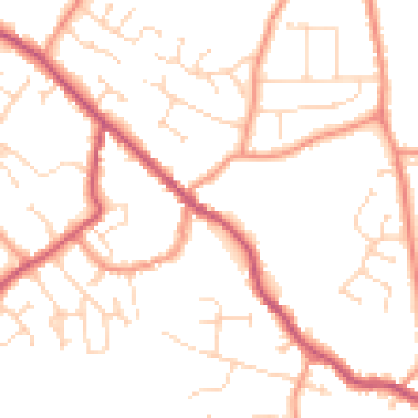
Daytime· 07:00 – 23:00
50.4dB

Night-time· 23:00 – 07:00
39.8dB