4 Bowling Green Avenue, Kettering, NN15 7QJ
About 4 Bowling Green Avenue
4 Bowling Green Avenue is a four-bedroom mid-terrace house in Kettering (NN15 7QJ). It has a recorded floor area of 109 m² (around 1173 sq ft), construction records dating it to before 1900 and council tax band B. The latest certificate (August 2022) shows an E (score 50), well below the UK norm with real room to improve. The rating has held steady at E across 2 certificates since March 2011. Between certificates, roof efficiency went from Very Poor to Poor, window efficiency went from Poor to Average and lighting went from Average to Very Good; while hot-water efficiency dropped from Very Good to Good and main heating dropped from Very Good to Good. The recommended improvements would lift it to C (score 79), a 2-band jump. Period features are noted in the property record.
Across 1996–2024, sale prices on this property compounded at 6.2% per year. On a £-per-square-foot basis, the last sale (£223/sq ft) was about 81.7% above the typical sold price in the postcode. 2 planning records sit against the property, 0 approved, 0 refused. Last sale on file: £261,500 in September 2024.
What this property has
Inside
- Bedrooms4
- Bathrooms1
Building
- Period featuresYes
Everything you need to know about 4 Bowling Green Avenue
The true value, the hidden risks and the full sale history, in one report.
Pick your report · every report is £14.99
One time fee only - money back guarantee

The data behind every report


Energy performance
4 Bowling Green Avenue's carbon output runs well above what efficient homes in the postcode produce.
EPC Rating
Property Improvements
Changes detected from historical EPC data
Hot water efficiency decreased
Roof insulation improved
More low energy lighting installed
Get a survey for this property
Level 3 Building Survey
Because the property was built before 1919, has been extended more than once, and has solid (non-cavity) walls, we believe a Level 3 building survey should be considered.
From £885 · Includes VAT
Planning history
2 applications on record at 4 Bowling Green Avenue, Kettering, NN15 7QJ
2 live now- Feb 2025Loft ConversionOutlineOutcome in report
Removal of chimney and creation of dormer to the rear
- Documents
- 7 docs on file
- Reference
- NK/2025/0082
- More recent applications — locked
- Loft ConversionApr 2025Decision
Unlock 4 Bowling Green Avenue, Kettering, NN15 7QJ's full planning history
You're seeing the shape of it. The report has the substance.
- Every decision — granted, refused or withdrawn
- All 2 applications on this property in full, plus 5 notable nearby
- The 20 documents, officer reports & conditions
- What the pattern means for extending or converting here
One time fee only - money back guarantee
Sales history & valuation
Latest sale on 4 Bowling Green Avenue was the highest on Land Registry record across the postcode.
£263,000
Modelled from EPC, postcode comparables and a sale-price growth of 6.2% per year over 29 years.
£261,500
Growth on file: 6.2% per year over 29 years.
Sales timeline
5 September 2024Most recent
£261,500
+32.7%over 8 years15 June 2016
£197,000
+25.5%over 2 years3 February 2014
£157,000
+16.9%over 10 years11 September 2003
£134,300
+35.7%over 9 months16 December 2002
£99,000
+110.6%over 6 years19 February 1996
£47,000
Median price across the last 5 sales in NN15 7QJ: £194,950 (2025–2018).
Nearby sales in NN15 7QJ
12 Bowling Green Avenue, Kettering, NN15 7QJ
Sold Apr 2025
£105,0005 Bowling Green Avenue, Kettering, NN15 7QJ
Sold Jul 2023
£240,00015 Bowling Green Avenue, Kettering, NN15 7QJ
Sold Sept 2020
£222,00014 Bowling Green Avenue, Kettering, NN15 7QJ
Sold Aug 2019
£194,95012a, Bowling Green Avenue, Kettering, NN15 7QJ
Sold Apr 2018
£105,000
Versus other Bowling Green Avenue homes
4 Bowling Green Avenue outperforms the street on price per m² by a wide margin.
Price per m²
£2,399
Street avg £1,665
Floor Area
109 m²
Street avg 106 m²
Habitable Rooms
6 rooms
Street avg 5 rooms
CO₂ Emissions
6.9 t/year
Street avg 6.9 t/year
Everything you need to know about 4 Bowling Green Avenue
The true value, the hidden risks and the full sale history, in one report.
Pick your report · every report is £14.99
One time fee only - money back guarantee
The data behind every report
Similar properties nearby
1 Caswell Close
NN15 7LU
1 Gillingham Road
NN15 7RA
1 Braithwaite Close
NN15 7JS
1 Clifton Grove
NN15 7NB
1 Broom Way
NN15 7RB
1 Clifton Close
NN15 7NA
1 Boardman Road
NN15 7DH
1 East Avenue
NN15 7AD
The neighbourhood at a glance
Rail-style transport is unusually close for this postcode.
Crime
2/mo
Steady year-on-year across the wider district.
Nearest stop
0.2 km
St Mary's Hospital — bus stop.
Closest school
0.3 km
Hawthorn Community Primary School. 21 schools nearby.
Go deeper on the local area
A Local Area report breaks down crime, transport links, schools and air quality in depth.
Road noise across the postcode
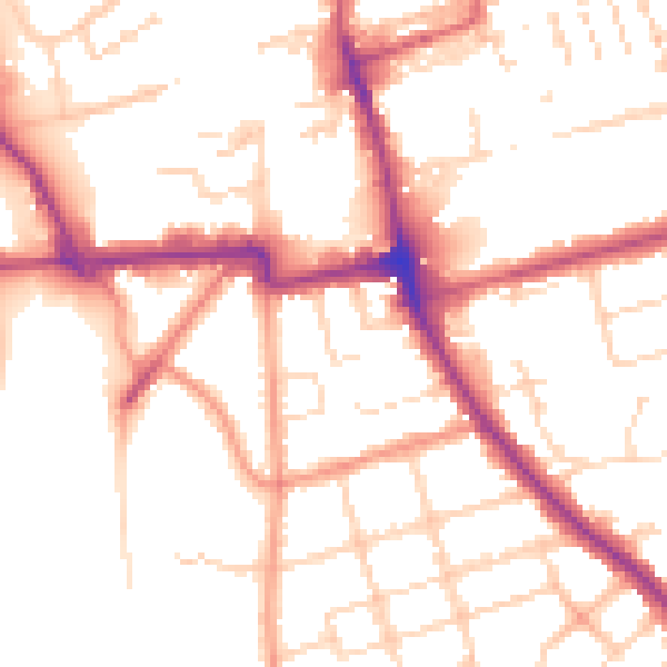
Daytime· 07:00 – 23:00
52.8dB

Night-time· 23:00 – 07:00
43.8dB