Are you a property professional?Get qualified leads from motivated homeowners.
Get started13 Broadlands Road, Haringey, London, N6 4AE
Extendable
About 13 Broadlands Road
A plain-English summary derived from public records, EPC certificates, sold prices and local data.
13 Broadlands Road is a seven-bedroom detached house in Haringey, London, London (N6 4AE). It has a recorded floor area of 648 m² (around 6975 sq ft), construction records dating it to 1900-1929 and council tax band G. The latest certificate (September 2022) shows a D (score 65), on the cusp of jumping into the C band. The rating has held steady at D across 2 certificates since August 2012. Between certificates, roof efficiency went from Poor to Good and lighting went from Very Poor to Poor; while wall efficiency dropped from Good to Very Poor and window efficiency dropped from Poor to Very Poor. The recommended improvements would lift it to B (score 81), a 2-band jump. Our model identifies extension potential, subject to local planning policy.
Untraded for 28 years, with the last transfer in April 1998. Only one transfer is on record with HM Land Registry, suggesting it has stayed in the same hands for a long time. At 648 m² the property is well over the postcode median (140 m² across 12 EPCs), placing it in the larger end of the local stock. 7 bedrooms is on the larger side for this postcode, where 5 is the typical count. Today's modelled estimate of £5,704,000 sits 714.9% above the 1998 sale of £700,000. On a £-per-square-foot basis, the last sale (£100/sq ft) was about 88.6% below the postcode norm. 2 planning records sit against the property, 0 approved, 0 refused.
What this property has
Pulled from EPC certificates, claim submissions and our property model. Empty categories are hidden — we only show what's known.
Inside
- Bedrooms7
- Bathrooms7
- Dining roomYes
- EnsuiteYes
Energy performance
Every EPC certificate filed against this property — current rating, recorded improvements, and where there's headroom to reach a higher band.
13 Broadlands Road's carbon output runs well above what efficient homes in the postcode produce.
Current Certificate(1 of 2)
Sept 2022
EPC Rating
A
B
C
D
D65
E
F
G
Main Heating
Gas
Main Fuel
Gas
Hot Water
Good
Windows
Very Poor
CO2 Emissions
22.0 t/year
Occupancy
Owner Occupied
Planning history
Applications and permits filed against 13 Broadlands Road, Haringey, London, N6 4AE, sourced from the PlanIt planning register.
- Mar 2022Tree WorksTreesNo Objection
Tree works as specified on application form
Sales history & valuation
Recorded transactions, our model's current estimate, and a quick read on what neighbouring properties have sold for.
13 Broadlands Road's modelled value sits at over four times its earliest registered sale price (1998).
Current estimate
See how we calculated this£5,704,000
Modelled from EPC, postcode comparables.
Last sold (1998)
£700,000
Recorded with HM Land Registry.
Sales timeline
Versus other Broadlands Road homes
Four headline reads against 6 similar houses on this street, drawn from the latest EPC and Land Registry data.
Price per m² for 13 Broadlands Road lags the street by a wide margin.
Price per m²
£1,080
Street avg £16,777
Floor Area
648 m²
Street avg 381 m²
Habitable Rooms
13 rooms
Similar properties nearby
A handful of close matches in the same postcode area, ranked by likeness on bedrooms, type and floor area.
The neighbourhood at a glance
A condensed read of the local area. Each tile links through to the full breakdown on the London district page.
Rail-style transport is unusually close for this postcode.
Crime
7/mo
Rising year-on-year across the wider district.
Nearest stop
0.2 km
Hillcrest Estate (N6) — bus stop.
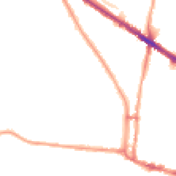
Road noise across the postcode
Modelled day and night-time noise levels around N6 4AE from Defra's strategic mapping. The pin marks this postcode's centroid.
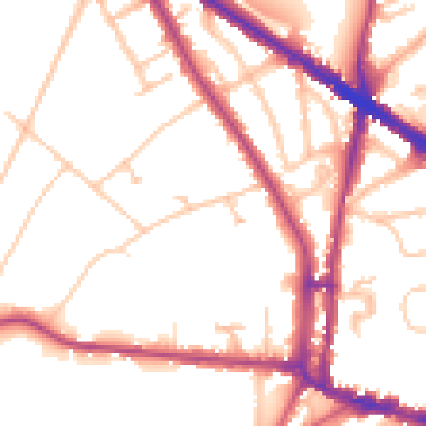
Daytime· 07:00 – 23:00
51.6dB
Everything within walking distance
Schools, transport stops and scenic spots near this property — 88 points of interest in total.
Beautiful places to visit nearby
Curated scenic spots within reach of this postcode, served by Beautifulplaces.ai. Photography and tagging come from their open dataset.
Common questions
The questions buyers, sellers and homeowners most often ask about 13 Broadlands Road, Haringey, London, N6 4AE. Each answer is also embedded as structured data for search engines.