19 Woodfield Way, Haringey, London, N11 2NP
About 19 Woodfield Way
19 Woodfield Way is a three-bedroom semi-detached house in Haringey, London, London (N11 2NP). It has a recorded floor area of 113 m² (around 1216 sq ft), construction records dating it to 1930-1949 and council tax band F. The latest certificate (March 2019) shows a D (score 56), a step below the typical UK home. The recommended improvements would lift it to B (score 83), a 2-band jump.
3 planning records sit against the property, 2 approved, 0 refused. Past consents include an extension, a porch and new windows, meaningful when judging how the property has evolved. Today's modelled estimate of £989,000 is 21.3% above the 2020 sale price. On a £-per-square-foot basis, the last sale (£670/sq ft) was about 30.7% above the typical sold price in the postcode. At 113 m² it's 18.1% smaller than the typical home in the postcode (138 m² median across 6 EPCs). Sold November 2020 for £815,000.
What this property has
Inside
- Bedrooms3
- Bathrooms1
- Dining roomYes
- CloakroomYes
Outside
- Private gardenRear
- GarageDetached
Everything you need to know about 19 Woodfield Way
The true value, the hidden risks and the full sale history, in one report.
30-day money-back guarantee

The data behind every report


Energy performance
Recommended upgrades on file would lift this property by multiple EPC bands.
EPC Rating
Planning history
- Oct 2020PorchFullIn report
Extension: Single storey · Rear of property
Erection of single storey rear extension and formation of raised terrace to its rear; Creation of front porch through enclosure of existing opening; External material changes; Replacement windows and doors.
ExtensionNew Windows- Documents
- 10 docs on file
- Reference
- HGY/2020/1977
- Sept 2020ExtensionOutlineIn report
Extension: Single storey · Rear of property
Erection of a single storey extension which extends beyond the rear wall of the original house by 6m, for which the maximum height would be 3.25m and for which the height of the eaves would be 3m.
- Documents
- 12 docs on file
- Reference
- HGY/2020/1899
We flagged 2 things worth checking at 19 Woodfield Way
Independent checks surfaced things a buyer would want to understand before offering. The report explains each one in full, with the underlying data and what to ask.
- Signs of HMO activity in the area
- Larger development activity nearby
30-day money-back guarantee
Sales history & valuation
The latest sale landed in the post-pandemic price surge — useful context when reading the figure.
£989,000
Modelled from EPC, postcode comparables.
£815,000
Recorded with HM Land Registry.
Sales timeline
6 November 2020Most recent
£815,000
Median price across the last 5 sales in N11 2NP: £1,218,500 (2025–2023).
Nearby sales in N11 2NP
11 Woodfield Way, Haringey, London, N11 2NP
Sold May 2025
£990,0001 Woodfield Way, Haringey, London, N11 2NP
Sold May 2024
£1,250,00023 Woodfield Way, Haringey, London, N11 2NP
Sold Dec 2023
£1,218,5007 Woodfield Way, Haringey, London, N11 2NP
Sold Sept 2023
£1,250,00025 Woodfield Way, Haringey, London, N11 2NP
Sold Aug 2023
£820,000
Versus other Woodfield Way homes
On years held, 19 Woodfield Way stands well clear of the street.
Price per m²
£7,212
Street avg £7,548
Floor Area
113 m²
Street avg 141 m²
Habitable Rooms
5 rooms
Street avg 6 rooms
CO₂ Emissions
5.6 t/year
Street avg 5.6 t/year
Everything you need to know about 19 Woodfield Way
The true value, the hidden risks and the full sale history, in one report.
30-day money-back guarantee
The data behind every report
Similar properties nearby
1 Hastings Road, Enfield
N11 2RJ
1 Bosworth Road, Enfield
N11 2SY
1 Lower Maidstone Road, Enfield
N11 2RU
1 Herbert Road, Haringey
N11 2QN
1 Ollerton Road, Enfield
N11 2JY
1 Bexhill Road, Enfield
N11 2RG
1 Fletton Road, Haringey
N11 2QL
1 Eleanor Road, Haringey
N11 2QS
The neighbourhood at a glance
Rail-style transport is unusually close for this postcode.
Crime
5/mo
Rising year-on-year across the wider district.
Nearest stop
0.3 km
Warwick Road (N11) — bus stop.
Closest school
0.2 km
St Martin of Porres Catholic Primary School. 62 schools nearby.
Go deeper on the local area
The full report breaks down crime, transport links, schools and air quality in depth.
Road noise across the postcode
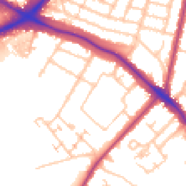
Daytime· 07:00 – 23:00
53.0dB

Night-time· 23:00 – 07:00
43.8dB