6 High Street, Brompton, Gillingham, ME7 5AE
About 6 High Street
6 High Street is a one-bedroom property in Brompton, Gillingham, Gillingham (ME7 5AE). It has council tax band B.
Held since December 2004 — that's 21 years off the open market, well above the local norm. 2 planning records sit against the property, 1 approved, 0 refused. Across 2003–2004, sale prices on this property compounded at 27.3% per year. 1 bedrooms is on the smaller side for this postcode, where 3 is the typical count.
What this property has
Inside
- Bedrooms1
Outside
- Private gardenYes
Everything you need to know about 6 High Street
The true value, the hidden risks and the full sale history, in one report.
30-day money-back guarantee

The data behind every report


Energy performance
No EPC on record
This property doesn't have an Energy Performance Certificate yet. An EPC is required to sell or let — and unlocks our automated valuation.
Get a survey for this property
Level 2 HomeBuyer Report
We've checked 10 risk factors against the available data for this property and believe a Level 2 HomeBuyer Report could be a suitable option for you.
Planning history
- Jun 2015ConditionsIn report
Details pursuant to condition 2 of Planning Permission MC/08/0033 for Alteration to front bay to form new door together with the conversion of part of the ground floor residential to office and shop area
- Reference
- MC/15/1581
- Feb 2008FullIn report
Alteration to front bay to form new door together with the conversion of part of the ground floor residential to office and shop area
- Agent
- Robert Lewis Thornton
- Documents
- 12 docs on file
- Reference
- MC/08/0033
We flagged 2 things worth checking at 6 High Street
Independent checks surfaced things a buyer would want to understand before offering. The report explains each one in full, with the underlying data and what to ask.
- Signs of HMO activity in the area
- Larger development activity nearby
30-day money-back guarantee
Sales history & valuation
£147,500
Growth on file: 27.3% per year over 2 years.
Sales timeline
17 December 2004Most recent
£147,500
+47.5%over 1 year8 May 2003
£100,000
Median price across the last 2 sales in ME7 5AE: £35,500 (1998–1997).
Nearby sales in ME7 5AE
Everything you need to know about 6 High Street
The true value, the hidden risks and the full sale history, in one report.
30-day money-back guarantee
The data behind every report
Similar properties nearby
The neighbourhood at a glance
Reported crime in the wider district is trending notably upward year-on-year.
Crime
10/mo
Rising year-on-year across the wider district.
Nearest stop
0.1 km
High Street — bus stop.
Closest school
0.7 km
Brompton-Westbrook Primary School. 42 schools nearby.
Go deeper on the local area
The full report breaks down crime, transport links, schools and air quality in depth.
Road noise across the postcode
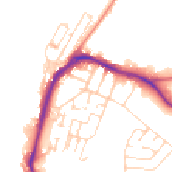
Daytime· 07:00 – 23:00
49.8dB

Night-time· 23:00 – 07:00
40.7dB