Cavendish Court, Flat 2, Cavendish Road, Urmston, Manchester, M41 0XJ
About Cavendish Court
Cavendish Court is a two-bedroom semi-detached house in Urmston, Manchester, Manchester (M41 0XJ). It has a recorded floor area of 64 m² (around 689 sq ft), construction records dating it to 1967-1975 and council tax band B. The latest certificate (August 2013) shows a D (score 60), on the cusp of jumping into the C band. The rating has held steady at D across 2 certificates since August 2013. Between certificates, wall efficiency dropped from Good to Poor. The recommended improvements would push it to C (score 74). The latest certificate is from August 2013, so improvements made since then won't be reflected. At 64 m² this is the 7th smallest of 9 units on EPC record in Cavendish Court, where floor areas span 63–67 m². The building's EPC ratings span E to C across 9 units on file.
It lags the bulk of the postcode on energy efficiency (less efficient than 75% of similar EPCs). Today's modelled estimate of £210,000 is 13.5% above the 2023 sale price. On a £-per-square-foot basis, the last sale (£269/sq ft) was about 51.9% above the typical sold price in the postcode. Most recent transfer: April 2023 at £185,000.
What this property has
Inside
- Bedrooms2
- Bathrooms1
Outside
- Communal gardenYes
- GarageYes
Building
- Heating systemGas
- RefurbishedYes
Everything you need to know about Cavendish Court
The true value, the hidden risks and the full sale history, in one report.
Pick your report · every report is £14.99
One time fee only - money back guarantee

The data behind every report


Energy performance
Cavendish Court's EPC is over a decade old — improvements since won't be reflected.
EPC Expired
This certificate is over 10 years old and is no longer valid.Expired 08 Aug 2023
EPC Rating
Get a survey for this property
Level 2 HomeBuyer Report
We've checked 10 risk factors against the available data for this property and believe a Level 2 HomeBuyer Report could be a suitable option for you.
From £545 · Includes VAT
Planning history
Cavendish Court has no planning applications on record.
But the area is active
3 notable applications nearby — larger schemes and conversions that could reshape the street. The report maps them all.
Sales history & valuation
Cavendish Court valuation sits well clear of the typical sold price in this postcode.
£210,000
Modelled from EPC, postcode comparables.
£185,000
Recorded with HM Land Registry.
Sales timeline
4 April 2023Most recent
£185,000
Median price across the last 5 sales in M41 0XJ: £138,500 (2024–2017).
Nearby sales in M41 0XJ
Cavendish Court, Flat 9, Cavendish Road, Urmston, Manchester, M41 0XJ
Sold Oct 2024
£185,000Cavendish Court, Flat 8, Cavendish Road, Urmston, Manchester, M41 0XJ
Sold Dec 2023
£160,000Cavendish Court, Flat 5, Cavendish Road, Urmston, Manchester, M41 0XJ
Sold Jul 2017
£138,500Cavendish Court, Flat 7, Cavendish Road, Urmston, Manchester, M41 0XJ
Sold Jul 2017
£130,000Cavendish Court, Flat 3, Cavendish Road, Urmston, Manchester, M41 0XJ
Sold Mar 2017
£117,000
Versus other Cavendish Road homes
On price per m², Cavendish Court stands well clear of the street.
Price per m²
£2,891
Street avg £1,985
Floor Area
64 m²
Street avg 64 m²
Habitable Rooms
3 rooms
Street avg 3 rooms
CO₂ Emissions
3.2 t/year
Street avg 2.2 t/year
Everything you need to know about Cavendish Court
The true value, the hidden risks and the full sale history, in one report.
Pick your report · every report is £14.99
One time fee only - money back guarantee
The data behind every report
Similar properties nearby
Cavendish Court, Flat 7, Cavendish Road, Urmston
M41 0XJ
Cavendish Court, Flat 9, Cavendish Road, Urmston
M41 0XJ
Cavendish Court, Flat 1, Cavendish Road, Urmston
M41 0XJ
Cavendish Court, Flat 5, Cavendish Road, Urmston
M41 0XJ
Cavendish Court, Flat 3, Cavendish Road, Urmston
M41 0XJ
Cavendish Court, Flat 4, Cavendish Road, Urmston
M41 0XJ
1a, Apartment 5, Railway Road, Urmston
M41 0XL
Circle House, Flat 2, 17 Lostock Road, Urmston
M41 0AF
The neighbourhood at a glance
Rail-style transport is unusually close for this postcode.
Crime
1/mo
Steady year-on-year across the wider district.
Nearest stop
0.2 km
Cavendish Road — bus stop.
Closest school
0.5 km
Highfield Primary School. 25 schools nearby.
Go deeper on the local area
A Local Area report breaks down crime, transport links, schools and air quality in depth.
Road noise across the postcode
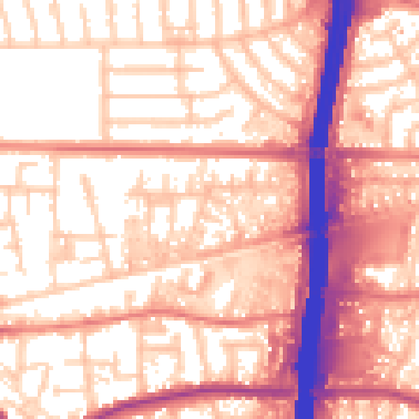
Daytime· 07:00 – 23:00
58.1dB

Night-time· 23:00 – 07:00
49.6dB