6 Ancaster Avenue, Lincoln, LN2 4AY
About 6 Ancaster Avenue
6 Ancaster Avenue is a three-bedroom semi-detached house in Lincoln (LN2 4AY). It has a recorded floor area of 107 m² (around 1152 sq ft), construction records dating it to 1930-1949 and council tax band C. The latest certificate (January 2013) shows a C (score 71). When first surveyed in January 2010 the rating was E, the property has climbed 2 bands since. Between certificates, wall efficiency went from Poor to Good and roof efficiency went from Average to Very Good; while lighting dropped from Very Good to Good. The recommended improvements would push it to B (score 83). The latest certificate is from January 2013, so improvements made since then won't be reflected.
One planning record on file: an extension approved in 2021. Past consents include an extension and partial demolition, meaningful when judging how the property has evolved. Across 2008–2019, sale prices on this property compounded at 6.6% per year. Today's modelled estimate of £334,000 is 14% above the 2019 sale price. On a £-per-square-foot basis, the last sale (£254/sq ft) was about 54% above the typical sold price in the postcode. Sold July 2019 for £293,000.
What this property has
Inside
- Bedrooms3
- Bathrooms1
- Dining roomYes
Outside
- Private gardenRear
- GarageYes
Building
- RefurbishedYes
Everything you need to know about 6 Ancaster Avenue
The true value, the hidden risks and the full sale history, in one report.
Pick your report · every report is £14.99
One time fee only - money back guarantee

The data behind every report


Energy performance
6 Ancaster Avenue's EPC is over a decade old — improvements since won't be reflected.
EPC Expired
This certificate is over 10 years old and is no longer valid.Expired 24 Jan 2023
EPC Rating
Property Improvements
Changes detected from historical EPC data
Cavity wall insulation installed
Loft insulation upgraded to recommended levels
Get a survey for this property
Level 2 HomeBuyer Report
We've checked 10 risk factors against the available data for this property and believe a Level 2 HomeBuyer Report could be a suitable option for you.
From £595 · Includes VAT
Planning history
Planning history includes recorded demolition works, indicating a major rebuild phase at this address.
1 application on record at 6 Ancaster Avenue, Lincoln, LN2 4AY
- Nov 2021DemolitionFullOutcome in report
Extension: Two storey · Side and rear of property
Removal of existing garage and rear extension. Erection of two storey side extension and single storey rear extension.
Extension- Documents
- 5 docs on file
- Reference
- 2021/0824/HOU
Unlock 6 Ancaster Avenue, Lincoln, LN2 4AY's full planning history
You're seeing the shape of it. The report has the substance.
- Every decision — granted, refused or withdrawn (1 on record)
- All 1 application on this property in full, plus 6 notable nearby
- The 5 documents, officer reports & conditions
- What the pattern means for extending or converting here
One time fee only - money back guarantee
Sales history & valuation
6 Ancaster Avenue valuation sits well clear of the typical sold price in this postcode.
£334,000
Modelled from EPC, postcode comparables and a sale-price growth of 6.6% per year over 11 years.
£293,000
Growth on file: 6.6% per year over 11 years.
Sales timeline
7 July 2019Most recent
£293,000
+33.2%over 5 years28 October 2013
£220,000
+49.7%over 5 years15 October 2008
£147,000
Median price across the last 5 sales in LN2 4AY: £350,000 (2024–2014).
Nearby sales in LN2 4AY
Versus other Ancaster Avenue homes
On floor area, 6 Ancaster Avenue runs well behind the street norm.
Price per m²
£2,738
Street avg £2,671
Floor Area
107 m²
Street avg 113 m²
Habitable Rooms
6 rooms
Street avg 6 rooms
CO₂ Emissions
3.4 t/year
Street avg 4.0 t/year
Everything you need to know about 6 Ancaster Avenue
The true value, the hidden risks and the full sale history, in one report.
Pick your report · every report is £14.99
One time fee only - money back guarantee
The data behind every report
Similar properties nearby
1 Bellflower Close
LN2 4UD
1 Byron Avenue
LN2 4DX
1 Aster Close
LN2 4SU
1 Blackthorn Close
LN2 4UE
1 Arabis Close
LN2 4UF
1 Burneside Close
LN2 4XA
1 Byland Close
LN2 4GH
1 Atwater Grove
LN2 4SG
The neighbourhood at a glance
Crime
3/mo
Steady year-on-year across the wider district.
Nearest stop
0.1 km
Maternity Unit — bus stop.
Closest school
0.4 km
Lincoln Christ's Hospital School. 16 schools nearby.
Go deeper on the local area
A Local Area report breaks down crime, transport links, schools and air quality in depth.
Road noise across the postcode
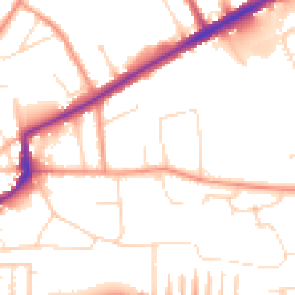
Daytime· 07:00 – 23:00
51.1dB

Night-time· 23:00 – 07:00
40.6dB