2a, Churchfields, Loughton, IG10 1AG
About 2a
2a is a four-bedroom semi-detached house in Loughton (IG10 1AG). It has a recorded floor area of 122 m² (around 1313 sq ft). The latest certificate (July 2015) returns a high B (score 85), putting the home a stone's throw from an A rating. The recommended improvements would push it to A (score 94). The latest certificate is from July 2015, so improvements made since then won't be reflected. The property has underfloor heating on record, all of which lower running costs and tend to lift resale appeal. Other recorded features include outbuildings and a basement. Period features are noted in the property record. The home occupies a cul-de-sac position.
8 years since the last transfer (July 2018). Across the public record there are 4 sales, relatively high churn for a single property. Its energy rating outperforms most of the postcode (better than 86% of similar EPCs). Across 2003–2018, sale prices on this property compounded at 6.7% per year. Today's modelled estimate of £869,000 is 12.1% above the 2018 sale price. On a £-per-square-foot basis, the last sale (£590/sq ft) was about 20.8% above the typical sold price in the postcode.
What this property has
Inside
- Bedrooms4
- Bathrooms2
- Open-plan layoutYes
- Dining roomYes
- CloakroomYes
- EnsuiteYes
- BasementYes
Outside
- Private gardenRear
- OutbuildingsYes
- Cul-de-sacYes
Building
- Underfloor heatingYes
- Period featuresYes
Everything you need to know about 2a
The true value, the hidden risks and the full sale history, in one report.
Pick your report · from £14.99
One time fee only - money back guarantee

The data behind every report







Energy performance
2a's EPC is over a decade old — improvements since won't be reflected.
EPC Expired
This certificate is over 10 years old and is no longer valid.Expired 24 Jul 2025
EPC Rating
Certificate validity
Expired on 24 July 2025

Get a survey for this property
Level 3 Building Survey
Because the property has permanent outbuildings, we believe a Level 3 building survey should be considered.
From £1,360 · Includes VAT
Planning history
2a has no planning applications on record.
A planning report still maps activity across the surrounding area and reads this property's extension & conversion potential.
Sales history & valuation
Sale price has at least doubled since 2003.
£869,000
Modelled from EPC, postcode comparables and a sale-price growth of 6.7% per year over 15 years.
£775,000
Growth on file: 6.7% per year over 15 years.
Sales timeline
19 July 2018Most recent
£775,000
+6.2%over 2 years12 May 2016
£730,000
+57.0%over 2 years25 July 2013
£465,000
+56.0%over 9 years18 September 2003
£298,000
Median price across the last 5 sales in IG10 1AG: £785,000 (2026–2016).
Nearby sales in IG10 1AG
Versus other Churchfields homes
On epc rating, 2a stands well clear of the street.
Price per m²
£6,352
Street avg £5,282
Floor Area
122 m²
Street avg 131 m²
CO₂ Emissions
1.6 t/year
Street avg 5.7 t/year
Years Held
8 years
Street avg 10 years
Everything you need to know about 2a
The true value, the hidden risks and the full sale history, in one report.
Pick your report · from £14.99
One time fee only - money back guarantee
The data behind every report
Similar properties nearby
1 Forest Way
IG10 1JG
1 Hill Top Place, Hill Top Close
IG10 1PW
1 Brancaster Place, Church Hill
IG10 1QN
1 Ashfields
IG10 1SB
1 Elmores
IG10 1NS
1 Grasmere Close
IG10 1SL
1 Church Lane
IG10 1PD
1 Lanterns, Whitakers Way
IG10 1SQ
The neighbourhood at a glance
Rail-style transport is unusually close for this postcode.
Crime
222/mo
Falling year-on-year across the wider district.
Nearest stop
0.1 km
Forest Road — bus stop.
Closest school
0.3 km
Roding Valley High School. 13 schools nearby.
Go deeper on the local area
A Local Area report breaks down crime, transport links, schools and air quality in depth.
Road noise across the postcode
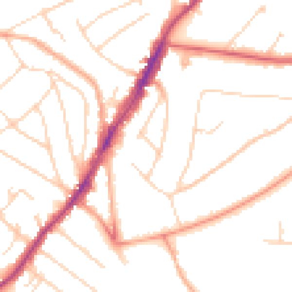
Daytime· 07:00 – 23:00
49.4dB

Night-time· 23:00 – 07:00
39.7dB