11 Beckside Gardens, Waterloo, Huddersfield, HD5 8RS
About 11 Beckside Gardens
11 Beckside Gardens is a property in Waterloo, Huddersfield, Huddersfield (HD5 8RS). It has council tax band D.
Untraded for 31 years, with the last transfer in July 1995. Only one transfer is on record with HM Land Registry, suggesting it has stayed in the same hands for a long time.
Everything you need to know about 11 Beckside Gardens
The true value, the hidden risks and the full sale history, in one report.
Pick your report · every report is £14.99
One time fee only - money back guarantee

The data behind every report


Energy performance
No EPC on record
This property doesn't have an Energy Performance Certificate yet. An EPC is required to sell or let — and unlocks our automated valuation.
Get a survey for this property
Level 2 HomeBuyer Report
We've checked 10 risk factors against the available data for this property and believe a Level 2 HomeBuyer Report could be a suitable option for you.
Planning history
11 Beckside Gardens has no planning applications on record.
But the area is active
5 notable applications nearby — larger schemes and conversions that could reshape the street. The report maps them all.
Sales history & valuation
11 Beckside Gardens has been held in the same hands since before 2000.
£87,500
Recorded with HM Land Registry.
Sales timeline
3 July 1995Most recent
£87,500
Median price across the last 5 sales in HD5 8RS: £231,950 (2024–2004).
Nearby sales in HD5 8RS
15 Beckside Gardens, Waterloo, Huddersfield, HD5 8RS
Sold Aug 2024
£340,0003 Beckside Gardens, Waterloo, Huddersfield, HD5 8RS
Sold Sept 2015
£245,50017 Beckside Gardens, Waterloo, Huddersfield, HD5 8RS
Sold Aug 2009
£90,0001 Beckside Gardens, Waterloo, Huddersfield, HD5 8RS
Sold Oct 2004
£185,0009 Beckside Gardens, Waterloo, Huddersfield, HD5 8RS
Sold Feb 1997
£90,000
Everything you need to know about 11 Beckside Gardens
The true value, the hidden risks and the full sale history, in one report.
Pick your report · every report is £14.99
One time fee only - money back guarantee
The data behind every report
Similar properties nearby
The neighbourhood at a glance
Crime
2/mo
Steady year-on-year across the wider district.
Nearest stop
0.1 km
Southfield Road — bus stop.
Closest school
0.9 km
Lepton CofE Primary Academy. 14 schools nearby.
Go deeper on the local area
A Local Area report breaks down crime, transport links, schools and air quality in depth.
Road noise across the postcode
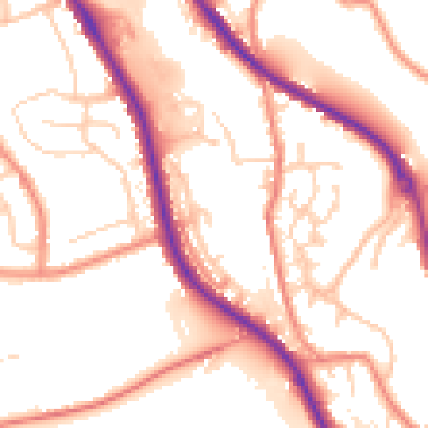
Daytime· 07:00 – 23:00
54.2dB

Night-time· 23:00 – 07:00
44.4dB