Broadlands Cottage, Ramshill, Petersfield, GU31 4BA
About Broadlands Cottage
Broadlands Cottage is a three-bedroom detached house in Petersfield (GU31 4BA). It has a recorded floor area of 199 m² (around 2142 sq ft) and construction records dating it to 1900-1929. The latest certificate (November 2019) shows a D (score 58), a step below the typical UK home. The recommended improvements would push it to C (score 74). Other recorded features include outbuildings. Period features are noted in the property record. The home occupies a corner plot and a cul-de-sac position.
3 planning records sit against the property, 1 approved, 0 refused. Past consents include an extension and a porch, meaningful when judging how the property has evolved. Across 1999–2022, sale prices on this property compounded at 6.1% per year. On a £-per-square-foot basis, the last sale (£462/sq ft) was about 15.4% above the typical sold price in the postcode. Most recent transfer: November 2022 at £990,000. That sale was during the post-pandemic price surge, when transactions cleared materially above pre-2020 trend.
Know exactly what you're buying at Broadlands Cottage
Before you offer, see what the listing won't tell you, the true value, the red flags and the full history.
Already flagged here
Valuation
against the asking price
Risks
planning & flood
Sold prices
similar homes nearby
Trends
the local market
What this property has
Inside
- Bedrooms3
- Bathrooms2
- Dining roomYes
- EnsuiteYes
- StudyYes
Outside
- Private gardenYes
- DrivewayYes
- OutbuildingsYes
- Corner plotYes
- Cul-de-sacYes
Building
- Period featuresYes
- RefurbishedYes
Energy performance
Broadlands Cottage's carbon output runs well above what efficient homes in the postcode produce.
EPC Rating
Planning history
- Jul 2023PorchFullIn report
Proposed construction of 2no. dormers, entrance porch and general door and window alterations.
- Agent
- JB Architecture Design Ltd
Extension- Documents
- 10 docs on file
- Reference
- SDNP/23/02322/HOUS
- Mar 2007ExtensionFullIn report
PORCH AND ATTACHED OPEN FRONTED DOUBLE GARAGE TO SIDE
- Agent
- Charles Allchurch
- Documents
- 8 docs on file
- Reference
- 35641/001
We flagged 1 thing worth checking at Broadlands Cottage
Independent checks surfaced things a buyer would want to understand before offering. The report explains each one in full, with the underlying data and what to ask.
- Larger development activity nearby
30-day money-back guarantee
Sales history & valuation
Broadlands Cottage has more than tripled in price since its earliest registered sale in 1999.
£1,050,000
Modelled from EPC, postcode comparables and a sale-price growth of 6.1% per year over 23 years.
£990,000
Growth on file: 6.1% per year over 23 years.
Sales timeline
11 November 2022Most recent
£990,000
+296.8%over 23 years5 September 1999
£249,500
Median price across the last 5 sales in GU31 4BA: £735,000 (2017–2008).
Nearby sales in GU31 4BA
Alverstone, Ramshill, Petersfield, GU31 4BA
Sold Sept 2017
£707,000Broadlands House, Ramshill, Petersfield, GU31 4BA
Sold Sept 2010
£1,950,000The Chestnuts, Ramshill, Petersfield, GU31 4BA
Sold Sept 2008
£450,000Kingswood House, Ramshill, Petersfield, GU31 4BA
Sold Jul 2008
£735,000The Garden House, Ramshill, Petersfield, GU31 4BA
Sold Feb 2008
£810,000
Everything we know about Broadlands Cottage, in one report
What it's really worth, what could be wrong, and the planning, sales and area data in full.
What we flagged
- Larger development activity nearby

Similar properties nearby
The neighbourhood at a glance
Crime
1/mo
Steady year-on-year across the wider district.
Nearest stop
0.3 km
Churchers College — bus stop.
Closest school
0.4 km
Sheet Primary School. 5 schools nearby.
Go deeper on the local area
The full report breaks down crime, transport links, schools and air quality in depth.
Road noise across the postcode
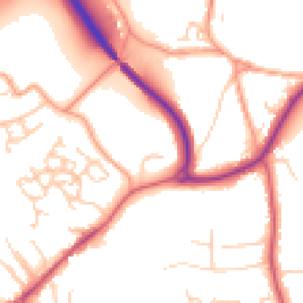
Daytime· 07:00 – 23:00
52.7dB

Night-time· 23:00 – 07:00
43.5dB