20 Brecon Road, Bristol, BS9 4DS
About 20 Brecon Road
20 Brecon Road is a five-bedroom detached house in Bristol (BS9 4DS). It has a recorded floor area of 258 m² (around 2777 sq ft), construction records dating it to 1900-1929 and council tax band G. The latest certificate (November 2021) shows an E (score 50), well below the UK norm with real room to improve. The recommended improvements would lift it to C (score 74), a 2-band jump. Other recorded features include a loft. Period features are noted in the property record. Our model identifies extension potential, subject to local planning policy. The home occupies a corner plot.
At 258 m² the property is well over the postcode median (160 m² across 7 EPCs), placing it in the larger end of the local stock. It lags the bulk of the postcode on energy efficiency (less efficient than 71% of similar EPCs). One planning record on file: an extension approved in 2023. Past consents include an extension, new windows and partial demolition, meaningful when judging how the property has evolved. On a £-per-square-foot basis, the last sale (£535/sq ft) was about 44.2% above the typical sold price in the postcode. Sold May 2022 for £1,486,500. That sale was during the post-pandemic price surge, when transactions cleared materially above pre-2020 trend.
What this property has
Inside
- Bedrooms5
- Bathrooms3
- Utility roomYes
- EnsuiteYes
- LoftYes
Outside
- Private gardenYes
- ParkingOff road
- Corner plotYes
Building
- Period featuresYes
- Extension potentialPossible
Everything you need to know about 20 Brecon Road
The true value, the hidden risks and the full sale history, in one report.
Pick your report · from £14.99
One time fee only - money back guarantee

The data behind every report







Energy performance
20 Brecon Road's carbon output runs well above what efficient homes in the postcode produce.
EPC Rating
Certificate validity
Valid until 30 November 2031

Get a survey for this property
Level 3 Building Survey
Because the property was built before 1919 and has solid (non-cavity) walls, we believe a Level 3 building survey should be considered.
From £1,795 · Includes VAT
Planning history
Planning history includes recorded demolition works, indicating a major rebuild phase at this address.
1 application on record at 20 Brecon Road, Bristol, BS9 4DS
- Oct 2023DemolitionFullOutcome in report
Extension: Rear of property
Demolition of existing extension and associated work. Proposed rear terrace, new ground floor windows & doors.
ExtensionNew Windows- Documents
- 11 docs on file
- Reference
- 23/00380/H
Unlock 20 Brecon Road, Bristol, BS9 4DS's full planning history
You're seeing the shape of it. The report has the substance.
- Every decision — granted, refused or withdrawn (1 on record)
- All 1 application on this property in full, plus 7 notable nearby
- The 11 documents, officer reports & conditions
- What the pattern means for extending or converting here
One time fee only - money back guarantee
Sales history & valuation
Latest sale on 20 Brecon Road was the highest on Land Registry record across the postcode.
£1,626,000
Modelled from EPC, postcode comparables.
£1,486,500
Recorded with HM Land Registry.
Sales timeline
19 May 2022Most recent
£1,486,500
Median price across the last 5 sales in BS9 4DS: £875,000 (2022–2013).
Versus other Brecon Road homes
20 Brecon Road is notably below the street on years held.
Price per m²
£5,762
Street avg £4,586
Floor Area
258 m²
Street avg 173 m²
Habitable Rooms
9 rooms
Street avg 8 rooms
CO₂ Emissions
13.0 t/year
Street avg 7.7 t/year
Everything you need to know about 20 Brecon Road
The true value, the hidden risks and the full sale history, in one report.
Pick your report · from £14.99
One time fee only - money back guarantee
The data behind every report
Similar properties nearby
1 Carmarthen Road
BS9 4DU
1 Cavendish Road
BS9 4DZ
1 Brecon Close, Henleaze
BS9 4DG
1 Duckett Fields
BS9 4DJ
1 Cransley Crescent
BS9 4PH
1 Croft View
BS9 4PT
1 Audrey Walk
BS9 4SJ
1 Broadleys Avenue
BS9 4LY
The neighbourhood at a glance
Daytime road noise here sits well below conversation level — a quiet pocket of the postcode.
Crime
164/mo
Steady year-on-year across the wider district.
Nearest stop
0.2 km
Henleaze Park Drive — bus stop.
Closest school
0.2 km
E-Act St Ursula's Academy. 36 schools nearby.
Go deeper on the local area
A Local Area report breaks down crime, transport links, schools and air quality in depth.
Road noise across the postcode
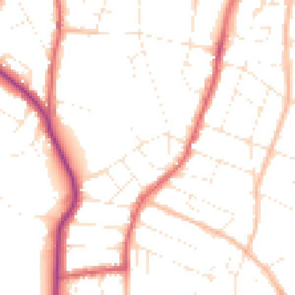
Daytime· 07:00 – 23:00
49.9dB
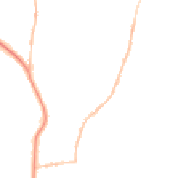
Night-time· 23:00 – 07:00
40.2dB