9a, Redfield Road, Patchway, Bristol, BS34 6PJ
About 9a
9a is a property in Patchway, Bristol, Bristol (BS34 6PJ). It has a recorded floor area of 69 m² (around 743 sq ft). The latest certificate (February 2016) returns a B (score 82), comfortably above the UK average. The recommended improvements would push it to A (score 95). The latest certificate is from February 2016, so improvements made since then won't be reflected.
At 69 m² it sits well below the postcode median (104 m² across 15 EPCs), making it one of the more compact homes locally. Its energy rating outperforms most of the postcode (better than 80% of similar EPCs). Across 2016–2018, sale prices on this property compounded at 4.7% per year. Today's modelled estimate of £383,000 is 32.1% above the 2018 sale price. On a £-per-square-foot basis, the last sale (£390/sq ft) was about 49% above the typical sold price in the postcode. Last sale on file: £290,000 in August 2018.
Everything you need to know about 9a
The true value, the hidden risks and the full sale history, in one report.
Pick your report · every report is £14.99
One time fee only - money back guarantee

The data behind every report


Energy performance
9a's carbon output is low for the local stock.
EPC Expired
This certificate is over 10 years old and is no longer valid.Expired 18 Feb 2026
EPC Rating
Get a survey for this property
Level 2 HomeBuyer Report
We've checked 10 risk factors against the available data for this property and believe a Level 2 HomeBuyer Report could be a suitable option for you.
From £595 · Includes VAT
Planning history
9a has no planning applications on record.
But the area is active
5 notable applications nearby — larger schemes and conversions that could reshape the street. The report maps them all.
Sales history & valuation
£383,000
Modelled from EPC, postcode comparables and a sale-price growth of 4.7% per year over 2 years.
£290,000
Growth on file: 4.7% per year over 2 years.
Sales timeline
2 August 2018Most recent
£290,000
+10.9%over 2 years26 April 2016
£261,500
Median price across the last 5 sales in BS34 6PJ: £400,000 (2025–2021).
Nearby sales in BS34 6PJ
15 Redfield Road, Patchway, Bristol, BS34 6PJ
Sold Mar 2025
£575,00017 Redfield Road, Patchway, Bristol, BS34 6PJ
Sold May 2024
£370,0003 Clanberris Court, Redfield Road, Patchway, Bristol, BS34 6PJ
Sold Jul 2023
£370,00021 Redfield Road, Patchway, Bristol, BS34 6PJ
Sold Jan 2023
£400,00019 Redfield Road, Patchway, Bristol, BS34 6PJ
Sold Mar 2021
£455,000
Versus other Redfield Road homes
On floor area, 9a runs well behind the street norm.
Price per m²
£4,203
Street avg £2,937
Floor Area
69 m²
Street avg 114 m²
CO₂ Emissions
1.2 t/year
Street avg 5.5 t/year
Years Held
8 years
Street avg 9 years
Everything you need to know about 9a
The true value, the hidden risks and the full sale history, in one report.
Pick your report · every report is £14.99
One time fee only - money back guarantee
The data behind every report
Similar properties nearby
1 Brookcote Drive, Little Stoke
BS34 6LG
1 Bourton Avenue, Patchway
BS34 6EB
1 Highnam Close, Patchway
BS34 6AB
1 Clanberris Court, Redfield Road, Patchway
BS34 6PJ
1 Brockley Close, Little Stoke
BS34 6EZ
1 Fairford Crescent, Patchway
BS34 6DH
1 Bibury Avenue, Patchway
BS34 6DE
1 Collins Avenue, Little Stoke
BS34 6JZ
The neighbourhood at a glance
Rail-style transport is unusually close for this postcode.
Crime
6/mo
Steady year-on-year across the wider district.
Nearest stop
0.2 km
The Grove — bus stop.
Closest school
0.3 km
Holy Family Catholic Primary School. 22 schools nearby.
Go deeper on the local area
A Local Area report breaks down crime, transport links, schools and air quality in depth.
Road noise across the postcode
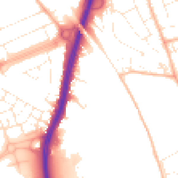
Daytime· 07:00 – 23:00
51.8dB

Night-time· 23:00 – 07:00
42.3dB