32 Gascoigns Way, Patchway, Bristol, BS34 5BY
About 32 Gascoigns Way
32 Gascoigns Way is a three-bedroom detached house in Patchway, Bristol, Bristol (BS34 5BY). It has a recorded floor area of 90 m² (around 969 sq ft) and construction records dating it to 2012 onwards. The latest certificate (July 2024) shows a C (score 79), near the top of the C band. Earlier certificates rated it B (December 2013); the latest reading is one band lower. Between certificates, roof efficiency dropped from Very Good to Good and window efficiency dropped from Very Good to Good. The recommended improvements would push it to B (score 90).
At 90 m² it's 26.8% larger than the typical home in the postcode (71 m² median across 24 EPCs). It lags the bulk of the postcode on energy efficiency (less efficient than 83% of similar EPCs). Across 2013–2022, sale prices on this property compounded at 6.1% per year. Today's modelled estimate of £417,000 is 12.6% above the 2022 sale price. On a £-per-square-foot basis, the last sale (£382/sq ft) was about 61.8% above the typical sold price in the postcode. Most recent transfer: February 2022 at £370,500. That sale was during the post-pandemic price surge, when transactions cleared materially above pre-2020 trend.
What this property has
Inside
- Bedrooms3
- Bathrooms2
- CloakroomYes
- EnsuiteYes
Outside
- Private gardenRear
- GarageSingle
Building
- Heating systemGas
- RefurbishedYes
Everything you need to know about 32 Gascoigns Way
The true value, the hidden risks and the full sale history, in one report.
Pick your report · every report is £14.99
One time fee only - money back guarantee

The data behind every report


Energy performance
EPC Rating
Property Improvements
Changes detected from historical EPC data
Heating controls changed
Floor insulation added or improved
Get a survey for this property
Level 2 HomeBuyer Report
We've checked 10 risk factors against the available data for this property and believe a Level 2 HomeBuyer Report could be a suitable option for you.
From £695 · Includes VAT
Planning history
32 Gascoigns Way has no planning applications on record.
But the area is active
11 notable applications nearby — larger schemes and conversions that could reshape the street. The report maps them all.
Sales history & valuation
Latest sale on 32 Gascoigns Way was the highest on Land Registry record across the postcode.
£417,000
Modelled from EPC, postcode comparables and a sale-price growth of 6.1% per year over 8 years.
£370,500
Growth on file: 6.1% per year over 8 years.
Sales timeline
24 February 2022Most recent
£370,500
+61.8%over 8 years18 December 2013
£228,995
Median price across the last 5 sales in BS34 5BY: £239,950 (2024–2022).
Nearby sales in BS34 5BY
16 Gascoigns Way, Patchway, Bristol, BS34 5BY
Sold Mar 2024
£230,50022 Gascoigns Way, Patchway, Bristol, BS34 5BY
Sold Feb 2024
£342,1006 Gascoigns Way, Patchway, Bristol, BS34 5BY
Sold Oct 2023
£239,95030 Gascoigns Way, Patchway, Bristol, BS34 5BY
Sold Feb 2023
£365,00018 Gascoigns Way, Patchway, Bristol, BS34 5BY
Sold Jan 2022
£191,221
Versus other Gascoigns Way homes
32 Gascoigns Way is notably below the street on epc rating.
Price per m²
£4,117
Street avg £3,010
Floor Area
90 m²
Street avg 91 m²
CO₂ Emissions
1.9 t/year
Street avg 1.5 t/year
Years Held
4 years
Street avg 9 years
Everything you need to know about 32 Gascoigns Way
The true value, the hidden risks and the full sale history, in one report.
Pick your report · every report is £14.99
One time fee only - money back guarantee
The data behind every report
Similar properties nearby
1 Eamoth Ground, Patchway
BS34 5SR
1 Broad Croft, Patchway
BS34 5FS
1 Buckleys Road, Patchway
BS34 5BJ
1 Calves Garden, Patchway
BS34 5GZ
1 Clermont Close, Patchway
BS34 5QJ
1 Eagle Drive, Patchway
BS34 5RJ
1 Donns Close, Patchway
BS34 5JW
1 Birch Close, Patchway
BS34 5SB
The neighbourhood at a glance
Rail-style transport is unusually close for this postcode.
Crime
6/mo
Steady year-on-year across the wider district.
Nearest stop
0.1 km
Charlton Boulevard — bus stop.
Closest school
0.2 km
Charlton Wood Primary Academy. 24 schools nearby.
Go deeper on the local area
A Local Area report breaks down crime, transport links, schools and air quality in depth.
Road noise across the postcode
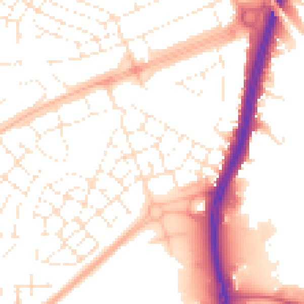
Daytime· 07:00 – 23:00
53.4dB

Night-time· 23:00 – 07:00
42.8dB