11a, The Goffs, Eastbourne, BN21 1HA
About 11a
11a is a detached house in Eastbourne (BN21 1HA). It has a recorded floor area of 549 m² (around 5909 sq ft), construction records dating it to 1930-1949 and council tax band A. The latest certificate (July 2016) shows an E (score 43), well below the UK norm with real room to improve. The recommended improvements would lift it to C (score 74), a 2-band jump. The latest certificate is from July 2016, so improvements made since then won't be reflected.
3 planning records sit against the property, 0 approved, 0 refused.
Everything you need to know about 11a
The true value, the hidden risks and the full sale history, in one report.
Pick your report · from £14.99
One time fee only - money back guarantee

The data behind every report







Energy performance
11a's carbon output runs well above what efficient homes in the postcode produce.
EPC Expired
This certificate is over 10 years old and is no longer valid.Expired 02 Jul 2026
EPC Rating
Certificate validity
Expired on 2 July 2026

Get a survey for this property
Level 3 Building Survey
Because the property is a large detached home over 300m², we believe a Level 3 building survey should be considered.
From £1,155 · Includes VAT
Planning history
3 applications on record at 11a, The Goffs, Eastbourne, BN21 1HA
- May 2015OutlineOutcome in report
Wendy house in rear garden and pond in front garden.
- Documents
- 1 doc on file
- Reference
- 150524
- More recent applications — locked
- OutlineMar 2017Decision
- ConditionsAug 2015Decision
Unlock 11a, The Goffs, Eastbourne, BN21 1HA's full planning history
You're seeing the shape of it. The report has the substance.
- Every decision — granted, refused or withdrawn (1 on record)
- All 3 applications on this property in full, plus 7 notable nearby
- The 20 documents, officer reports & conditions
- What the pattern means for extending or converting here
One time fee only - money back guarantee
Sales history & valuation
11a has no Land Registry sales on file, suggesting it has stayed in the same hands since registration began.
£689,000
Modelled from EPC, postcode comparables.
No sales recorded with HM Land Registry
That can mean the property has never traded since the registry began publishing in 1995, was a new build that hasn't been registered yet, or is held in the same hands long-term.
Median price across the last 2 sales in BN21 1HA: £792,500 (2017–2008).
Everything you need to know about 11a
The true value, the hidden risks and the full sale history, in one report.
Pick your report · from £14.99
One time fee only - money back guarantee
The data behind every report
Similar properties nearby
1 Glendale Avenue
BN21 1UT
1 Baldwin Avenue
BN21 1UJ
1 Cobbold Avenue
BN21 1XB
1 Gore Park Avenue
BN21 1QB
1 Clifford Avenue
BN21 1XL
1 Letheren Place
BN21 1HL
1 Farlaine Road
BN21 1XG
1 Bakewell Road
BN21 1PX
The neighbourhood at a glance
Rail-style transport is unusually close for this postcode.
Crime
484/mo
Steady year-on-year across the wider district.
Nearest stop
0.1 km
Hartfield Road — bus stop.
Closest school
0.4 km
Gildredge House. 15 schools nearby.
Go deeper on the local area
A Local Area report breaks down crime, transport links, schools and air quality in depth.
Road noise across the postcode
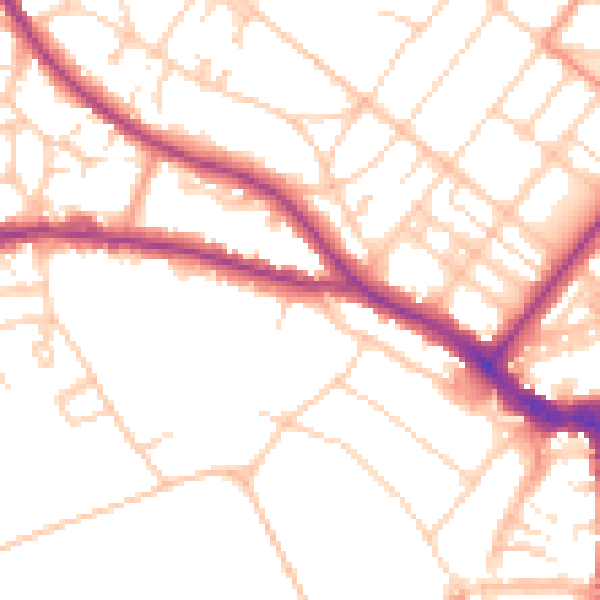
Daytime· 07:00 – 23:00
51.1dB

Night-time· 23:00 – 07:00
41.6dB