Second Floor Flat, 23 Priory Street, York, YO1 6ET
About Second Floor Flat
Second Floor Flat is an end-of-terrace house in York (YO1 6ET). It has a recorded floor area of 60 m² (around 646 sq ft) and construction records dating it to before 1900. The latest certificate (January 2021) shows a C (score 71).
At 60 m² it's 27.7% larger than the typical home in the postcode (47 m² median across 24 EPCs).
Everything you need to know about Second Floor Flat
The true value, the hidden risks and the full sale history, in one report.
30-day money-back guarantee

The data behind every report


Energy performance
EPC Rating
Planning history
Second Floor Flat has no planning applications on record.
Notable planning nearby
10applications of note in the surrounding area
We flagged 2 things worth checking at Second Floor Flat
Independent checks surfaced things a buyer would want to understand before offering. The report explains each one in full, with the underlying data and what to ask.
- Signs of HMO activity in the area
- Larger development activity nearby
30-day money-back guarantee
Sales history & valuation
Second Floor Flat has no Land Registry sales on file, suggesting it has stayed in the same hands since registration began.
£245,000
Modelled from EPC, postcode comparables.
No sales recorded with HM Land Registry
That can mean the property has never traded since the registry began publishing in 1995, was a new build that hasn't been registered yet, or is held in the same hands long-term.
Median price across the last 5 sales in YO1 6ET: £575,000 (2025–2013).
Versus other Priory Street homes
Floor Area for Second Floor Flat runs comfortably ahead of the street norm.
EPC Rating
71 (C)
Street avg 66 (D)
Floor Area
60 m²
Street avg 40 m²
CO₂ Emissions
2.4 t/year
Street avg 2.0 t/year
Habitable Rooms
3 rooms
Street avg 2 rooms
Everything you need to know about Second Floor Flat
The true value, the hidden risks and the full sale history, in one report.
30-day money-back guarantee
The data behind every report
Similar properties nearby
40a, Flat 5, Micklegate
YO1 6LF
40a, Flat 1, Micklegate
YO1 6LF
11 Victoria Bar Apartments, Victor Street
YO1 6HQ
40a, Flat 6, Micklegate
YO1 6LF
6 7, Flat 3, Bridge Street
YO1 6DD
17 Victoria Bar Apartments, Victor Street
YO1 6HQ
5 Victoria Bar Apartments, Victor Street
YO1 6HQ
29a, Flat 2, George Hudson Street
YO1 6JL
The neighbourhood at a glance
Rail-style transport is unusually close for this postcode.
Crime
5/mo
Rising year-on-year across the wider district.
Nearest stop
0.2 km
Nunnery Lane Car Park — bus stop.
Closest school
0.4 km
Scarcroft Primary School. 30 schools nearby.
Go deeper on the local area
The full report breaks down crime, transport links, schools and air quality in depth.
Road noise across the postcode
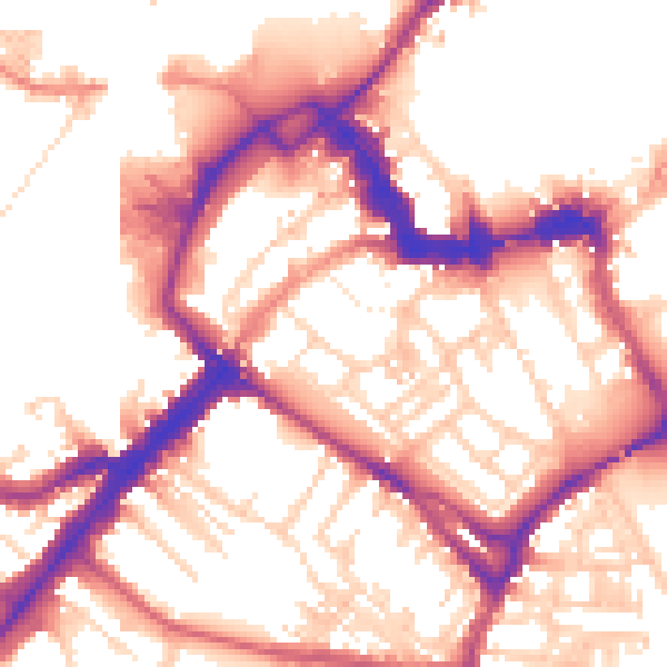
Daytime· 07:00 – 23:00
55.2dB
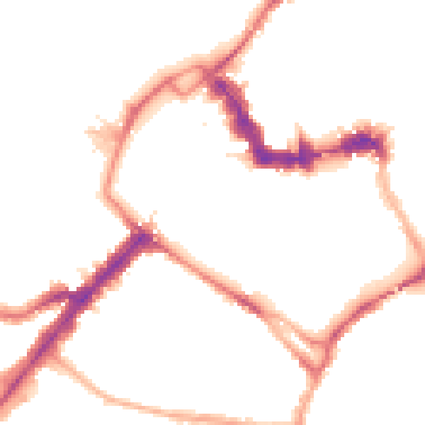
Night-time· 23:00 – 07:00
46.3dB