18 Garden Lane, Knottingley, WF11 9BS
About 18 Garden Lane
A plain-English summary derived from public records, EPC certificates, sold prices and local data.
18 Garden Lane is a two-bedroom end-of-terrace house in Knottingley (WF11 9BS). It has a recorded floor area of 71 m² (around 764 sq ft), construction records dating it to 1930-1949 and council tax band A. The latest certificate (April 2015) shows a D (score 62), on the cusp of jumping into the C band. The recommended improvements would push it to C (score 77). The latest certificate is from April 2015, so improvements made since then won't be reflected.
It lags the bulk of the postcode on energy efficiency (less efficient than 74% of similar EPCs). Today's modelled estimate of £177,000 is 30.6% above the 2021 sale price. On a £-per-square-foot basis, the last sale (£177/sq ft) was about 65.7% above the typical sold price in the postcode. Sold October 2021 for £135,500. That sale was during the post-pandemic price surge, when transactions cleared materially above pre-2020 trend.
Before you offer
Know exactly what you're buying at 18 Garden Lane
Before you offer, see what the listing won't tell you, the true value, the red flags and the full history.
Already flagged here
Larger development activity nearby
£9.99£14.99
Launch offer · save £5
What this property has
Pulled from EPC certificates, claim submissions and our property model. Empty categories are hidden — we only show what's known.
Inside
- Bedrooms2
- Bathrooms1
- Dining roomYes
Outside
- Private garden
Energy performance
Every EPC certificate filed against this property — current rating, recorded improvements, and where there's headroom to reach a higher band.
18 Garden Lane's EPC is over a decade old — improvements since won't be reflected.
EPC Expired
This certificate is over 10 years old and is no longer valid.Expired 27 Apr 2025
Planning history
Applications and permits filed against 18 Garden Lane, Knottingley, WF11 9BS, sourced from the PlanIt planning register.
18 Garden Lane has no planning applications on record.
Notable planning nearby
4applications of note in the surrounding area
Before you offer
We flagged 1 thing worth checking at 18 Garden Lane
Independent checks surfaced things a buyer would want to understand before offering. The report explains each one in full, with the underlying data and what to ask.
- Larger development activity nearby
£9.99£14.99
30-day money-back guarantee
Sales history & valuation
Recorded transactions, our model's current estimate, and a quick read on what neighbouring properties have sold for.
The latest sale landed in the post-pandemic price surge — useful context when reading the figure.
Current estimate
See how we calculated this£177,000
Modelled from EPC, postcode comparables.
Last sold (2021)
£135,500
Recorded with HM Land Registry.
Sales timeline
Before you offerLaunch offer · save £5
Everything we know about 18 Garden Lane, in one report
What it's really worth, what could be wrong, and the planning, sales and area data in full.
What we flagged
- Larger development activity nearby
£9.99£14.99
Versus other Garden Lane homes
Four headline reads against 17 similar houses on this street, drawn from the latest EPC and Land Registry data.
EPC Rating for 18 Garden Lane lags the street by a wide margin.
Price per m²
£1,908
Street avg £1,591
Floor Area
71 m²
Street avg 80 m²
Habitable Rooms
4 rooms
Street avg 5 rooms
Similar properties nearby
A handful of close matches in the same postcode area, ranked by likeness on bedrooms, type and floor area.
The neighbourhood at a glance
A condensed read of the local area. Each tile links through to the full breakdown on the Knottingley district page.
Daytime road noise here sits well below conversation level — a quiet pocket of the postcode.
Crime
5/mo
Steady year-on-year across the wider district.
Nearest stop
0.1 km
Road noise across the postcode
Modelled day and night-time noise levels around WF11 9BS from Defra's strategic mapping. The pin marks this postcode's centroid.
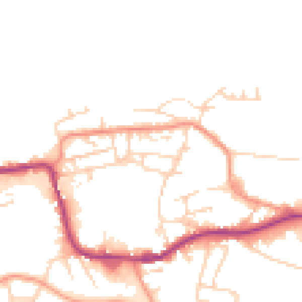
Daytime· 07:00 – 23:00
48.4dB

Everything within walking distance
Schools, transport stops and scenic spots near this property — 37 points of interest in total.
Common questions
The questions buyers, sellers and homeowners most often ask about 18 Garden Lane, Knottingley, WF11 9BS. Each answer is also embedded as structured data for search engines.
