27 Berry Avenue, Watford, WD24 6RU
About 27 Berry Avenue
27 Berry Avenue is a three-bedroom semi-detached house in Watford (WD24 6RU). It has a recorded floor area of 106 m² (around 1141 sq ft), construction records dating it to 1930-1949 and council tax band D. The latest certificate (May 2023) shows a D (score 66), on the cusp of jumping into the C band. The recommended improvements would lift it to B (score 83), a 2-band jump. Records show the property has been extended at some point in its history.
At 106 m² it's 26.9% larger than the typical home in the postcode (84 m² median across 22 EPCs). Today's modelled estimate of £529,000 is 11.4% above the 2023 sale price. On a £-per-square-foot basis, the last sale (£416/sq ft) was about 46.5% above the typical sold price in the postcode. Sold August 2023 for £475,000.
What this property has
Inside
- Bedrooms3
- Bathrooms1
Outside
- Private gardenNorth-west-facing
- ParkingOff street
Building
- Previously extendedYes
Everything you need to know about 27 Berry Avenue
The true value, the hidden risks and the full sale history, in one report.
30-day money-back guarantee

The data behind every report


Energy performance
Recommended upgrades on file would lift this property by multiple EPC bands.
EPC Rating
Planning history
27 Berry Avenue has no planning applications on record.
Notable planning nearby
4applications of note in the surrounding area
We flagged 1 thing worth checking at 27 Berry Avenue
Independent checks surfaced things a buyer would want to understand before offering. The report explains each one in full, with the underlying data and what to ask.
- Signs of HMO activity in the area
30-day money-back guarantee
Sales history & valuation
27 Berry Avenue valuation sits well clear of the typical sold price in this postcode.
£529,000
Modelled from EPC, postcode comparables.
£475,000
Recorded with HM Land Registry.
Sales timeline
24 August 2023Most recent
£475,000
Median price across the last 5 sales in WD24 6RU: £430,000 (2024–2021).
Versus other Berry Avenue homes
27 Berry Avenue is notably below the street on years held.
Price per m²
£4,481
Street avg £4,149
Floor Area
106 m²
Street avg 86 m²
Habitable Rooms
5 rooms
Street avg 5 rooms
CO₂ Emissions
4.3 t/year
Street avg 3.9 t/year
Everything you need to know about 27 Berry Avenue
The true value, the hidden risks and the full sale history, in one report.
30-day money-back guarantee
The data behind every report
Similar properties nearby
The neighbourhood at a glance
Rail-style transport is unusually close for this postcode.
Crime
4/mo
Rising year-on-year across the wider district.
Nearest stop
0.3 km
Library — bus stop.
Closest school
0.3 km
Cherry Tree Primary School. 29 schools nearby.
Go deeper on the local area
The full report breaks down crime, transport links, schools and air quality in depth.
Road noise across the postcode
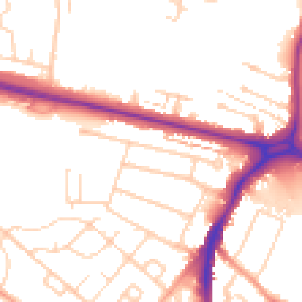
Daytime· 07:00 – 23:00
52.0dB

Night-time· 23:00 – 07:00
42.8dB