Skip to content

16 Bucks Avenue, Watford, WD19 4AS

Property type
Detached
Bedrooms
5
Bathrooms
3
Floor area
187 m²
2013 sq ft
Energy rating
D
Score 66
Council tax
Band G
Tenure
Owner Occupied
Overview

About 16 Bucks Avenue

A plain-English summary derived from public records, EPC certificates, sold prices and local data.

16 Bucks Avenue is a five-bedroom detached house in Watford (WD19 4AS). It has a recorded floor area of 187 m² (around 2013 sq ft), construction records dating it to 1900-1929 and council tax band G. The latest certificate (January 2017) shows a D (score 66), on the cusp of jumping into the C band. The recommended improvements would lift it to B (score 81), a 2-band jump. Other recorded features include a self-contained annexe.

At 187 m² the property is well over the postcode median (131 m² across 12 EPCs), placing it in the larger end of the local stock. 5 bedrooms is on the larger side for this postcode, where 3 is the typical count. On the market in March 2017 and unlisted since — roughly 9 years. Today's modelled estimate of £1,153,000 is 37.3% above the 2017 sale price.

Specifications

What this property has

Pulled from EPC certificates, claim submissions and our property model. Empty categories are hidden — we only show what's known.

Inside

  • Bedrooms5
  • Bathrooms3
  • Dining roomYes
  • EnsuiteYes

Outside

  • Private gardenSouth-facing
Before you decide

Everything you need to know about 16 Bucks Avenue

The true value, the hidden risks and the full sale history, in one report.

Larger development activity nearby
£14.99one-off

30-day money-back guarantee

Preview of the full property report

The data behind every report

  • HM Land Registry, source of sold price history
  • Department for Education, source of schools data
  • Police.uk, source of crime statistics
  • Department for Transport, source of stations and transport links
  • Environment Agency, source of flood risk data
  • Department for Environment, Food & Rural Affairs, source of road noise data
  • PlanIt, source of planning application records
  • Beautiful Places, source of nearby scenic places
Energy

Energy performance

Every EPC certificate filed against this property — current rating, recorded improvements, and where there's headroom to reach a higher band.

16 Bucks Avenue's carbon output runs well above what efficient homes in the postcode produce.

EPC Rating

A
B
C
D
D66
E
F
G
Main Heating
Gas
Main Fuel
Gas
Hot Water
Good
Windows
Good
CO2 Emissions
6.7 t/year
Occupancy
Owner Occupied
Planning

Planning history

Applications and permits filed against 16 Bucks Avenue, Watford, WD19 4AS, sourced from the PlanIt planning register.

16 Bucks Avenue has no planning applications on record.

Notable planning nearby

4applications of note in the surrounding area

Before you offer

We flagged 1 thing worth checking at 16 Bucks Avenue

Independent checks surfaced things a buyer would want to understand before offering. The report explains each one in full, with the underlying data and what to ask.

  • Larger development activity nearby
£14.99

30-day money-back guarantee

Price

Sales history & valuation

Recorded transactions, our model's current estimate, and a quick read on what neighbouring properties have sold for.

16 Bucks Avenue valuation sits well clear of the typical sold price in this postcode.

Current estimate

£1,153,000

Modelled from EPC, postcode comparables.

See how we calculated this
Last sold (2017)

£840,000

Recorded with HM Land Registry.

Sales timeline

  1. 1 March 2017Most recent

    £840,000

Median price across the last 5 sales in WD19 4AS: £680,000 (2025–2020).

On the street

Versus other Bucks Avenue homes

Four headline reads against 12 similar houses on this street, drawn from the latest EPC and Land Registry data.

16 Bucks Avenue outperforms the street on habitable rooms by a wide margin.

Price per m²

£4,492

Street avg £5,723

Below

Floor Area

187 m²

Street avg 134 m²

Strongly above

Habitable Rooms

9 rooms

Street avg 6 rooms

Strongly above

CO₂ Emissions

6.7 t/year

Street avg 7.0 t/year

On par
Before you decide

Everything you need to know about 16 Bucks Avenue

The true value, the hidden risks and the full sale history, in one report.

Larger development activity nearby
£14.99one-off

30-day money-back guarantee

Preview of the full property report

The data behind every report

  • HM Land Registry, source of sold price history
  • Department for Education, source of schools data
  • Police.uk, source of crime statistics
  • Department for Transport, source of stations and transport links
  • Environment Agency, source of flood risk data
  • Department for Environment, Food & Rural Affairs, source of road noise data
  • PlanIt, source of planning application records
  • Beautiful Places, source of nearby scenic places
Area

The neighbourhood at a glance

A condensed read of the local area. Each tile links through to the full breakdown on the Watford district page.

Rail-style transport is unusually close for this postcode.

Crime

4/mo

Steady year-on-year across the wider district.

Nearest stop

0.1 km

Heath Road — bus stop.

Closest school

0.5 km

Bromet Primary School. 34 schools nearby.

Go deeper on the local area

The full report breaks down crime, transport links, schools and air quality in depth.

Noise

Road noise across the postcode

Modelled day and night-time noise levels around WD19 4AS from Defra's strategic mapping. The pin marks this postcode's centroid.
Daytime road noise heatmap for WD19 4AS

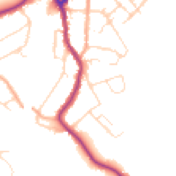
Daytime· 07:00 – 23:00

47.3dB

Low
Night-time road noise heatmap for WD19 4AS

Night-time· 23:00 – 07:00

39.1dB

Low
55 dB
60 dB
65 dB
70 dB
75 dB
80 dB
Defra Road Noise Strategic Mapping, Round 4
FAQ

Common questions

The questions buyers, sellers and homeowners most often ask about 16 Bucks Avenue, Watford, WD19 4AS. Each answer is also embedded as structured data for search engines.