67 Villiers Road, Watford, WD19 4AL
About 67 Villiers Road
67 Villiers Road is a mid-terrace house in Watford (WD19 4AL). It has a recorded floor area of 64 m² (around 689 sq ft), construction records dating it to 1900-1929 and council tax band D. The latest certificate (January 2013) shows a C (score 72). The recommended improvements would push it to B (score 91). The latest certificate is from January 2013, so improvements made since then won't be reflected.
Held since January 1996 — that's 30 years off the open market, well above the local norm. Only one transfer is on record with HM Land Registry, suggesting it has stayed in the same hands for a long time. Today's modelled estimate of £456,000 sits 409.5% above the 1996 sale of £89,500. On a £-per-square-foot basis, the last sale (£130/sq ft) was about 58.8% below the postcode norm. 3 planning records sit against the property, 2 approved, 0 refused. Past consents include tree works, meaningful when judging how the property has evolved. The record references conservation-area consent, which constrain future alterations. At 64 m² it's 16.3% smaller than the typical home in the postcode (77 m² median across 34 EPCs). Its energy rating outperforms most of the postcode (better than 82% of similar EPCs).
Everything you need to know about 67 Villiers Road
The true value, the hidden risks and the full sale history, in one report.
30-day money-back guarantee

The data behind every report


Energy performance
67 Villiers Road's EPC is over a decade old — improvements since won't be reflected.
EPC Expired
This certificate is over 10 years old and is no longer valid.Expired 25 Jan 2023
EPC Rating
Planning history
67 Villiers Road sits within a conservation area — exterior works face additional planning controls.
- Jul 2024RenovationFullIn report
Repair of cracks in the render at the rear of the property and rendering the property using ivory Corksol.
- Documents
- 15 docs on file
- Reference
- 24/00555/FULH
- Sept 2023Tree WorksTreesIn report
Works to trees in conservation area - Silver Birch - crown reduction 2m, Sycamore - crown reduction 3-4m, Mountain Ash - crown reduction, Leylandii - fell to stump due to disease, Cherry - crown reduction
Conservation Area- Documents
- 12 docs on file
- Reference
- 23/00773/TCA
We flagged 1 thing worth checking at 67 Villiers Road
Independent checks surfaced things a buyer would want to understand before offering. The report explains each one in full, with the underlying data and what to ask.
- Larger development activity nearby
30-day money-back guarantee
Sales history & valuation
67 Villiers Road's modelled value sits at over four times its earliest registered sale price (1996).
£456,000
Modelled from EPC, postcode comparables.
£89,500
Recorded with HM Land Registry.
Sales timeline
26 January 1996Most recent
£89,500
Median price across the last 5 sales in WD19 4AL: £675,000 (2025–2022).
Nearby sales in WD19 4AL
Versus other Villiers Road homes
CO₂ Emissions for 67 Villiers Road runs comfortably ahead of the street norm.
Price per m²
£1,398
Street avg £4,619
Floor Area
64 m²
Street avg 82 m²
Habitable Rooms
5 rooms
Street avg 4 rooms
CO₂ Emissions
2.1 t/year
Street avg 3.8 t/year
Everything you need to know about 67 Villiers Road
The true value, the hidden risks and the full sale history, in one report.
30-day money-back guarantee
The data behind every report
Similar properties nearby
1 Crossmead
WD19 4JG
1 Caroline Place, Capel Road
WD19 4AF
1 Blackwell Drive
WD19 4HP
1 Field End Mews
WD19 4FD
1 Colne Avenue
WD19 4JF
1 Brookside Road
WD19 4BW
1 Brookmill Close
WD19 4BB
1 Carlton Court, Eastbury Road
WD19 4QA
The neighbourhood at a glance
Rail-style transport is unusually close for this postcode.
Crime
4/mo
Steady year-on-year across the wider district.
Nearest stop
0.1 km
Oxhey Avenue — bus stop.
Closest school
0.4 km
Bushey and Oxhey Infant School. 34 schools nearby.
Go deeper on the local area
The full report breaks down crime, transport links, schools and air quality in depth.
Road noise across the postcode
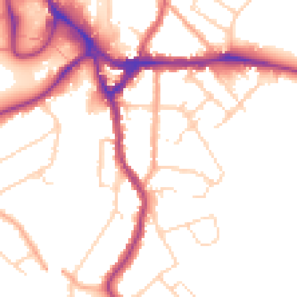
Daytime· 07:00 – 23:00
50.8dB

Night-time· 23:00 – 07:00
42.3dB