11a, Hampden Way, Watford, WD17 4SS
About 11a
11a is a four-bedroom detached house in Watford (WD17 4SS). It has a recorded floor area of 151 m² (around 1625 sq ft) and council tax band G. The latest certificate (April 2012) returns a B (score 81), comfortably above the UK average. The latest certificate is from April 2012, so improvements made since then won't be reflected.
On energy efficiency it sits in the top 10% of properties in this postcode. Today's modelled estimate of £787,000 is 10.1% above the 2015 sale price. On a £-per-square-foot basis, the last sale (£440/sq ft) was about 49.3% above the typical sold price in the postcode. On the market in August 2015 and unlisted since — roughly 11 years. 2 planning records sit against the property, 0 approved, 0 refused.
What this property has
Inside
- Bedrooms4
Everything you need to know about 11a
The true value, the hidden risks and the full sale history, in one report.
30-day money-back guarantee

The data behind every report


Energy performance
11a ranks among the most efficient homes in the postcode for energy use.
EPC Expired
This certificate is over 10 years old and is no longer valid.Expired 18 Apr 2022
EPC Rating
Planning history
11a has 2 separate extension applications on the council record.
- May 2018ExtensionFullIn report
Extension: Two storey · Rear of property
Erection of a two storey rear extension.
- Documents
- 17 docs on file
- Reference
- 18/00318/FULH
- Apr 2014ExtensionFullIn report
Extension: Single storey · Rear of property
Erection of a single storey rear extension
- Documents
- 9 docs on file
- Reference
- 14/00312/FULH
What's in 11a, Hampden Way, Watford, WD17 4SS's planning history?
Refusals, disputes and full decisions on this property and nearby, in the report.
Sales history & valuation
11a valuation sits well clear of the typical sold price in this postcode.
£787,000
Modelled from EPC, postcode comparables.
£715,000
Recorded with HM Land Registry.
Sales timeline
6 August 2015Most recent
£715,000
Median price across the last 5 sales in WD17 4SS: £1,000,000 (2024–2022).
Nearby sales in WD17 4SS
Versus other Hampden Way homes
EPC Rating for 11a runs comfortably ahead of the street norm.
Price per m²
£4,735
Street avg £4,452
Floor Area
151 m²
Street avg 159 m²
CO₂ Emissions
2.6 t/year
Street avg 5.1 t/year
Years Held
11 years
Street avg 12 years
Everything you need to know about 11a
The true value, the hidden risks and the full sale history, in one report.
30-day money-back guarantee
The data behind every report
Similar properties nearby
The neighbourhood at a glance
Crime
10/mo
Steady year-on-year across the wider district.
Nearest stop
0.3 km
Hollytree House — bus stop.
Closest school
0.3 km
Holy Rood Catholic Primary School. 22 schools nearby.
Go deeper on the local area
The full report breaks down crime, transport links, schools and air quality in depth.
Road noise across the postcode
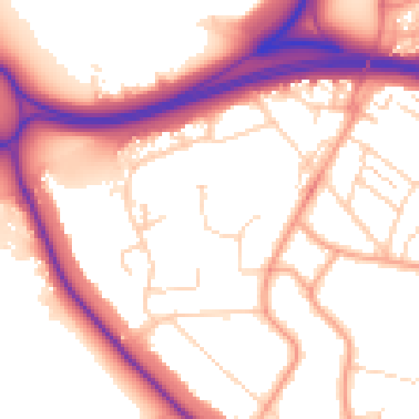
Daytime· 07:00 – 23:00
55.0dB

Night-time· 23:00 – 07:00
46.2dB