Skip to content

16a, Hampden Way, Watford, WD17 4SS

EPC A
Property type
Detached
Floor area
156 m²
1679 sq ft
Energy rating
A
Score 94
Overview

About 16a

A plain-English summary derived from public records, EPC certificates, sold prices and local data.

16a is a detached house in Watford (WD17 4SS). It has a recorded floor area of 156 m² (around 1679 sq ft) and construction records dating it to 2022. The latest certificate (June 2023) returns an A (score 94), the top energy band on the EPC scale.

On energy efficiency it sits in the top 10% of properties in this postcode. Across 2022–2023, sale prices on this property compounded at 233.6% per year. On a £-per-square-foot basis, the last sale (£596/sq ft) was about 95.9% above the typical sold price in the postcode. Most recent transfer: October 2023 at £1,000,000.

Before you decide

Everything you need to know about 16a

The true value, the hidden risks and the full sale history, in one report.

Recent ownership pattern worth a look
£14.99one-off

30-day money-back guarantee

Preview of the full property report

The data behind every report

  • HM Land Registry, source of sold price history
  • Department for Education, source of schools data
  • Police.uk, source of crime statistics
  • Department for Transport, source of stations and transport links
  • Environment Agency, source of flood risk data
  • Department for Environment, Food & Rural Affairs, source of road noise data
  • PlanIt, source of planning application records
  • Beautiful Places, source of nearby scenic places
Energy

Energy performance

Every EPC certificate filed against this property — current rating, recorded improvements, and where there's headroom to reach a higher band.

16a ranks among the most efficient homes in the postcode for energy use.

EPC Rating

A
A94
B
C
D
E
F
G
Main Heating
Electric & Gas
Main Fuel
Gas
Hot Water
Good
Windows
Very Good
CO2 Emissions
0.6 t/year
Occupancy
Planning

Planning history

Applications and permits filed against 16a, Hampden Way, Watford, WD17 4SS, sourced from the PlanIt planning register.

16a has no planning applications on record.

Notable planning nearby

3applications of note in the surrounding area

Before you offer

We flagged 1 thing worth checking at 16a

Independent checks surfaced things a buyer would want to understand before offering. The report explains each one in full, with the underlying data and what to ask.

  • Recent ownership pattern worth a look
£14.99

30-day money-back guarantee

Price

Sales history & valuation

Recorded transactions, our model's current estimate, and a quick read on what neighbouring properties have sold for.

Sale price has grown by over 3x since 2022.

Current estimate

£1,029,000

Modelled from EPC, postcode comparables and a sale-price growth of 233.6% per year over 1 year.

See how we calculated this
Last sold (2023)

£1,000,000

Growth on file: 233.6% per year over 1 year.

Sales timeline

  1. 5 October 2023Most recent

    £1,000,000

    +233.6%over 11 months
  2. 20 October 2022

    £299,750

Median price across the last 5 sales in WD17 4SS: £939,250 (2024–2020).

On the street

Versus other Hampden Way homes

Four headline reads against 16 similar houses on this street, drawn from the latest EPC and Land Registry data.

16a outperforms the street on epc rating by a wide margin.

Price per m²

£6,410

Street avg £4,347

Strongly above

Floor Area

156 m²

Street avg 159 m²

On par

CO₂ Emissions

0.6 t/year

Street avg 5.2 t/year

Strongly above

Years Held

3 years

Street avg 12 years

Strongly below
Before you decide

Everything you need to know about 16a

The true value, the hidden risks and the full sale history, in one report.

Recent ownership pattern worth a look
£14.99one-off

30-day money-back guarantee

Preview of the full property report

The data behind every report

  • HM Land Registry, source of sold price history
  • Department for Education, source of schools data
  • Police.uk, source of crime statistics
  • Department for Transport, source of stations and transport links
  • Environment Agency, source of flood risk data
  • Department for Environment, Food & Rural Affairs, source of road noise data
  • PlanIt, source of planning application records
  • Beautiful Places, source of nearby scenic places
Area

The neighbourhood at a glance

A condensed read of the local area. Each tile links through to the full breakdown on the Watford district page.

Crime

10/mo

Steady year-on-year across the wider district.

Nearest stop

0.3 km

Hollytree House — bus stop.

Closest school

0.3 km

Holy Rood Catholic Primary School. 22 schools nearby.

Go deeper on the local area

The full report breaks down crime, transport links, schools and air quality in depth.

Noise

Road noise across the postcode

Modelled day and night-time noise levels around WD17 4SS from Defra's strategic mapping. The pin marks this postcode's centroid.
Daytime road noise heatmap for WD17 4SS

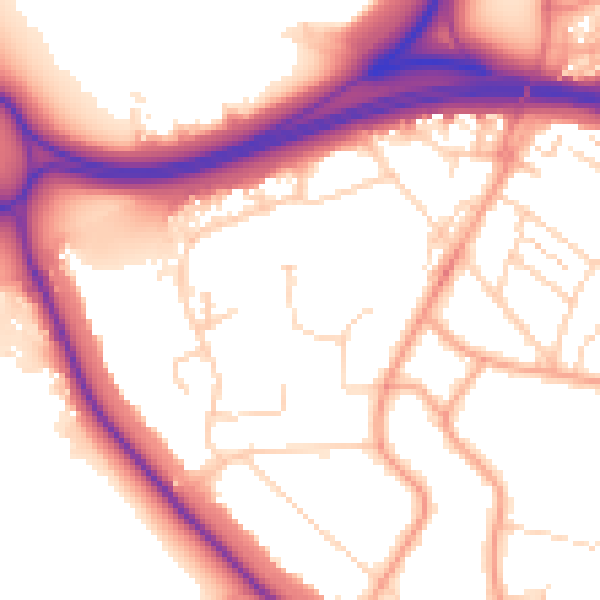
Daytime· 07:00 – 23:00

55.0dB

Moderate
Night-time road noise heatmap for WD17 4SS

Night-time· 23:00 – 07:00

46.2dB

Low
55 dB
60 dB
65 dB
70 dB
75 dB
80 dB
Defra Road Noise Strategic Mapping, Round 4
FAQ

Common questions

The questions buyers, sellers and homeowners most often ask about 16a, Hampden Way, Watford, WD17 4SS. Each answer is also embedded as structured data for search engines.