21 Brancaster Drive, Lowton, Warrington, WA3 1AT
About 21 Brancaster Drive
21 Brancaster Drive is a detached house in Lowton, Warrington, Warrington (WA3 1AT). It has a recorded floor area of 71 m² (around 764 sq ft), construction records dating it to 1996-2002 and council tax band C. The latest certificate (March 2014) shows a D (score 63), on the cusp of jumping into the C band. The recommended improvements would lift it to B (score 84), a 2-band jump. The latest certificate is from March 2014, so improvements made since then won't be reflected.
It hasn't traded since March 1998, a hold of 28 years that's notably long for the area. Only one transfer is on record with HM Land Registry, suggesting it has stayed in the same hands for a long time. Today's modelled estimate of £241,000 sits 276.6% above the 1998 sale of £64,000. On a £-per-square-foot basis, the last sale (£84/sq ft) was about 38.9% below the postcode norm.
Everything you need to know about 21 Brancaster Drive
The true value, the hidden risks and the full sale history, in one report.
Pick your report · every report is £14.99
One time fee only - money back guarantee

The data behind every report


Energy performance
Recommended upgrades on file would lift this property by multiple EPC bands.
EPC Expired
This certificate is over 10 years old and is no longer valid.Expired 27 Mar 2024
EPC Rating
Get a survey for this property
Level 2 HomeBuyer Report
We've checked 10 risk factors against the available data for this property and believe a Level 2 HomeBuyer Report could be a suitable option for you.
From £545 · Includes VAT
Planning history
21 Brancaster Drive has no planning applications on record.
A planning report still maps activity across the surrounding area and reads this property's extension & conversion potential.
Sales history & valuation
21 Brancaster Drive's estimated value is more than triple its earliest registered sale price (1998).
£241,000
Modelled from EPC, postcode comparables.
£64,000
Recorded with HM Land Registry.
Sales timeline
6 March 1998Most recent
£64,000
Median price across the last 5 sales in WA3 1AT: £182,500 (2022–2013).
Nearby sales in WA3 1AT
6 Brancaster Drive, Lowton, Warrington, WA3 1AT
Sold Dec 2022
£202,00016 Brancaster Drive, Lowton, Warrington, WA3 1AT
Sold Dec 2019
£335,00028 Brancaster Drive, Lowton, Warrington, WA3 1AT
Sold Nov 2019
£174,75032 Brancaster Drive, Lowton, Warrington, WA3 1AT
Sold Aug 2019
£182,5004 Brancaster Drive, Lowton, Warrington, WA3 1AT
Sold May 2013
£115,000
Versus other Brancaster Drive homes
Price per m² for 21 Brancaster Drive lags the street by a wide margin.
Price per m²
£901
Street avg £2,083
Floor Area
71 m²
Street avg 78 m²
Habitable Rooms
5 rooms
Street avg 5 rooms
CO₂ Emissions
3.3 t/year
Street avg 2.9 t/year
Everything you need to know about 21 Brancaster Drive
The true value, the hidden risks and the full sale history, in one report.
Pick your report · every report is £14.99
One time fee only - money back guarantee
The data behind every report
Similar properties nearby
1 Clayhill Grove, Lowton
WA3 1FZ
1 Adwell Close, Lowton
WA3 1DE
1 Heathmoor Avenue, Lowton
WA3 1HP
1 Astbury Close, Lowton
WA3 1ED
1 Church Lane, Lowton
WA3 1HA
1 Carr Green, Lowton
WA3 1EQ
1 Kirkham Avenue, Lowton
WA3 1LL
1 Bodden Street, Lowton
WA3 1DX
The neighbourhood at a glance
Crime
1/mo
Steady year-on-year across the wider district.
Nearest stop
0.3 km
Hesketh Meadow Lane — bus stop.
Closest school
0.3 km
Lowton Junior and Infant School. 11 schools nearby.
Go deeper on the local area
A Local Area report breaks down crime, transport links, schools and air quality in depth.
Road noise across the postcode
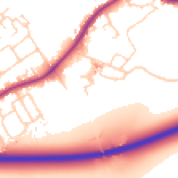
Daytime· 07:00 – 23:00
55.6dB

Night-time· 23:00 – 07:00
49.1dB