9 Barnfield Road, Woolston, Warrington, WA1 4NW
About 9 Barnfield Road
9 Barnfield Road is a semi-detached house in Woolston, Warrington, Warrington (WA1 4NW). It has a recorded floor area of 84 m² (around 909 sq ft), construction records dating it to 1950-1966 and council tax band C. The latest certificate (July 2011) shows an E (score 50), well below the UK norm with real room to improve. The recommended improvements would lift it to C (score 70), a 2-band jump. The latest certificate is from July 2011, so improvements made since then won't be reflected.
Today's modelled estimate of £256,000 sits 82.9% above the 2011 sale of £140,000. It lags the bulk of the postcode on energy efficiency (less efficient than 75% of similar EPCs). Last sold in November 2011, so it's been off the market for around 15 years. One historical planning record sits against the property in 2012.
Everything you need to know about 9 Barnfield Road
The true value, the hidden risks and the full sale history, in one report.
30-day money-back guarantee

The data behind every report


Energy performance
Recommended upgrades on file would lift this property by multiple EPC bands.
EPC Expired
This certificate is over 10 years old and is no longer valid.Expired 08 Jul 2021
EPC Rating
Planning history
- Apr 2012ExtensionFullIn report
Extension: Single storey
Proposed first floor rear extension and single storey side extension.
- Documents
- 7 docs on file
- Reference
- 2012/19582
We flagged 1 thing worth checking at 9 Barnfield Road
Independent checks surfaced things a buyer would want to understand before offering. The report explains each one in full, with the underlying data and what to ask.
- Larger development activity nearby
30-day money-back guarantee
Sales history & valuation
9 Barnfield Road valuation sits well clear of the typical sold price in this postcode.
£256,000
Modelled from EPC, postcode comparables.
£140,000
Recorded with HM Land Registry.
Sales timeline
23 November 2011Most recent
£140,000
Median price across the last 5 sales in WA1 4NW: £280,000 (2025–2018).
Nearby sales in WA1 4NW
17 Barnfield Road, Woolston, Warrington, WA1 4NW
Sold Feb 2025
£262,0001 Barnfield Road, Woolston, Warrington, WA1 4NW
Sold Oct 2024
£370,00021 Barnfield Road, Woolston, Warrington, WA1 4NW
Sold Mar 2024
£280,0005 Barnfield Road, Woolston, Warrington, WA1 4NW
Sold Jun 2023
£325,0003 Barnfield Road, Woolston, Warrington, WA1 4NW
Sold Aug 2017
£191,200
Versus other Barnfield Road homes
9 Barnfield Road is notably below the street on price per m².
Price per m²
£1,657
Street avg £2,305
Floor Area
84 m²
Street avg 92 m²
Habitable Rooms
5 rooms
Street avg 5 rooms
CO₂ Emissions
5.5 t/year
Street avg 4.4 t/year
Everything you need to know about 9 Barnfield Road
The true value, the hidden risks and the full sale history, in one report.
30-day money-back guarantee
The data behind every report
Similar properties nearby
1 Elm Tree Avenue, Padgate
WA1 4HZ
1 Epping Drive, Woolston
WA1 4QL
1 Clifton Close, Woolston
WA1 4BE
1 Ascot Close, Woolston
WA1 4HE
1 Baron Close, Woolston
WA1 4EU
1 Durham Close, Woolston
WA1 4DZ
1 Berkshire Drive, Woolston
WA1 4EX
1 Brickhurst Way, Woolston
WA1 4LG
The neighbourhood at a glance
Crime
3/mo
Steady year-on-year across the wider district.
Nearest stop
0.1 km
Barnfield Road — bus stop.
Closest school
0.1 km
Woolston Community Primary School. 26 schools nearby.
Go deeper on the local area
The full report breaks down crime, transport links, schools and air quality in depth.
Road noise across the postcode
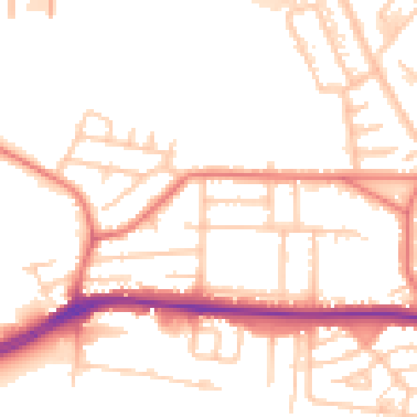
Daytime· 07:00 – 23:00
53.3dB

Night-time· 23:00 – 07:00
44.5dB