4 Primrose Grove, Arleston, Telford, TF1 2HX
About 4 Primrose Grove
4 Primrose Grove is a two-bedroom semi-detached house in Arleston, Telford, Telford (TF1 2HX). It has a recorded floor area of 75 m² (around 807 sq ft), construction records dating it to 1950-1966 and council tax band B. The latest certificate (March 2014) shows a C (score 72). The recommended improvements would push it to B (score 87). The latest certificate is from March 2014, so improvements made since then won't be reflected. Our model identifies extension potential, subject to local planning policy.
Untraded for 21 years, with the last transfer in August 2005. Today's modelled estimate of £173,000 sits 86% above the 2005 sale of £93,000. One historical planning record sits against the property in 2019.
Know exactly what you're buying at 4 Primrose Grove
Before you offer, see what the listing won't tell you, the true value, the red flags and the full history.
Valuation
against the asking price
Risks
planning & flood
Sold prices
similar homes nearby
Trends
the local market
What this property has
Inside
- Bedrooms2
- Bathrooms1
- Dining roomYes
Outside
- Private gardenSouth-facing
Building
- Heating systemGas
- Extension potentialPossible
Energy performance
4 Primrose Grove's EPC is over a decade old — improvements since won't be reflected.
EPC Expired
This certificate is over 10 years old and is no longer valid.Expired 28 Mar 2024
EPC Rating
Planning history
- Aug 2019
What's in 4 Primrose Grove, Arleston, Telford, TF1 2HX's planning history?
Refusals, disputes and full decisions on this property and nearby, in the report.
Sales history & valuation
4 Primrose Grove valuation sits well clear of the typical sold price in this postcode.
£173,000
Modelled from EPC, postcode comparables.
£93,000
Recorded with HM Land Registry.
Sales timeline
4 August 2005Most recent
£93,000
Median price across the last 5 sales in TF1 2HX: £97,000 (2020–2004).
Nearby sales in TF1 2HX
8 Primrose Grove, Arleston, Telford, TF1 2HX
Sold Dec 2020
£116,0003 Primrose Grove, Arleston, Telford, TF1 2HX
Sold Apr 2015
£86,0005 Primrose Grove, Arleston, Telford, TF1 2HX
Sold Apr 2013
£102,0007 Primrose Grove, Arleston, Telford, TF1 2HX
Sold Jul 2002
£64,9509 Primrose Grove, Arleston, Telford, TF1 2HX
Sold Mar 1999
£39,950
Everything we know about 4 Primrose Grove, in one report
What it's really worth, what could be wrong, and the planning, sales and area data in full.
- Am I paying too much?
- Is something wrong with it?
- Is the agent's story true?
- Will it hold its value?

Versus other Primrose Grove homes
On years held, 4 Primrose Grove stands well clear of the street.
Price per m²
£1,240
Street avg £1,369
Floor Area
75 m²
Street avg 74 m²
Habitable Rooms
4 rooms
Street avg 4 rooms
CO₂ Emissions
2.4 t/year
Street avg 2.8 t/year
Similar properties nearby
1 Braithwaite Row, Wellington
TF1 2HJ
1 Bickerstaff Court, Wellington
TF1 2HL
1 Arleston Court, Arleston
TF1 2NB
1 Christie Way, Wellington
TF1 2GJ
1 Chartwell Road, Arleston
TF1 2LR
1 Avondale Road, Wellington
TF1 2HD
1 Bowlers Close, Wellington
TF1 2GL
1 Birchwood Close, Arleston
TF1 2NU
The neighbourhood at a glance
Crime
5/mo
Steady year-on-year across the wider district.
Nearest stop
0.1 km
Primrose Grove — bus stop.
Closest school
0.3 km
Short Wood Primary School. 15 schools nearby.
Go deeper on the local area
The full report breaks down crime, transport links, schools and air quality in depth.
Road noise across the postcode
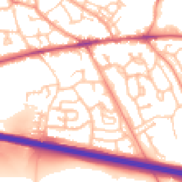
Daytime· 07:00 – 23:00
55.2dB

Night-time· 23:00 – 07:00
44.0dB