Stretton, Lyth Hill, Bayston Hill, Shrewsbury, SY3 0AX
About Stretton
Stretton is a semi-detached house in Bayston Hill, Shrewsbury, Shrewsbury (SY3 0AX). It has a recorded floor area of 302 m² (around 3251 sq ft) and construction records dating it to 2003-2006. The latest certificate (August 2020) shows a C (score 72). The rating has held steady at C across 2 certificates since November 2010. Between certificates, wall efficiency dropped from Very Good to Good. Main heating runs on oil.
At 302 m² the property is well over the postcode median (176 m² across 6 EPCs), placing it in the larger end of the local stock. Its energy rating outperforms most of the postcode (better than 83% of similar EPCs). 4 planning records sit against the property, 3 approved, 1 refused. Past consents include new windows, meaningful when judging how the property has evolved. The record references listed-building consent, which constrain future alterations. Across 2005–2021, sale prices on this property compounded at 2.8% per year. Today's modelled estimate of £780,000 is 18% above the 2021 sale price. On a £-per-square-foot basis, the last sale (£203/sq ft) was about 32.5% above the typical sold price in the postcode. Most recent transfer: January 2021 at £661,000. That sale was during the post-pandemic price surge, when transactions cleared materially above pre-2020 trend.
Everything you need to know about Stretton
The true value, the hidden risks and the full sale history, in one report.
30-day money-back guarantee

The data behind every report


Energy performance
Stretton's carbon output runs well above what efficient homes in the postcode produce.
EPC Rating
Property Improvements
Changes detected from historical EPC data
External or internal wall insulation added
Planning history
Stretton has multiple listed-building consents on file — alterations need formal heritage approval.
- Jul 2010RenovationHeritageIn report
Internal alterations to include insertion of staircase, floors and walls and insertion of window in connection with provision of second floor accommodation affecting a Grade II Listed Building
Listed- Documents
- 7 docs on file
- Reference
- 10/01961/LBC
- Dec 2009RenovationHeritageIn report
Alterations in association with installation of a new floor to create bedroom with new internal staircase, formation of a new window opening and insertion of a rooflight affecting a Grade II Listed Building
- Agent
- Bleazard and Galletta LLP
Listed- Documents
- 13 docs on file
- Reference
- 09/02800/LBC
What's in Stretton, Lyth Hill, Bayston Hill, Shrewsbury, SY3 0AX's planning history?
2 more on this property, plus refusals, disputes and full decisions nearby, in the report.
Sales history & valuation
Latest sale on Stretton was the highest on Land Registry record across the postcode.
£780,000
Modelled from EPC, postcode comparables and a sale-price growth of 2.8% per year over 16 years.
£661,000
Growth on file: 2.8% per year over 16 years.
Sales timeline
29 January 2021Most recent
£661,000
+24.7%over 9 years23 June 2011
£530,000
+23.0%over 6 years22 June 2005
£431,000
Median price across the last 5 sales in SY3 0AX: £375,000 (2025–2005).
Nearby sales in SY3 0AX
Little Lyth Barn, Lyth Hill, Bayston Hill, Shrewsbury, SY3 0AX
Sold Mar 2025
£600,000The Old Carriage House, Lyth Hill, Bayston Hill, Shrewsbury, SY3 0AX
Sold Mar 2011
£375,000Netherhill, Lyth Hill, Bayston Hill, Shrewsbury, SY3 0AX
Sold May 2006
£475,0002 Little Lyth House, Lyth Hill, Bayston Hill, Shrewsbury, SY3 0AX
Sold Aug 2005
£250,000
Versus other Lyth Hill homes
Stretton outperforms the street on floor area by a wide margin.
Price per m²
£2,189
Street avg £2,480
Floor Area
302 m²
Street avg 181 m²
Habitable Rooms
9 rooms
Street avg 6 rooms
CO₂ Emissions
8.7 t/year
Street avg 7.4 t/year
Everything you need to know about Stretton
The true value, the hidden risks and the full sale history, in one report.
30-day money-back guarantee
The data behind every report
Similar properties nearby
1 Amblecote, Grove Lane, Bayston Hill
SY3 0HW
1 Beddoes Drive, Bayston Hill
SY3 0BU
1 Coppice Gate, Lyth Hill, Lyth Bank
SY3 0BT
1 Chestnut Drive, Bayston Hill
SY3 0QQ
1 Downey Ridge, Bayston Hill
SY3 0BF
1 Butcher Lane, Lythwood Road, Bayston Hill
SY3 0LZ
1 Berwyn Drive, Bayston Hill
SY3 0JF
1 Brookfield, Bayston Hill
SY3 0LQ
The neighbourhood at a glance
Daytime road noise here sits well below conversation level — a quiet pocket of the postcode.
Crime
9/mo
Steady year-on-year across the wider district.
Closest school
1.8 km
Condover CofE Primary School. 2 schools nearby.
Go deeper on the local area
The full report breaks down crime, transport links, schools and air quality in depth.
Road noise across the postcode
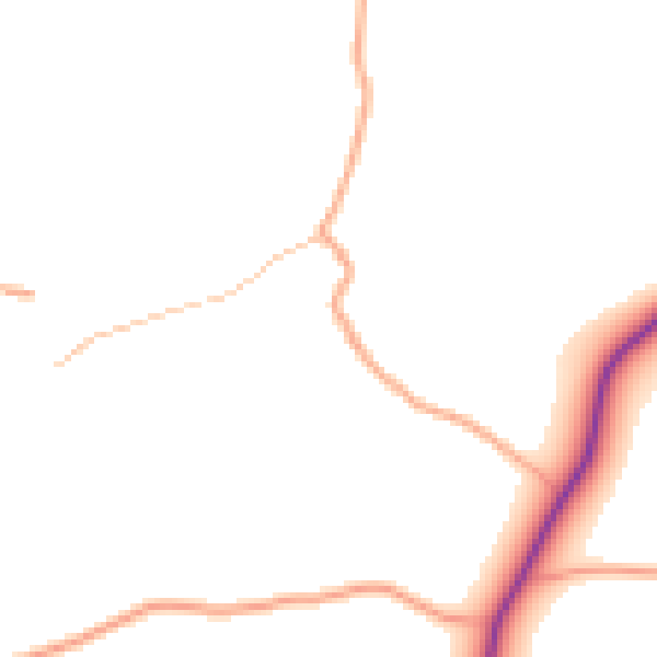
Daytime· 07:00 – 23:00
46.5dB

Night-time· 23:00 – 07:00
40.1dB