20 Bishop Street, Shrewsbury, SY2 5HA
About 20 Bishop Street
20 Bishop Street is a mid-terrace house in Shrewsbury (SY2 5HA). It has a recorded floor area of 107 m² (around 1152 sq ft), construction records dating it to before 1900 and council tax band C. The latest certificate (March 2025) shows a D (score 61), on the cusp of jumping into the C band. The rating has held steady at D across 2 certificates since March 2014. Between certificates, window efficiency went from Very Poor to Poor and lighting went from Average to Very Good. The recommended improvements would lift it to B (score 84), a 2-band jump.
5 planning records sit against the property, 1 approved, 0 refused. Past consents include tree works, meaningful when judging how the property has evolved. The record references conservation-area consent, which constrain future alterations.
Everything you need to know about 20 Bishop Street
The true value, the hidden risks and the full sale history, in one report.
30-day money-back guarantee

The data behind every report


Energy performance
Recommended upgrades on file would lift this property by multiple EPC bands.
EPC Rating
Property Improvements
Changes detected from historical EPC data
Single glazing replaced with double or better glazing
More low energy lighting installed
Planning history
Planning history at 20 Bishop Street is exclusively tree-management applications — typical for a property with mature trees on or near the plot.
- Jan 2022Tree WorksTreesIn report
Reduce the by up to 25% 1No Cherry within Shrewsbury Conservation Area (Amended 13/01/22)
Conservation Area- Documents
- 3 docs on file
- Reference
- 21/05703/TCA
- Sept 2016Tree WorksTreesIn report
To prune and reduce by 20%-25% and reshape one Cherry tree; remove one Cherry tree within Shrewsbury Conservation Area
Conservation Area- Documents
- 3 docs on file
- Reference
- 16/03840/TCA
We flagged 1 thing worth checking at 20 Bishop Street
Independent checks surfaced things a buyer would want to understand before offering. The report explains each one in full, with the underlying data and what to ask.
- Larger development activity nearby
30-day money-back guarantee
Sales history & valuation
20 Bishop Street has no Land Registry sales on file, suggesting it has stayed in the same hands since registration began.
£282,000
Modelled from EPC, postcode comparables.
No sales recorded with HM Land Registry
That can mean the property has never traded since the registry began publishing in 1995, was a new build that hasn't been registered yet, or is held in the same hands long-term.
Median price across the last 5 sales in SY2 5HA: £335,000 (2025–2020).
Nearby sales in SY2 5HA
Versus other Bishop Street homes
On co₂ emissions, 20 Bishop Street stands well clear of the street.
EPC Rating
61 (D)
Street avg 54 (E)
Floor Area
107 m²
Street avg 122 m²
CO₂ Emissions
4.9 t/year
Street avg 6.4 t/year
Habitable Rooms
6 rooms
Street avg 6 rooms
Everything you need to know about 20 Bishop Street
The true value, the hidden risks and the full sale history, in one report.
30-day money-back guarantee
The data behind every report
Similar properties nearby
The neighbourhood at a glance
Rail-style transport is unusually close for this postcode.
Crime
1/mo
Steady year-on-year across the wider district.
Nearest stop
1.0 km
Shrewsbury Rail Station — railway station.
Closest school
0.7 km
Crowmoor Primary School. 20 schools nearby.
Go deeper on the local area
The full report breaks down crime, transport links, schools and air quality in depth.
Road noise across the postcode
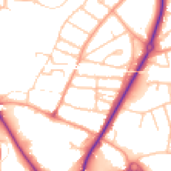
Daytime· 07:00 – 23:00
51.7dB

Night-time· 23:00 – 07:00
42.1dB